![](/images/other/stat-length.png)
![Tour Mountainbike Habscht - Hobscheid S 37km 2016 - Photo](https://media.geolcdn.com/t/1900/400/ext.pjpeg?maxdim=2&url=https%3A%2F%2Fstatic1.geolcdn.com%2Fsiteimages%2Fupload%2Ffiles%2F1524743154velo.jpg)
Hobscheid S 37km 2016
Ricco57
Benutzer
![Länge](/images/other/stat-length.png)
Länge
37 km
![Maximale Höhe](https://static1.geolcdn.com/siteimages/upload/files/1508320355ic_sort_altitude_max_24dp.png)
Maximale Höhe
403 m
![Positive Höhendifferenz](https://static1.geolcdn.com/siteimages/upload/files/1508320355ic_sort_den_pos_24dp.png)
Positive Höhendifferenz
929 m
![Km-Effort](/images/other/stat-length.png)
Km-Effort
49 km
![Min. Höhe](https://static1.geolcdn.com/siteimages/upload/files/1508320355ic_sort_altitude_min_24dp.png)
Min. Höhe
275 m
![Negative Höhendifferenz](https://static1.geolcdn.com/siteimages/upload/files/1508320355ic_sort_den_neg_24dp.png)
Negative Höhendifferenz
934 m
![Boucle](https://static1.geolcdn.com/siteimages/upload/files/16400158638029165_repeat_loop_refresh_sync_direction_icon.png)
Boucle
Nein
Erstellungsdatum :
2016-05-09 00:00:00.0
Letzte Änderung :
2016-05-09 00:00:00.0
![Mountainbike](https://static1.geolcdn.com/sitytour/trail-icons/202.png)
2h24
Schwierigkeit : Schwierig
![Scannen Sie diesen QR-Code, um die Tour in der SityTrail-Anwendung zu öffnen](https://capi.geolives.com/qq0zvz2zws4bq2lad0pu/sitytour/trails/566131/qr.png?size=200)
Kostenlosegpshiking-Anwendung
Über SityTrail
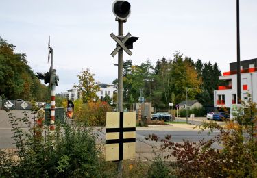
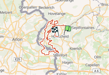
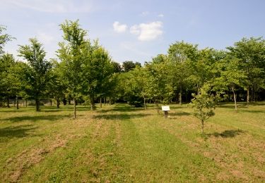
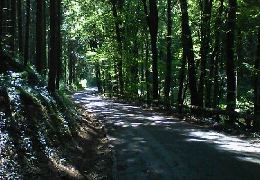
Tour Mountainbike von 37 km verfügbar auf Unbekannt, Kanton Kapellen, Habscht. Diese Tour wird von Ricco57 vorgeschlagen.
Beschreibung
Très beau parcours avec de belle descentes, des track superbe. Quelques passages difficiles et technique... Ouuuui! Vivement la prochaine...
Ort
Land:
Luxembourg
Region :
Unbekannt
Abteilung/Provinz :
Kanton Kapellen
Kommune :
Habscht
Standort:
Hobscheid
Gehen Sie:(Dec)
Gehen Sie:(UTM)
710799 ; 5508195 (31U) N.
Kommentare
Touren in der Umgebung
![Tour Wandern Arel - Clairefontaine - Circuit Natura 2000, des sites qui valent le détour - Lx15 - Photo](https://media.geolcdn.com/t/375/260/ext.jpg?maxdim=2&url=https%3A%2F%2Fservices.sitytrail.com%2FGeolivesWS%2FDownloadMedia.ashx%3FTrailID%3D333331%26Media%3D011bab6f-c149-41bf-be76-696578f9f696.JPG)
![Wandern Wandern](https://static1.geolcdn.com/sitytour/trail-icons/101.png)
Clairefontaine - Circuit Natura 2000, des sites qui valent le détour - Lx15
Wandern
Einfach
(2)
Arel,
Wallonien,
Luxemburg,
Belgium
![](/images/other/stat-length.png)
4,1 km | 5,3 km-effort
1h 11min
![](https://static1.geolcdn.com/siteimages/upload/files/16400158638029165_repeat_loop_refresh_sync_direction_icon.png)
Ja
![Tour Wandern Arel - Guirsch, vallée des moulins - Photo](https://media.geolcdn.com/t/375/260/ext.jpg?maxdim=2&url=https%3A%2F%2Fservices.sitytrail.com%2FGeolivesWS%2FDownloadMedia.ashx%3FTrailID%3D462490%26Media%3Dfix__20150822151852.jpg)
![Wandern Wandern](https://static1.geolcdn.com/sitytour/trail-icons/101.png)
Guirsch, vallée des moulins
Wandern
Sehr leicht
(1)
Arel,
Wallonien,
Luxemburg,
Belgium
![](/images/other/stat-length.png)
5,8 km | 7,2 km-effort
1h 33min
![](https://static1.geolcdn.com/siteimages/upload/files/16400158638029165_repeat_loop_refresh_sync_direction_icon.png)
Nein
![Tour Wandern Habscht - Tunnel Tour - Photo](https://media.geolcdn.com/t/375/260/82720245-2ef9-4a0b-a9f7-0bd828756b2c.jpg&format=jpg&maxdim=2)
![Wandern Wandern](https://static1.geolcdn.com/sitytour/trail-icons/101.png)
Tunnel Tour
Wandern
Medium
(1)
Habscht,
Unbekannt,
Kanton Kapellen,
Luxembourg
![](/images/other/stat-length.png)
4,2 km | 6,2 km-effort
1h 24min
![](https://static1.geolcdn.com/siteimages/upload/files/16400158638029165_repeat_loop_refresh_sync_direction_icon.png)
Ja
![Tour Wandern Arel - RF-Lu-15 - Une randonnée (trans)frontalière : Clairefontaine - Photo](https://media.geolcdn.com/t/375/260/ext.jpg?maxdim=2&url=https%3A%2F%2Fstatic1.geolcdn.com%2Fsiteimages%2Fupload%2Ffiles%2F1553511878bg_sport_marche.png)
![Wandern Wandern](https://static1.geolcdn.com/sitytour/trail-icons/101.png)
RF-Lu-15 - Une randonnée (trans)frontalière : Clairefontaine
Wandern
Sehr leicht
(3)
Arel,
Wallonien,
Luxemburg,
Belgium
![](/images/other/stat-length.png)
11,1 km | 14,7 km-effort
3h 11min
![](https://static1.geolcdn.com/siteimages/upload/files/16400158638029165_repeat_loop_refresh_sync_direction_icon.png)
Ja
![Tour Zu Fuß Arel - N° 8 - Waltzing-Eischen, balade belgo-luxembourgeoise - Photo](https://media.geolcdn.com/t/375/260/b0eed337-7084-4191-bc62-985346659136.jpeg&format=jpg&maxdim=2)
![Zu Fuß Zu Fuß](https://static1.geolcdn.com/sitytour/trail-icons/100.png)
N° 8 - Waltzing-Eischen, balade belgo-luxembourgeoise
Zu Fuß
Einfach
Arel,
Wallonien,
Luxemburg,
Belgium
![](/images/other/stat-length.png)
10,3 km | 13 km-effort
2h 57min
![](https://static1.geolcdn.com/siteimages/upload/files/16400158638029165_repeat_loop_refresh_sync_direction_icon.png)
Ja
![Tour Zu Fuß Arel - N° 10 - Clairefontaine : Ermesinde - Photo](https://media.geolcdn.com/t/375/260/06dc8e88-1074-4dc8-92e2-176257711686.jpeg&format=jpg&maxdim=2)
![Zu Fuß Zu Fuß](https://static1.geolcdn.com/sitytour/trail-icons/100.png)
N° 10 - Clairefontaine : Ermesinde
Zu Fuß
Einfach
Arel,
Wallonien,
Luxemburg,
Belgium
![](/images/other/stat-length.png)
4 km | 5,1 km-effort
1h 9min
![](https://static1.geolcdn.com/siteimages/upload/files/16400158638029165_repeat_loop_refresh_sync_direction_icon.png)
Ja
![Tour Zu Fuß Arel - N° 7 - Clairefontaine - L'Eisch - Photo](https://media.geolcdn.com/t/375/260/06dc8e88-1074-4dc8-92e2-176257711686.jpeg&format=jpg&maxdim=2)
![Zu Fuß Zu Fuß](https://static1.geolcdn.com/sitytour/trail-icons/100.png)
N° 7 - Clairefontaine - L'Eisch
Zu Fuß
Einfach
Arel,
Wallonien,
Luxemburg,
Belgium
![](/images/other/stat-length.png)
4,1 km | 5,4 km-effort
1h 13min
![](https://static1.geolcdn.com/siteimages/upload/files/16400158638029165_repeat_loop_refresh_sync_direction_icon.png)
Ja
![Tour Zu Fuß Beckerich - Auto-Pedestre Beckerich - Photo](https://media.geolcdn.com/t/375/260/e2b91b31-ee5a-41a2-b3de-375bce3c0b8f.jpeg&format=jpg&maxdim=2)
![Zu Fuß Zu Fuß](https://static1.geolcdn.com/sitytour/trail-icons/100.png)
Auto-Pedestre Beckerich
Zu Fuß
Einfach
Beckerich,
Unbekannt,
Kanton Redingen,
Luxembourg
![](/images/other/stat-length.png)
11,6 km | 15,5 km-effort
3h 30min
![](https://static1.geolcdn.com/siteimages/upload/files/16400158638029165_repeat_loop_refresh_sync_direction_icon.png)
Ja
![Tour Zu Fuß Arel - Steinfort 1 - Photo](https://media.geolcdn.com/t/375/260/31cbcc06-04c7-4d6a-acf8-cc6973590a10.jpeg&format=jpg&maxdim=2)
![Zu Fuß Zu Fuß](https://static1.geolcdn.com/sitytour/trail-icons/100.png)