


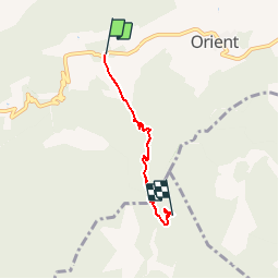

9,1 km | 19,1 km-effort


Benutzer


Kostenlosegpshiking-Anwendung
 SityTrail
IGN / Geografische Institute
SityTrail World
Die Welt öffnet sich für Sie
Tour Wandern von 3,6 km verfügbar auf Balearische Inseln, Unbekannt, Bunyola. Diese Tour wird von Polo-31 vorgeschlagen.
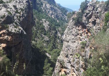
A/R sur le chemin en bordure du canyon de Coanegra. Montée à l'Avenc de Son Pou. Doubler les distances ci-dessous pour l'A/R.
Wandern
Wandern

Wandern
Wandern

Wandern

Wandern
Wandern

Rennrad
Fahrrad