![](/images/other/stat-length.png)
![Tour Wandern Espira-de-l'Agly - 66 CASES DE PÈNE - ESPIRA DE L'AGLY - ballade en bords et vallée d'Agly - Photo](https://media.geolcdn.com/t/1900/400/ext.pjpeg?maxdim=2&url=https%3A%2F%2Fstatic1.geolcdn.com%2Fsiteimages%2Fupload%2Ffiles%2F1553511878bg_sport_marche.png)
66 CASES DE PÈNE - ESPIRA DE L'AGLY - ballade en bords et vallée d'Agly
jeff66
Benutzer
![Länge](/images/other/stat-length.png)
![Maximale Höhe](https://static1.geolcdn.com/siteimages/upload/files/1508320355ic_sort_altitude_max_24dp.png)
![Positive Höhendifferenz](https://static1.geolcdn.com/siteimages/upload/files/1508320355ic_sort_den_pos_24dp.png)
![Km-Effort](/images/other/stat-length.png)
![Min. Höhe](https://static1.geolcdn.com/siteimages/upload/files/1508320355ic_sort_altitude_min_24dp.png)
![Negative Höhendifferenz](https://static1.geolcdn.com/siteimages/upload/files/1508320355ic_sort_den_neg_24dp.png)
![Boucle](https://static1.geolcdn.com/siteimages/upload/files/16400158638029165_repeat_loop_refresh_sync_direction_icon.png)
![Wandern](https://static1.geolcdn.com/sitytour/trail-icons/101.png)
2h23
Schwierigkeit : Medium
![Scannen Sie diesen QR-Code, um die Tour in der SityTrail-Anwendung zu öffnen](https://capi.geolives.com/qq0zvz2zws4bq2lad0pu/sitytour/trails/553792/qr.png?size=200)
Kostenlosegpshiking-Anwendung
Über SityTrail
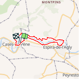
Tour Wandern von 12,8 km verfügbar auf Okzitanien, Ostpyrenäen, Espira-de-l'Agly. Diese Tour wird von jeff66 vorgeschlagen.
Beschreibung
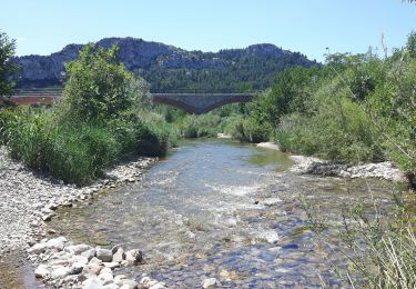
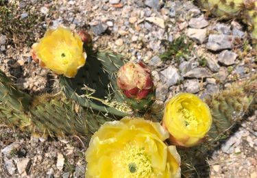
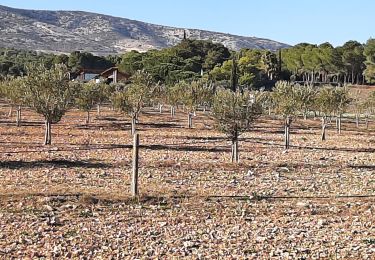
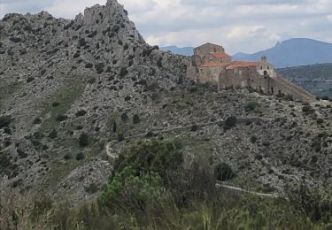
66 CASES DE PÈNE - Parking A proximité zone de loisirs et cave en Bord de la RD117 - Mas Ferriol - le relais de Marie - els Vinyers Baixos - ESPIRA DE L'AGLY - chemin du Garriga - rue du pont - Eglise Ste Marie - rue ND des Anges - rue Pasteur - radier sur l'Agly - Serrat de la Devesa - Correc Dels Tamarius - Mas Cremat - mas Mirs - CASE DE P. - el camp del Colom - el camp del Fuster - cimetiere - rue Victor Hugo - mairie - école - pont sur l'agly - longer la Rd117
Ort
Kommentare
Touren in der Umgebung
![Tour Wandern Tautavel - Tautavel chemin des bacs - Photo](https://media.geolcdn.com/t/375/260/4347d338-087b-4ab9-a23d-b90780ad37c2.jpg&format=jpg&maxdim=2)
![Wandern Wandern](https://static1.geolcdn.com/sitytour/trail-icons/101.png)
Wandern
![](/images/other/stat-length.png)
![](https://static1.geolcdn.com/siteimages/upload/files/16400158638029165_repeat_loop_refresh_sync_direction_icon.png)
![Tour Wandern Cases-de-Pène - Hermitage de case de pène, le 11 août 2013 - Photo](https://media.geolcdn.com/t/375/260/ext.jpg?maxdim=2&url=https%3A%2F%2Fstatic1.geolcdn.com%2Fsiteimages%2Fupload%2Ffiles%2F1553511878bg_sport_marche.png)
![Wandern Wandern](https://static1.geolcdn.com/sitytour/trail-icons/101.png)
Wandern
![](/images/other/stat-length.png)
![](https://static1.geolcdn.com/siteimages/upload/files/16400158638029165_repeat_loop_refresh_sync_direction_icon.png)
![Tour Wandern Baixas - baixas chapelle ste catherine - Photo](https://media.geolcdn.com/t/375/260/d3b7c9c4-76b1-42bc-afd1-f1141b6126a7.jpg&format=jpg&maxdim=2)
![Wandern Wandern](https://static1.geolcdn.com/sitytour/trail-icons/101.png)
Wandern
![](/images/other/stat-length.png)
![](https://static1.geolcdn.com/siteimages/upload/files/16400158638029165_repeat_loop_refresh_sync_direction_icon.png)
![Tour Wandern Cases-de-Pène - 2023-08-01_12h04m36_SityTrail - 3754591 - cases-de-pene-x-detour-et-retour - Photo](https://media.geolcdn.com/t/375/260/883a1714-3990-4d53-92ac-a82da8ee9827.jpg&format=jpg&maxdim=2)
![Wandern Wandern](https://static1.geolcdn.com/sitytour/trail-icons/101.png)
Wandern
![](/images/other/stat-length.png)
![](https://static1.geolcdn.com/siteimages/upload/files/16400158638029165_repeat_loop_refresh_sync_direction_icon.png)
![Tour Wandern Cases-de-Pène - 20230528 Nostradamus Seynora de Pene - Photo](https://media.geolcdn.com/t/375/260/8ec76a99-d504-40dd-9657-2c438f447ce5.jpg&format=jpg&maxdim=2)
![Wandern Wandern](https://static1.geolcdn.com/sitytour/trail-icons/101.png)
Wandern
![](/images/other/stat-length.png)
![](https://static1.geolcdn.com/siteimages/upload/files/16400158638029165_repeat_loop_refresh_sync_direction_icon.png)
![Tour Wandern Espira-de-l'Agly - espira montpins - Photo](https://media.geolcdn.com/t/375/260/a49b025a-ead8-4ed6-b68b-909149e1220d.jpg&format=jpg&maxdim=2)
![Wandern Wandern](https://static1.geolcdn.com/sitytour/trail-icons/101.png)
Wandern
![](/images/other/stat-length.png)
![](https://static1.geolcdn.com/siteimages/upload/files/16400158638029165_repeat_loop_refresh_sync_direction_icon.png)
![Tour Wandern Cases-de-Pène - 20220419 Ermitage Cases-de-Pene - Photo](https://media.geolcdn.com/t/375/260/d51772c3-7cce-4e42-801a-cc23a8ec9c89.jpg&format=jpg&maxdim=2)
![Wandern Wandern](https://static1.geolcdn.com/sitytour/trail-icons/101.png)
Wandern
![](/images/other/stat-length.png)
![](https://static1.geolcdn.com/siteimages/upload/files/16400158638029165_repeat_loop_refresh_sync_direction_icon.png)
![Tour Wandern Tautavel - TAUTAVEL la Tour del Far A/R - Photo](https://media.geolcdn.com/t/375/260/7315cb9e-35b2-46c7-8732-adf6f85e9975.jpg&format=jpg&maxdim=2)
![Wandern Wandern](https://static1.geolcdn.com/sitytour/trail-icons/101.png)
Wandern
![](/images/other/stat-length.png)
![](https://static1.geolcdn.com/siteimages/upload/files/16400158638029165_repeat_loop_refresh_sync_direction_icon.png)
![Tour Wandern Tautavel - Tautavel -Torre del Far - Photo](https://media.geolcdn.com/t/375/260/f1e44f1c-1dc1-496a-9f67-a9c732e79842.jpg&format=jpg&maxdim=2)
![Wandern Wandern](https://static1.geolcdn.com/sitytour/trail-icons/101.png)
Wandern
![](/images/other/stat-length.png)
![](https://static1.geolcdn.com/siteimages/upload/files/16400158638029165_repeat_loop_refresh_sync_direction_icon.png)