![](/images/other/stat-length.png)
![Tour Mountainbike Andelnach - Andelnans Bretagne - Photo](https://media.geolcdn.com/t/1900/400/ext.pjpeg?maxdim=2&url=https%3A%2F%2Fstatic1.geolcdn.com%2Fsiteimages%2Fupload%2Ffiles%2F1524743154velo.jpg)
Andelnans Bretagne
qlqin
Benutzer
![Länge](/images/other/stat-length.png)
Länge
39 km
![Maximale Höhe](https://static1.geolcdn.com/siteimages/upload/files/1508320355ic_sort_altitude_max_24dp.png)
Maximale Höhe
407 m
![Positive Höhendifferenz](https://static1.geolcdn.com/siteimages/upload/files/1508320355ic_sort_den_pos_24dp.png)
Positive Höhendifferenz
419 m
![Km-Effort](/images/other/stat-length.png)
Km-Effort
44 km
![Min. Höhe](https://static1.geolcdn.com/siteimages/upload/files/1508320355ic_sort_altitude_min_24dp.png)
Min. Höhe
328 m
![Negative Höhendifferenz](https://static1.geolcdn.com/siteimages/upload/files/1508320355ic_sort_den_neg_24dp.png)
Negative Höhendifferenz
420 m
![Boucle](https://static1.geolcdn.com/siteimages/upload/files/16400158638029165_repeat_loop_refresh_sync_direction_icon.png)
Boucle
Ja
Erstellungsdatum :
2016-04-04 00:00:00.0
Letzte Änderung :
2016-04-04 00:00:00.0
![Mountainbike](https://static1.geolcdn.com/sitytour/trail-icons/202.png)
2h55
Schwierigkeit : Einfach
![Scannen Sie diesen QR-Code, um die Tour in der SityTrail-Anwendung zu öffnen](https://capi.geolives.com/qq0zvz2zws4bq2lad0pu/sitytour/trails/548276/qr.png?size=200)
Kostenlosegpshiking-Anwendung
Über SityTrail
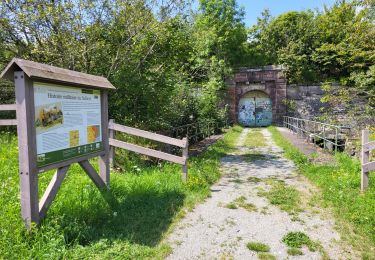
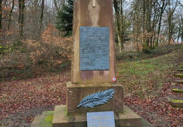
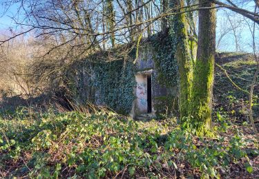
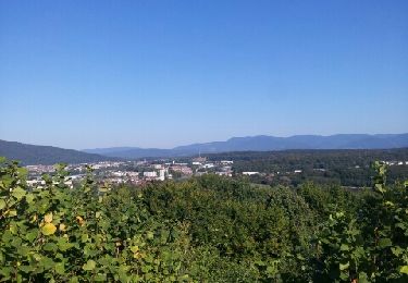
Tour Mountainbike von 39 km verfügbar auf Burgund und Freigrafschaft, Territoire-de-Belfort, Andelnach. Diese Tour wird von qlqin vorgeschlagen.
Beschreibung
Belle rando qui se profite par beau temps sec, sinon boue et glissades assurées.
Ort
Land:
France
Region :
Burgund und Freigrafschaft
Abteilung/Provinz :
Territoire-de-Belfort
Kommune :
Andelnach
Standort:
Unknown
Gehen Sie:(Dec)
Gehen Sie:(UTM)
340567 ; 5275027 (32T) N.
Kommentare
Touren in der Umgebung
![Tour Mountainbike Andelnach - Tour d'Essert - Photo](https://media.geolcdn.com/t/375/260/ext.jpg?maxdim=2&url=https%3A%2F%2Fstatic1.geolcdn.com%2Fsiteimages%2Fupload%2Ffiles%2F1524743154velo.jpg)
![Mountainbike Mountainbike](https://static1.geolcdn.com/sitytour/trail-icons/202.png)
Tour d'Essert
Mountainbike
Einfach
(2)
Andelnach,
Burgund und Freigrafschaft,
Territoire-de-Belfort,
France
![](/images/other/stat-length.png)
29 km | 36 km-effort
2h 12min
![](https://static1.geolcdn.com/siteimages/upload/files/16400158638029165_repeat_loop_refresh_sync_direction_icon.png)
Ja
![Tour Wandern Belfort - Offemont - La ballade des Champs Cerisiers - Photo](https://media.geolcdn.com/t/375/260/ext.jpg?maxdim=2&url=https%3A%2F%2Fstatic1.geolcdn.com%2Fsiteimages%2Fupload%2Ffiles%2F1553511878bg_sport_marche.png)
![Wandern Wandern](https://static1.geolcdn.com/sitytour/trail-icons/101.png)
Offemont - La ballade des Champs Cerisiers
Wandern
Einfach
(1)
Belfort,
Burgund und Freigrafschaft,
Territoire-de-Belfort,
France
![](/images/other/stat-length.png)
8,8 km | 10,8 km-effort
Unbekannt
![](https://static1.geolcdn.com/siteimages/upload/files/16400158638029165_repeat_loop_refresh_sync_direction_icon.png)
Ja
![Tour Elektrofahrrad Schert - VTT - Essert - Salbert - Vétrigne - Miotte - Citadelle Belfort - Essert - Photo](https://media.geolcdn.com/t/375/260/9ea3754c-f673-4e19-890f-f64e417a9f4d.jpg&format=jpg&maxdim=2)
![Elektrofahrrad Elektrofahrrad](https://static1.geolcdn.com/sitytour/trail-icons/205.png)
VTT - Essert - Salbert - Vétrigne - Miotte - Citadelle Belfort - Essert
Elektrofahrrad
Schwierig
Schert,
Burgund und Freigrafschaft,
Territoire-de-Belfort,
France
![](/images/other/stat-length.png)
42 km | 55 km-effort
4h 55min
![](https://static1.geolcdn.com/siteimages/upload/files/16400158638029165_repeat_loop_refresh_sync_direction_icon.png)
Ja
![Tour Wandern Banvillars - Banvillars - forts du Hauts Bois et du Bois d'Oye - Photo](https://media.geolcdn.com/t/375/260/88f0967b-6ffd-4876-9f84-18be058a8f3f.jpg&format=jpg&maxdim=2)
![Wandern Wandern](https://static1.geolcdn.com/sitytour/trail-icons/101.png)
Banvillars - forts du Hauts Bois et du Bois d'Oye
Wandern
Sehr schwierig
Banvillars,
Burgund und Freigrafschaft,
Territoire-de-Belfort,
France
![](/images/other/stat-length.png)
16,3 km | 21 km-effort
4h 40min
![](https://static1.geolcdn.com/siteimages/upload/files/16400158638029165_repeat_loop_refresh_sync_direction_icon.png)
Ja
![Tour Wandern Sevenans - Randonnée des forts depuis Sévenans - Photo](https://media.geolcdn.com/t/375/260/f60b66f1-29f9-4bb6-9be8-f56ded01ac55.jpg&format=jpg&maxdim=2)
![Wandern Wandern](https://static1.geolcdn.com/sitytour/trail-icons/101.png)
Randonnée des forts depuis Sévenans
Wandern
Sehr schwierig
Sevenans,
Burgund und Freigrafschaft,
Territoire-de-Belfort,
France
![](/images/other/stat-length.png)
19,9 km | 24 km-effort
5h 26min
![](https://static1.geolcdn.com/siteimages/upload/files/16400158638029165_repeat_loop_refresh_sync_direction_icon.png)
Ja
![Tour Zu Fuß Offemundt - Sentier de la Roselière - Photo](https://media.geolcdn.com/t/375/260/c8e60aaf-8ba5-407b-b750-77a1aea99966.jpeg&format=jpg&maxdim=2)
![Zu Fuß Zu Fuß](https://static1.geolcdn.com/sitytour/trail-icons/100.png)
Sentier de la Roselière
Zu Fuß
Einfach
Offemundt,
Burgund und Freigrafschaft,
Territoire-de-Belfort,
France
![](/images/other/stat-length.png)
3,9 km | 4,3 km-effort
58min
![](https://static1.geolcdn.com/siteimages/upload/files/16400158638029165_repeat_loop_refresh_sync_direction_icon.png)
Ja
![Tour Mountainbike Wieswald - 1er tour avec Olivier - Photo](https://media.geolcdn.com/t/375/260/ext.jpg?maxdim=2&url=https%3A%2F%2Fstatic1.geolcdn.com%2Fsiteimages%2Fupload%2Ffiles%2F1524743154velo.jpg)
![Mountainbike Mountainbike](https://static1.geolcdn.com/sitytour/trail-icons/202.png)
1er tour avec Olivier
Mountainbike
Einfach
(1)
Wieswald,
Burgund und Freigrafschaft,
Territoire-de-Belfort,
France
![](/images/other/stat-length.png)
38 km | 47 km-effort
2h 59min
![](https://static1.geolcdn.com/siteimages/upload/files/16400158638029165_repeat_loop_refresh_sync_direction_icon.png)
Ja
![Tour Wandern Schert - Essert - Petit Salbert - Photo](https://media.geolcdn.com/t/375/260/ext.jpg?maxdim=2&url=https%3A%2F%2Fstatic1.geolcdn.com%2Fsiteimages%2Fupload%2Ffiles%2F1553511878bg_sport_marche.png)
![Wandern Wandern](https://static1.geolcdn.com/sitytour/trail-icons/101.png)
Essert - Petit Salbert
Wandern
Sehr leicht
(1)
Schert,
Burgund und Freigrafschaft,
Territoire-de-Belfort,
France
![](/images/other/stat-length.png)
7,4 km | 10,2 km-effort
2h 10min
![](https://static1.geolcdn.com/siteimages/upload/files/16400158638029165_repeat_loop_refresh_sync_direction_icon.png)
Ja
![Tour Mountainbike Belfort - tour de la miotte Blingarno - Photo](https://media.geolcdn.com/t/375/260/ext.jpg?maxdim=2&url=https%3A%2F%2Fservices.sitytrail.com%2FGeolivesWS%2FDownloadMedia.ashx%3FTrailID%3D219178%26Media%3Dfix__20130905100532.jpg)
![Mountainbike Mountainbike](https://static1.geolcdn.com/sitytour/trail-icons/202.png)
tour de la miotte Blingarno
Mountainbike
Medium
Belfort,
Burgund und Freigrafschaft,
Territoire-de-Belfort,
France
![](/images/other/stat-length.png)
10,5 km | 12,4 km-effort
52min
![](https://static1.geolcdn.com/siteimages/upload/files/16400158638029165_repeat_loop_refresh_sync_direction_icon.png)
Ja