![](/images/other/stat-length.png)
RB-Lu-20_Marbehan_Boucle-2
GR Rando
Randonnez sur et autour des GR ® wallons (Sentiers de Grande Randonnée). PRO
![Länge](/images/other/stat-length.png)
Länge
14,6 km
![Maximale Höhe](https://static1.geolcdn.com/siteimages/upload/files/1508320355ic_sort_altitude_max_24dp.png)
Maximale Höhe
464 m
![Positive Höhendifferenz](https://static1.geolcdn.com/siteimages/upload/files/1508320355ic_sort_den_pos_24dp.png)
Positive Höhendifferenz
255 m
![Km-Effort](/images/other/stat-length.png)
Km-Effort
18 km
![Min. Höhe](https://static1.geolcdn.com/siteimages/upload/files/1508320355ic_sort_altitude_min_24dp.png)
Min. Höhe
343 m
![Negative Höhendifferenz](https://static1.geolcdn.com/siteimages/upload/files/1508320355ic_sort_den_neg_24dp.png)
Negative Höhendifferenz
255 m
![Boucle](https://static1.geolcdn.com/siteimages/upload/files/16400158638029165_repeat_loop_refresh_sync_direction_icon.png)
Boucle
Ja
Erstellungsdatum :
2019-08-07 07:20:47.146
Letzte Änderung :
2023-10-27 05:41:00.704
![Wandern](https://static1.geolcdn.com/sitytour/trail-icons/101.png)
3h53
Schwierigkeit : Einfach
![Scannen Sie diesen QR-Code, um die Tour in der SityTrail-Anwendung zu öffnen](https://capi.geolives.com/qq0zvz2zws4bq2lad0pu/sitytour/trails/541346/qr.png?size=200)
Kostenlosegpshiking-Anwendung
Über SityTrail
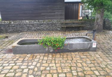
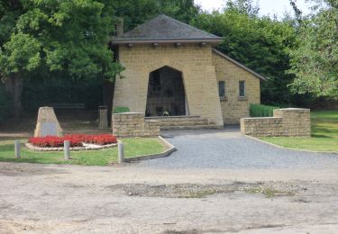
Tour Wandern von 14,6 km verfügbar auf Wallonien, Luxemburg, Habich. Diese Tour wird von GR Rando vorgeschlagen.
Beschreibung
RB-Lu-20- Variante -Randonnée adossée à la ligne 162
Ort
Land:
Belgium
Region :
Wallonien
Abteilung/Provinz :
Luxemburg
Kommune :
Habich
Standort:
Unknown
Gehen Sie:(Dec)
Gehen Sie:(UTM)
682994 ; 5511410 (31U) N.
Kommentare
Touren in der Umgebung
![Tour Wandern Habich - RB-Lu-20_Marbehan - Photo](https://media.geolcdn.com/t/375/260/ext.jpg?maxdim=2&url=https%3A%2F%2Fmedia.geolcdn.com%2Ff%2F10f52014-be4e-406f-a9f0-44c65148f259.JPG)
![Wandern Wandern](https://static1.geolcdn.com/sitytour/trail-icons/101.png)
RB-Lu-20_Marbehan
Wandern
Schwierig
(2)
Habich,
Wallonien,
Luxemburg,
Belgium
![](/images/other/stat-length.png)
25 km | 31 km-effort
6h 32min
![](https://static1.geolcdn.com/siteimages/upload/files/16400158638029165_repeat_loop_refresh_sync_direction_icon.png)
Ja
![Tour Wandern Habich - Marbehan. Natura 2000, des sites qui valent le détour. Lx4 - Photo](https://media.geolcdn.com/t/375/260/ext.jpg?maxdim=2&url=https%3A%2F%2Fservices.sitytrail.com%2FGeolivesWS%2FDownloadMedia.ashx%3FTrailID%3D163714%26Media%3De2832806-23fb-4057-bbee-f836d150b0a6.JPG)
![Wandern Wandern](https://static1.geolcdn.com/sitytour/trail-icons/101.png)
Marbehan. Natura 2000, des sites qui valent le détour. Lx4
Wandern
Einfach
(3)
Habich,
Wallonien,
Luxemburg,
Belgium
![](/images/other/stat-length.png)
10 km | 12,4 km-effort
2h 41min
![](https://static1.geolcdn.com/siteimages/upload/files/16400158638029165_repeat_loop_refresh_sync_direction_icon.png)
Ja
![Tour Reiten Habich - Forêt de Rulles - Photo](https://media.geolcdn.com/t/375/260/ext.jpg?maxdim=2&url=https%3A%2F%2Fmedia.geolcdn.com%2Ff%2Fa38a8cb1-ff9c-4914-bcb7-5d901a1c22cc.jpg)
![Reiten Reiten](https://static1.geolcdn.com/sitytour/trail-icons/301.png)
Forêt de Rulles
Reiten
Einfach
(1)
Habich,
Wallonien,
Luxemburg,
Belgium
![](/images/other/stat-length.png)
12,5 km | 15,3 km-effort
1h 56min
![](https://static1.geolcdn.com/siteimages/upload/files/16400158638029165_repeat_loop_refresh_sync_direction_icon.png)
Ja
![Tour Wandern Étalle - Sentier des mardelles - Photo](https://media.geolcdn.com/t/375/260/ext.jpg?maxdim=2&url=https%3A%2F%2Fservices.sitytrail.com%2FGeolivesWS%2FDownloadMedia.ashx%3FTrailID%3D67799%26Media%3D7cf7391b-4ead-4d15-8bef-379f53159afc.JPG)
![Wandern Wandern](https://static1.geolcdn.com/sitytour/trail-icons/101.png)
Sentier des mardelles
Wandern
Einfach
(1)
Étalle,
Wallonien,
Luxemburg,
Belgium
![](/images/other/stat-length.png)
3,7 km | 4,2 km-effort
1h 0min
![](https://static1.geolcdn.com/siteimages/upload/files/16400158638029165_repeat_loop_refresh_sync_direction_icon.png)
Ja
![Tour Wandern Habich - Marche 10 km 400 à Marbehan. - Photo](https://media.geolcdn.com/t/375/260/ext.jpg?maxdim=2&url=https%3A%2F%2Fmedia.geolcdn.com%2Ff%2F5d029b46-ad34-4684-830a-fb2218d37132.jpg)
![Wandern Wandern](https://static1.geolcdn.com/sitytour/trail-icons/101.png)
Marche 10 km 400 à Marbehan.
Wandern
Schwierig
Habich,
Wallonien,
Luxemburg,
Belgium
![](/images/other/stat-length.png)
10,3 km | 12,9 km-effort
2h 1min
![](https://static1.geolcdn.com/siteimages/upload/files/16400158638029165_repeat_loop_refresh_sync_direction_icon.png)
Ja
![Tour Wandern Habich - Marche ADEPS 10 Km à Rulles. - Photo](https://media.geolcdn.com/t/375/260/ext.jpg?maxdim=2&url=https%3A%2F%2Fmedia.geolcdn.com%2Ff%2F904acb29-9c19-4959-adec-83e780accc04.jpg)
![Wandern Wandern](https://static1.geolcdn.com/sitytour/trail-icons/101.png)
Marche ADEPS 10 Km à Rulles.
Wandern
Einfach
Habich,
Wallonien,
Luxemburg,
Belgium
![](/images/other/stat-length.png)
9,9 km | 12,3 km-effort
2h 5min
![](https://static1.geolcdn.com/siteimages/upload/files/16400158638029165_repeat_loop_refresh_sync_direction_icon.png)
Ja
![Tour Mountainbike Habich - 25km Tour Forêt de Rulles depuis Asinerie de l'O - Photo](https://media.geolcdn.com/t/375/260/ext.jpg?maxdim=2&url=https%3A%2F%2Fstatic1.geolcdn.com%2Fsiteimages%2Fupload%2Ffiles%2F1524743154velo.jpg)
![Mountainbike Mountainbike](https://static1.geolcdn.com/sitytour/trail-icons/202.png)
25km Tour Forêt de Rulles depuis Asinerie de l'O
Mountainbike
Medium
(3)
Habich,
Wallonien,
Luxemburg,
Belgium
![](/images/other/stat-length.png)
25 km | 31 km-effort
2h 1min
![](https://static1.geolcdn.com/siteimages/upload/files/16400158638029165_repeat_loop_refresh_sync_direction_icon.png)
Ja
![Tour Wandern Habich - RB-Lu-20_Marbehan_Boucle-1 - Photo](https://media.geolcdn.com/t/375/260/ext.jpg?maxdim=2&url=https%3A%2F%2Fmedia.geolcdn.com%2Ff%2Fa2064c44-1fc4-4155-864a-7b19f800722a.JPG)
![Wandern Wandern](https://static1.geolcdn.com/sitytour/trail-icons/101.png)
RB-Lu-20_Marbehan_Boucle-1
Wandern
Einfach
Habich,
Wallonien,
Luxemburg,
Belgium
![](/images/other/stat-length.png)
11,5 km | 14,5 km-effort
3h 7min
![](https://static1.geolcdn.com/siteimages/upload/files/16400158638029165_repeat_loop_refresh_sync_direction_icon.png)
Ja
![Tour Wandern Étalle - cyruse - Photo](https://media.geolcdn.com/t/375/260/ext.jpg?maxdim=2&url=https%3A%2F%2Fstatic1.geolcdn.com%2Fsiteimages%2Fupload%2Ffiles%2F1553511878bg_sport_marche.png)
![Wandern Wandern](https://static1.geolcdn.com/sitytour/trail-icons/101.png)
cyruse
Wandern
Sehr leicht
(1)
Étalle,
Wallonien,
Luxemburg,
Belgium
![](/images/other/stat-length.png)
41 km | 47 km-effort
1h 18min
![](https://static1.geolcdn.com/siteimages/upload/files/16400158638029165_repeat_loop_refresh_sync_direction_icon.png)
Nein