


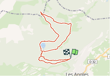

13,9 km | 19,1 km-effort


Benutzer


Kostenlosegpshiking-Anwendung
 SityTrail
IGN / Geografische Institute
SityTrail World
Die Welt öffnet sich für Sie
Tour Schneeschuhwandern von 10,8 km verfügbar auf Okzitanien, Ostpyrenäen, Les Angles. Diese Tour wird von jpipacific vorgeschlagen.
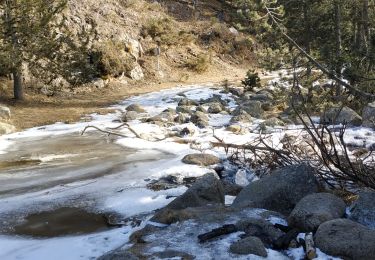
Ballade qui alterne bois lac et points de vue. Mieux de faire la première boucle dans l'autre sens car depuis le lac la montée est rude.

Schneeschuhwandern

Wandern

Wandern

Wandern

Wandern

Schneeschuhwandern
Wandern


sport
Wandern