


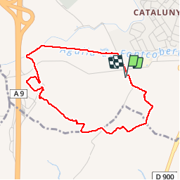


33 km | 40 km-effort


Benutzer


Kostenlosegpshiking-Anwendung
 SityTrail
IGN / Geografische Institute
SityTrail World
Die Welt öffnet sich für Sie
Tour Wandern von 4,3 km verfügbar auf Okzitanien, Ostpyrenäen, Perpignan. Diese Tour wird von jeff66 vorgeschlagen.
66 PERPIGNAN - autour des mas Du petit et du grand Bresson, CAN Marra, vues sur les Alberes et le Canigou, serrat de la Garriga Dels Frares, canal de Perpignan


23 Fotos insgesamt. Klicken Sie auf ein Foto, um sie alle in der Galerie zu sehen.

Quad

Wandern

Wandern

Wandern
Wandern

Mountainbike

Quad
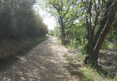
Wandern

Wandern