


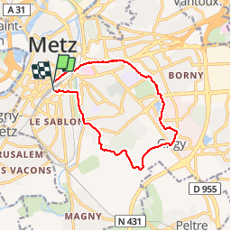

6,9 km | 9,2 km-effort


Benutzer


Kostenlosegpshiking-Anwendung
 SityTrail
IGN / Geografische Institute
SityTrail World
Die Welt öffnet sich für Sie
Tour Wandern von 11,7 km verfügbar auf Großer Osten, Mosel, Metz. Diese Tour wird von joelclaudel vorgeschlagen.
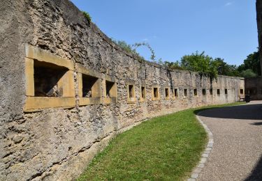
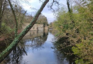
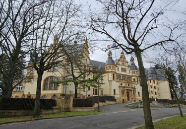
Gare de Metz,GR5G, Belle Tanche, lac Symphonie, Grigy, Haute Bévoye, Queuleu, Parc de la Seille et retour gare par le Centre Georges Pompidou.

Wandern

Wandern

Zu Fuß

Zu Fuß

Zu Fuß
Wandern

Mountainbike
Wandern
Wandern