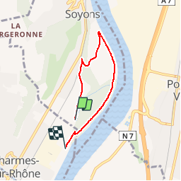
![](/images/other/stat-length.png)
![Tour Wandern Soyons - Marche rapide Charmes sur Rhone - Photo](https://media.geolcdn.com/t/1900/400/ext.pjpeg?maxdim=2&url=https%3A%2F%2Fservices.sitytrail.com%2FGeolivesWS%2FDownloadMedia.ashx%3FTrailID%3D512320%26Media%3Dfix__20160113120837.jpg)
Marche rapide Charmes sur Rhone
patchil
Benutzer
![Länge](/images/other/stat-length.png)
Länge
4,9 km
![Maximale Höhe](https://static1.geolcdn.com/siteimages/upload/files/1508320355ic_sort_altitude_max_24dp.png)
Maximale Höhe
110 m
![Positive Höhendifferenz](https://static1.geolcdn.com/siteimages/upload/files/1508320355ic_sort_den_pos_24dp.png)
Positive Höhendifferenz
31 m
![Km-Effort](/images/other/stat-length.png)
Km-Effort
5,4 km
![Min. Höhe](https://static1.geolcdn.com/siteimages/upload/files/1508320355ic_sort_altitude_min_24dp.png)
Min. Höhe
98 m
![Negative Höhendifferenz](https://static1.geolcdn.com/siteimages/upload/files/1508320355ic_sort_den_neg_24dp.png)
Negative Höhendifferenz
31 m
![Boucle](https://static1.geolcdn.com/siteimages/upload/files/16400158638029165_repeat_loop_refresh_sync_direction_icon.png)
Boucle
Nein
Erstellungsdatum :
2016-01-15 00:00:00.0
Letzte Änderung :
2016-01-15 00:00:00.0
![Wandern](https://static1.geolcdn.com/sitytour/trail-icons/101.png)
1h25
Schwierigkeit : Einfach
![Scannen Sie diesen QR-Code, um die Tour in der SityTrail-Anwendung zu öffnen](https://capi.geolives.com/qq0zvz2zws4bq2lad0pu/sitytour/trails/512320/qr.png?size=200)
Kostenlosegpshiking-Anwendung
Über SityTrail
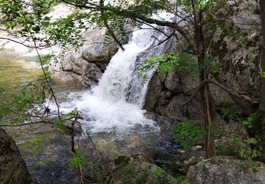
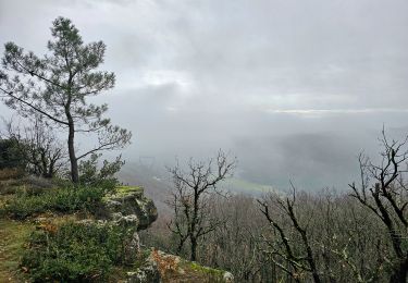
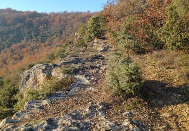
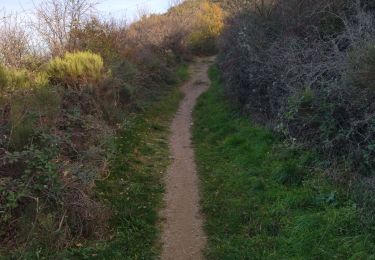
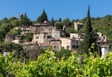
Tour Wandern von 4,9 km verfügbar auf Auvergne-Rhone-Alpen, Ardèche, Soyons. Diese Tour wird von patchil vorgeschlagen.
Beschreibung
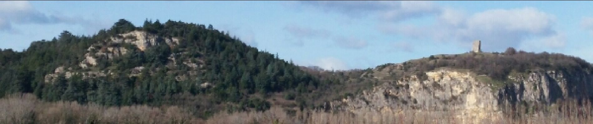
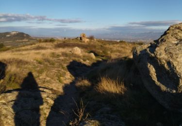
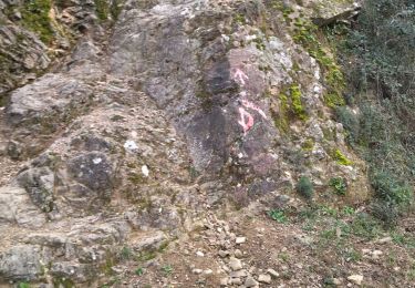
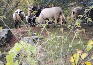
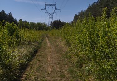
Petite marche de 6 kms /h au bord du Rhône à partir de Charmes sur Rhône en direction de Soyons. Une petite boucle qu'il est possible de rallonger suivant le programme. On passe le long d'une chemin très agréable sans voiture , avec un paysage agréable.
Ort
Land:
France
Region :
Auvergne-Rhone-Alpen
Abteilung/Provinz :
Ardèche
Kommune :
Soyons
Standort:
Unknown
Gehen Sie:(Dec)
Gehen Sie:(UTM)
646053 ; 4970191 (31T) N.
Kommentare
Touren in der Umgebung
![Tour Wandern Toulaud - l'Embroye - Photo](https://media.geolcdn.com/t/375/260/ext.jpg?maxdim=2&url=https%3A%2F%2Fmedia.geolcdn.com%2Ff%2Fcb947bb6-7dc1-43ba-a067-9c4f7f015103.jpg)
![Wandern Wandern](https://static1.geolcdn.com/sitytour/trail-icons/101.png)
l'Embroye
Wandern
Medium
Toulaud,
Auvergne-Rhone-Alpen,
Ardèche,
France
![](/images/other/stat-length.png)
12,6 km | 19,6 km-effort
6h 9min
![](https://static1.geolcdn.com/siteimages/upload/files/16400158638029165_repeat_loop_refresh_sync_direction_icon.png)
Nein
![Tour Wandern Toulaud - 07 toulaud - Photo](https://media.geolcdn.com/t/375/260/ext.jpg?maxdim=2&url=https%3A%2F%2Fmedia.geolcdn.com%2Ff%2F89acc3af-3d99-4629-8f1e-c7b281476088.jpg)
![Wandern Wandern](https://static1.geolcdn.com/sitytour/trail-icons/101.png)
07 toulaud
Wandern
Sehr leicht
Toulaud,
Auvergne-Rhone-Alpen,
Ardèche,
France
![](/images/other/stat-length.png)
7,1 km | 10,9 km-effort
2h 24min
![](https://static1.geolcdn.com/siteimages/upload/files/16400158638029165_repeat_loop_refresh_sync_direction_icon.png)
Ja
![Tour Wandern Saint-Georges-les-Bains - Saint Georges les Bains - Photo](https://media.geolcdn.com/t/375/260/ext.jpg?maxdim=2&url=https%3A%2F%2Fmedia.geolcdn.com%2Ff%2Fe93486d4-d5f4-4b3e-8536-d4298013ea4d.jpg)
![Wandern Wandern](https://static1.geolcdn.com/sitytour/trail-icons/101.png)
Saint Georges les Bains
Wandern
Sehr schwierig
Saint-Georges-les-Bains,
Auvergne-Rhone-Alpen,
Ardèche,
France
![](/images/other/stat-length.png)
16,4 km | 23 km-effort
5h 19min
![](https://static1.geolcdn.com/siteimages/upload/files/16400158638029165_repeat_loop_refresh_sync_direction_icon.png)
Ja
![Tour Wandern Saint-Georges-les-Bains - col de Rotison - Photo](https://media.geolcdn.com/t/375/260/ext.jpg?maxdim=2&url=https%3A%2F%2Fmedia.geolcdn.com%2Ff%2F8c3d1009-c72f-4ec6-bf61-7a2fde476dc2.jpg)
![Wandern Wandern](https://static1.geolcdn.com/sitytour/trail-icons/101.png)
col de Rotison
Wandern
Schwierig
Saint-Georges-les-Bains,
Auvergne-Rhone-Alpen,
Ardèche,
France
![](/images/other/stat-length.png)
9,4 km | 14,4 km-effort
6h 7min
![](https://static1.geolcdn.com/siteimages/upload/files/16400158638029165_repeat_loop_refresh_sync_direction_icon.png)
Ja
![Tour Wandern Toulaud - Gorges de l'Embroye - Photo](https://media.geolcdn.com/t/375/260/ext.jpg?maxdim=2&url=https%3A%2F%2Fmedia.geolcdn.com%2Ff%2F050f228b-bc3c-4cca-b6f5-b260ca37e31b.jpg)
![Wandern Wandern](https://static1.geolcdn.com/sitytour/trail-icons/101.png)
Gorges de l'Embroye
Wandern
Schwierig
Toulaud,
Auvergne-Rhone-Alpen,
Ardèche,
France
![](/images/other/stat-length.png)
7,3 km | 10,5 km-effort
2h 45min
![](https://static1.geolcdn.com/siteimages/upload/files/16400158638029165_repeat_loop_refresh_sync_direction_icon.png)
Ja
![Tour Mountainbike Toulaud - Valence - Arcens - Photo](https://media.geolcdn.com/t/375/260/ext.jpg?maxdim=2&url=https%3A%2F%2Fservices.sitytrail.com%2FGeolivesWS%2FDownloadMedia.ashx%3FTrailID%3D101098%26Media%3D585_3.jpg)
![Mountainbike Mountainbike](https://static1.geolcdn.com/sitytour/trail-icons/202.png)
Valence - Arcens
Mountainbike
Sehr schwierig
Toulaud,
Auvergne-Rhone-Alpen,
Ardèche,
France
![](/images/other/stat-length.png)
63 km | 90 km-effort
5h 0min
![](https://static1.geolcdn.com/siteimages/upload/files/16400158638029165_repeat_loop_refresh_sync_direction_icon.png)
Nein
![Tour Wandern Toulaud - toulaud - Photo](https://media.geolcdn.com/t/375/260/ext.jpg?maxdim=2&url=https%3A%2F%2Fmedia.geolcdn.com%2Ff%2F9eb559f9-0028-4c1d-a081-a96d926141e7.jpg)
![Wandern Wandern](https://static1.geolcdn.com/sitytour/trail-icons/101.png)
toulaud
Wandern
Medium
Toulaud,
Auvergne-Rhone-Alpen,
Ardèche,
France
![](/images/other/stat-length.png)
5,7 km | 9 km-effort
2h 4min
![](https://static1.geolcdn.com/siteimages/upload/files/16400158638029165_repeat_loop_refresh_sync_direction_icon.png)
Ja
![Tour Wandern Toulaud - 07 gorges embroye - Photo](https://media.geolcdn.com/t/375/260/ext.jpg?maxdim=2&url=https%3A%2F%2Fmedia.geolcdn.com%2Ff%2Fd81e90ab-1575-4c8f-b98f-1b96e0b43ac1.jpg)
![Wandern Wandern](https://static1.geolcdn.com/sitytour/trail-icons/101.png)
07 gorges embroye
Wandern
Einfach
Toulaud,
Auvergne-Rhone-Alpen,
Ardèche,
France
![](/images/other/stat-length.png)
7,8 km | 11,2 km-effort
2h 40min
![](https://static1.geolcdn.com/siteimages/upload/files/16400158638029165_repeat_loop_refresh_sync_direction_icon.png)
Ja
![Tour Wandern Beauchastel - 2022-06-25_20h37m57_Beauchastel 16,5km.gpx (1).xml - Photo](https://media.geolcdn.com/t/375/260/ext.jpg?maxdim=2&url=https%3A%2F%2Fmedia.geolcdn.com%2Ff%2Fc478205d-33f4-4e99-b83b-07be3d25d520.jpg)
![Wandern Wandern](https://static1.geolcdn.com/sitytour/trail-icons/101.png)
2022-06-25_20h37m57_Beauchastel 16,5km.gpx (1).xml
Wandern
Medium
Beauchastel,
Auvergne-Rhone-Alpen,
Ardèche,
France
![](/images/other/stat-length.png)
16,2 km | 23 km-effort
5h 17min
![](https://static1.geolcdn.com/siteimages/upload/files/16400158638029165_repeat_loop_refresh_sync_direction_icon.png)
Ja