![](/images/other/stat-length.png)
![Tour Wandern Maringues - maringues - Photo](https://media.geolcdn.com/t/1900/400/ext.pjpeg?maxdim=2&url=https%3A%2F%2Fstatic1.geolcdn.com%2Fsiteimages%2Fupload%2Ffiles%2F1553511878bg_sport_marche.png)
maringues
guy63
Benutzer
![Länge](/images/other/stat-length.png)
![Maximale Höhe](https://static1.geolcdn.com/siteimages/upload/files/1508320355ic_sort_altitude_max_24dp.png)
![Positive Höhendifferenz](https://static1.geolcdn.com/siteimages/upload/files/1508320355ic_sort_den_pos_24dp.png)
![Km-Effort](/images/other/stat-length.png)
![Min. Höhe](https://static1.geolcdn.com/siteimages/upload/files/1508320355ic_sort_altitude_min_24dp.png)
![Negative Höhendifferenz](https://static1.geolcdn.com/siteimages/upload/files/1508320355ic_sort_den_neg_24dp.png)
![Boucle](https://static1.geolcdn.com/siteimages/upload/files/16400158638029165_repeat_loop_refresh_sync_direction_icon.png)
![Wandern](https://static1.geolcdn.com/sitytour/trail-icons/101.png)
4h24
Schwierigkeit : Medium
![Scannen Sie diesen QR-Code, um die Tour in der SityTrail-Anwendung zu öffnen](https://capi.geolives.com/qq0zvz2zws4bq2lad0pu/sitytour/trails/509496/qr.png?size=200)
Kostenlosegpshiking-Anwendung
Über SityTrail
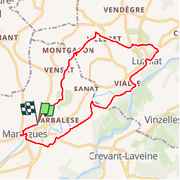
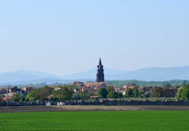
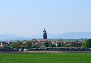
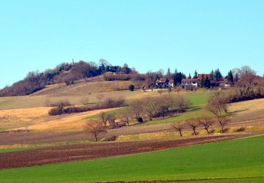
Tour Wandern von 17,7 km verfügbar auf Auvergne-Rhone-Alpen, Puy-de-Dôme, Maringues. Diese Tour wird von guy63 vorgeschlagen.
Beschreibung
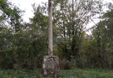
Départ parking Terrain des Sports point GPS Longitude : 3° 20' 8.8' E Latitude : 45° 55' 29.9' N. en traversant la ville prendre le temps de regarder les anciennes bâtisses en pierre de Volvic, le marché couvert, sur le parvis de l’Eglise la superbe vue sur la chaine des puys. Bon chemin partie boisée, l’autre longeant les pâturages et cour d’eau. En montant la bute de Montgacon allez à la vierge une vue à 360° sur tous les monts de la région. Vous êtes sur la plaine de la Limagne, respectez la nature ne pas sortir des chemins.
Ort
Kommentare
Touren in der Umgebung
![Tour Zu Fuß Maringues - La Butte de Montgacon - circuit court - Photo](https://media.geolcdn.com/t/375/260/ab4843d0-b44d-4ab7-8595-840f5a55ca60.jpeg&format=jpg&maxdim=2)
![Zu Fuß Zu Fuß](https://static1.geolcdn.com/sitytour/trail-icons/100.png)
Zu Fuß
![](/images/other/stat-length.png)
![](https://static1.geolcdn.com/siteimages/upload/files/16400158638029165_repeat_loop_refresh_sync_direction_icon.png)
![Tour Zu Fuß Luzillat - La Butte de Montgacon - Photo](https://media.geolcdn.com/t/375/260/dae0ac9a-ba68-464f-a0a3-8b55925d12f4.jpeg&format=jpg&maxdim=2)
![Zu Fuß Zu Fuß](https://static1.geolcdn.com/sitytour/trail-icons/100.png)
Zu Fuß
![](/images/other/stat-length.png)
![](https://static1.geolcdn.com/siteimages/upload/files/16400158638029165_repeat_loop_refresh_sync_direction_icon.png)
![Tour Zu Fuß Vinzelles - Entre Crevant et Laveine - Photo](https://media.geolcdn.com/t/375/260/dd947ee4-d5c1-4bf1-b419-c5f2be4d1510.jpeg&format=jpg&maxdim=2)
![Zu Fuß Zu Fuß](https://static1.geolcdn.com/sitytour/trail-icons/100.png)
Zu Fuß
![](/images/other/stat-length.png)
![](https://static1.geolcdn.com/siteimages/upload/files/16400158638029165_repeat_loop_refresh_sync_direction_icon.png)
![Wandern Wandern](https://static1.geolcdn.com/sitytour/trail-icons/101.png)
Wandern
![](/images/other/stat-length.png)
![](https://static1.geolcdn.com/siteimages/upload/files/16400158638029165_repeat_loop_refresh_sync_direction_icon.png)
![Tour Wandern Maringues - Maringues_Butte_Montgacon - Photo](https://media.geolcdn.com/t/375/260/fef1ecfc-3d14-4465-b9c8-110655272baa.jpg&format=jpg&maxdim=2)
![Wandern Wandern](https://static1.geolcdn.com/sitytour/trail-icons/101.png)
Wandern
![](/images/other/stat-length.png)
![](https://static1.geolcdn.com/siteimages/upload/files/16400158638029165_repeat_loop_refresh_sync_direction_icon.png)
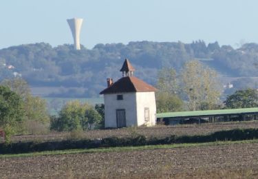
![Tour Wandern Crevant-Laveine - [Itinéraire] Entre Crevant et Laveine - Photo](https://media.geolcdn.com/t/375/260/6fa182a0-77c3-4ab4-a1f7-73c600d86e47.png&format=jpg&maxdim=2)
![Wandern Wandern](https://static1.geolcdn.com/sitytour/trail-icons/101.png)
Wandern
![](/images/other/stat-length.png)
![](https://static1.geolcdn.com/siteimages/upload/files/16400158638029165_repeat_loop_refresh_sync_direction_icon.png)
![Wandern Wandern](https://static1.geolcdn.com/sitytour/trail-icons/101.png)
Wandern
![](/images/other/stat-length.png)
![](https://static1.geolcdn.com/siteimages/upload/files/16400158638029165_repeat_loop_refresh_sync_direction_icon.png)
![Tour Wandern Crevant-Laveine - crevant Laveine par les chemins - Photo](https://media.geolcdn.com/t/375/260/65c9ac11-9bc3-49c0-96c9-fc6caab54fb2.jpg&format=jpg&maxdim=2)
![Wandern Wandern](https://static1.geolcdn.com/sitytour/trail-icons/101.png)
Wandern
![](/images/other/stat-length.png)
![](https://static1.geolcdn.com/siteimages/upload/files/16400158638029165_repeat_loop_refresh_sync_direction_icon.png)
![Tour Wandern Saint-Laure - 2022-10-25 Saint Laure - Photo](https://media.geolcdn.com/t/375/260/c8f90e77-25e2-4769-a5e7-90ee0c50591a.png&format=jpg&maxdim=2)
![Wandern Wandern](https://static1.geolcdn.com/sitytour/trail-icons/101.png)
Wandern
![](/images/other/stat-length.png)
![](https://static1.geolcdn.com/siteimages/upload/files/16400158638029165_repeat_loop_refresh_sync_direction_icon.png)