![](/images/other/stat-length.png)
![Tour Wandern Chéroy - Vallées du Lunain - Photo](https://media.geolcdn.com/t/1900/400/ext.pjpeg?maxdim=2&url=https%3A%2F%2Fstatic1.geolcdn.com%2Fsiteimages%2Fupload%2Ffiles%2F1553511878bg_sport_marche.png)
Vallées du Lunain
micheljannot
Benutzer
![Länge](/images/other/stat-length.png)
Länge
17,3 km
![Maximale Höhe](https://static1.geolcdn.com/siteimages/upload/files/1508320355ic_sort_altitude_max_24dp.png)
Maximale Höhe
153 m
![Positive Höhendifferenz](https://static1.geolcdn.com/siteimages/upload/files/1508320355ic_sort_den_pos_24dp.png)
Positive Höhendifferenz
151 m
![Km-Effort](/images/other/stat-length.png)
Km-Effort
19,3 km
![Min. Höhe](https://static1.geolcdn.com/siteimages/upload/files/1508320355ic_sort_altitude_min_24dp.png)
Min. Höhe
115 m
![Negative Höhendifferenz](https://static1.geolcdn.com/siteimages/upload/files/1508320355ic_sort_den_neg_24dp.png)
Negative Höhendifferenz
149 m
![Boucle](https://static1.geolcdn.com/siteimages/upload/files/16400158638029165_repeat_loop_refresh_sync_direction_icon.png)
Boucle
Ja
Erstellungsdatum :
2016-07-17 00:00:00.0
Letzte Änderung :
2016-07-17 00:00:00.0
![Wandern](https://static1.geolcdn.com/sitytour/trail-icons/101.png)
4h17
Schwierigkeit : Einfach
![Scannen Sie diesen QR-Code, um die Tour in der SityTrail-Anwendung zu öffnen](https://capi.geolives.com/qq0zvz2zws4bq2lad0pu/sitytour/trails/493273/qr.png?size=200)
Kostenlosegpshiking-Anwendung
Über SityTrail
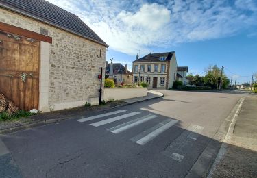
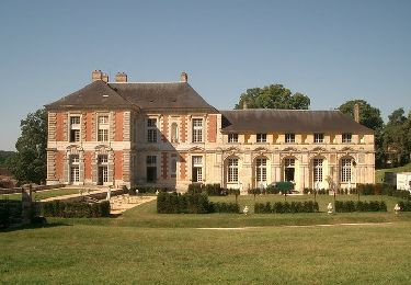
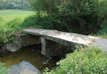
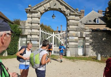
Tour Wandern von 17,3 km verfügbar auf Burgund und Freigrafschaft, Yonne, Chéroy. Diese Tour wird von micheljannot vorgeschlagen.
Beschreibung
circuit à cheval sur Yonne et Seine-et-Marne
circuit balisé par les deux comités FFRP
sans description sur topoguide
Ort
Land:
France
Region :
Burgund und Freigrafschaft
Abteilung/Provinz :
Yonne
Kommune :
Chéroy
Standort:
Unknown
Gehen Sie:(Dec)
Gehen Sie:(UTM)
499960 ; 5338845 (31U) N.
Kommentare
Touren in der Umgebung
![Tour Wandern Montacher-Villegardin - Montacher 240421 - Photo](https://media.geolcdn.com/t/375/260/26a00fef-49af-47e5-872c-1301bc752964.jpg&format=jpg&maxdim=2)
![Wandern Wandern](https://static1.geolcdn.com/sitytour/trail-icons/101.png)
Montacher 240421
Wandern
Sehr leicht
Montacher-Villegardin,
Burgund und Freigrafschaft,
Yonne,
France
![](/images/other/stat-length.png)
10,2 km | 11,4 km-effort
3h 34min
![](https://static1.geolcdn.com/siteimages/upload/files/16400158638029165_repeat_loop_refresh_sync_direction_icon.png)
Ja
![Tour Mountainbike Vallery - Circuit VTT à Vallery - Photo](https://media.geolcdn.com/t/375/260/ext.jpg?maxdim=2&url=https%3A%2F%2Fservices.sitytrail.com%2FGeolivesWS%2FDownloadMedia.ashx%3FTrailID%3D173059%26Media%3D14585_4.jpg)
![Mountainbike Mountainbike](https://static1.geolcdn.com/sitytour/trail-icons/202.png)
Circuit VTT à Vallery
Mountainbike
Schwierig
Vallery,
Burgund und Freigrafschaft,
Yonne,
France
![](/images/other/stat-length.png)
42 km | 47 km-effort
3h 30min
![](https://static1.geolcdn.com/siteimages/upload/files/16400158638029165_repeat_loop_refresh_sync_direction_icon.png)
Ja
![Tour Wandern Chéroy - A la recherche du Lunain - Photo](https://media.geolcdn.com/t/375/260/ext.jpg?maxdim=2&url=https%3A%2F%2Fservices.sitytrail.com%2FGeolivesWS%2FDownloadMedia.ashx%3FTrailID%3D101526%26Media%3D1628_6.jpg)
![Wandern Wandern](https://static1.geolcdn.com/sitytour/trail-icons/101.png)
A la recherche du Lunain
Wandern
Schwierig
(1)
Chéroy,
Burgund und Freigrafschaft,
Yonne,
France
![](/images/other/stat-length.png)
14,6 km | 16,6 km-effort
4h 0min
![](https://static1.geolcdn.com/siteimages/upload/files/16400158638029165_repeat_loop_refresh_sync_direction_icon.png)
Ja
![Tour Wandern Chéroy - cheroy - Photo](https://media.geolcdn.com/t/375/260/ae0311ec-20ac-4f8b-bc62-04984631a788.jpg&format=jpg&maxdim=2)
![Wandern Wandern](https://static1.geolcdn.com/sitytour/trail-icons/101.png)
cheroy
Wandern
Sehr schwierig
Chéroy,
Burgund und Freigrafschaft,
Yonne,
France
![](/images/other/stat-length.png)
70 km | 77 km-effort
5h 20min
![](https://static1.geolcdn.com/siteimages/upload/files/16400158638029165_repeat_loop_refresh_sync_direction_icon.png)
Nein
![Tour Rennrad Villebéon - EXT75 Villebéon-01 - Photo](https://media.geolcdn.com/t/375/260/ext.jpg?maxdim=2&url=https%3A%2F%2Fstatic1.geolcdn.com%2Fsiteimages%2Fupload%2Ffiles%2F1524743154velo.jpg)
![Rennrad Rennrad](https://static1.geolcdn.com/sitytour/trail-icons/201.png)
EXT75 Villebéon-01
Rennrad
Sehr leicht
Villebéon,
Île-de-France,
Seine-et-Marne,
France
![](/images/other/stat-length.png)
74 km | 83 km-effort
Unbekannt
![](https://static1.geolcdn.com/siteimages/upload/files/16400158638029165_repeat_loop_refresh_sync_direction_icon.png)
Ja
![Tour Mountainbike Vaux-sur-Lunain - La vallée du Lunain - Photo](https://media.geolcdn.com/t/375/260/b6067454-149c-457c-9fe8-8d4542708754.jpg&format=jpg&maxdim=2)
![Mountainbike Mountainbike](https://static1.geolcdn.com/sitytour/trail-icons/202.png)
La vallée du Lunain
Mountainbike
Sehr leicht
Vaux-sur-Lunain,
Île-de-France,
Seine-et-Marne,
France
![](/images/other/stat-length.png)
31 km | 35 km-effort
3h 21min
![](https://static1.geolcdn.com/siteimages/upload/files/16400158638029165_repeat_loop_refresh_sync_direction_icon.png)
Ja
![Tour Wandern Vallery - vallery 89 - Photo](https://media.geolcdn.com/t/375/260/ext.jpg?maxdim=2&url=https%3A%2F%2Fstatic1.geolcdn.com%2Fsiteimages%2Fupload%2Ffiles%2F1553511878bg_sport_marche.png)
![Wandern Wandern](https://static1.geolcdn.com/sitytour/trail-icons/101.png)
vallery 89
Wandern
Medium
Vallery,
Burgund und Freigrafschaft,
Yonne,
France
![](/images/other/stat-length.png)
7,5 km | 9 km-effort
1h 22min
![](https://static1.geolcdn.com/siteimages/upload/files/16400158638029165_repeat_loop_refresh_sync_direction_icon.png)
Ja
![Tour Mountainbike Vallery - 2016-08-15 Valléry 45 km - Photo](https://media.geolcdn.com/t/375/260/ext.jpg?maxdim=2&url=https%3A%2F%2Fstatic1.geolcdn.com%2Fsiteimages%2Fupload%2Ffiles%2F1524743154velo.jpg)
![Mountainbike Mountainbike](https://static1.geolcdn.com/sitytour/trail-icons/202.png)
2016-08-15 Valléry 45 km
Mountainbike
Einfach
Vallery,
Burgund und Freigrafschaft,
Yonne,
France
![](/images/other/stat-length.png)
45 km | 50 km-effort
3h 19min
![](https://static1.geolcdn.com/siteimages/upload/files/16400158638029165_repeat_loop_refresh_sync_direction_icon.png)
Ja
![Tour Wandern Vaux-sur-Lunain - Vaux sur Lunain - Photo](https://media.geolcdn.com/t/375/260/ext.jpg?maxdim=2&url=https%3A%2F%2Fstatic1.geolcdn.com%2Fsiteimages%2Fupload%2Ffiles%2F1553511878bg_sport_marche.png)
![Wandern Wandern](https://static1.geolcdn.com/sitytour/trail-icons/101.png)
Vaux sur Lunain
Wandern
Einfach
Vaux-sur-Lunain,
Île-de-France,
Seine-et-Marne,
France
![](/images/other/stat-length.png)
15,7 km | 17,5 km-effort
3h 52min
![](https://static1.geolcdn.com/siteimages/upload/files/16400158638029165_repeat_loop_refresh_sync_direction_icon.png)
Ja