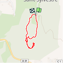
![](/images/other/stat-length.png)
![Tour Wandern Saint-Sylvestre - FAILLES_ST_SYLVESTRE - Photo](https://media.geolcdn.com/t/1900/400/ext.pjpeg?maxdim=2&url=https%3A%2F%2Fservices.sitytrail.com%2FGeolivesWS%2FDownloadMedia.ashx%3FTrailID%3D479927%26Media%3D35564f14-db11-4f0e-9afc-25cd032c1f16.jpg)
FAILLES_ST_SYLVESTRE
HERRY
Benutzer GUIDE
![Länge](/images/other/stat-length.png)
![Maximale Höhe](https://static1.geolcdn.com/siteimages/upload/files/1508320355ic_sort_altitude_max_24dp.png)
![Positive Höhendifferenz](https://static1.geolcdn.com/siteimages/upload/files/1508320355ic_sort_den_pos_24dp.png)
![Km-Effort](/images/other/stat-length.png)
![Min. Höhe](https://static1.geolcdn.com/siteimages/upload/files/1508320355ic_sort_altitude_min_24dp.png)
![Negative Höhendifferenz](https://static1.geolcdn.com/siteimages/upload/files/1508320355ic_sort_den_neg_24dp.png)
![Boucle](https://static1.geolcdn.com/siteimages/upload/files/16400158638029165_repeat_loop_refresh_sync_direction_icon.png)
![Wandern](https://static1.geolcdn.com/sitytour/trail-icons/101.png)
1h03
Schwierigkeit : Medium
![Scannen Sie diesen QR-Code, um die Tour in der SityTrail-Anwendung zu öffnen](https://capi.geolives.com/qq0zvz2zws4bq2lad0pu/sitytour/trails/479927/qr.png?size=200)
Kostenlosegpshiking-Anwendung
Über SityTrail
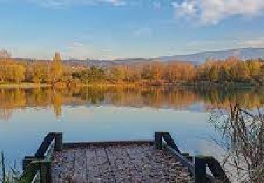
Tour Wandern von 1,6 km verfügbar auf Auvergne-Rhone-Alpen, Hochsavoyen, Saint-Sylvestre. Diese Tour wird von HERRY vorgeschlagen.
Beschreibung
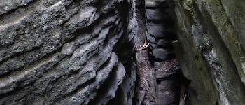
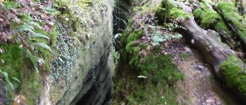
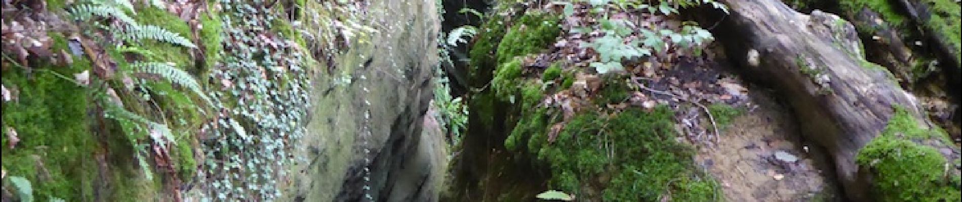
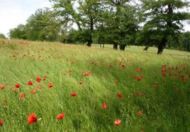
la curiosité géologique de cette randonnée compense la durée assez courte (1H AR). Les failles sont dues à l'accumulation de sable aggloméré provenant de l'ancienne mer Thétys. Au cours des ères géologiques le travail des plaques ainsi que celui des glaciers a relevé ,fissuré cet agglomérat puis creusé et érodé comme on peut le voir aujourd'hui.
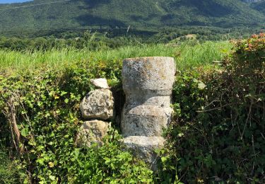
Pour y accéder se garer près de l'Eglise puis descendre vers l'école pour atteindre une chapelle. Rester sur le chemin de droite qui en 15 minutes vous amène au niveau des failles. Attention le terrain peut-être glissant. Il est déconseillé d'amener de jeunes enfants. La prudence est de mise tout au long du chemin
Ort
Kommentare
Touren in der Umgebung
![Tour Mountainbike Marcellaz-Albanais - Site VTT FFC de l'Albanais - Circuit N°4 Bois aux Loups - Marcellaz-Albanais - Photo](https://media.geolcdn.com/t/375/260/ext.jpg?maxdim=2&url=https%3A%2F%2Fservices.sitytrail.com%2FGeolivesWS%2FDownloadMedia.ashx%3FTrailID%3D191600%26Media%3D15236_1.jpg)
![Mountainbike Mountainbike](https://static1.geolcdn.com/sitytour/trail-icons/202.png)
Mountainbike
![](/images/other/stat-length.png)
![](https://static1.geolcdn.com/siteimages/upload/files/16400158638029165_repeat_loop_refresh_sync_direction_icon.png)
![Tour Wandern Viuz-la-Chiésaz - Circuit de Viuz La Chiesaz - Photo](https://media.geolcdn.com/t/375/260/5ec881e2-7522-436f-aeef-d18c681a45ff.jpg&format=jpg&maxdim=2)
![Wandern Wandern](https://static1.geolcdn.com/sitytour/trail-icons/101.png)
Wandern
![](/images/other/stat-length.png)
![](https://static1.geolcdn.com/siteimages/upload/files/16400158638029165_repeat_loop_refresh_sync_direction_icon.png)
![Tour Wandern Héry-sur-Alby - Les Hauts d'Héry - Photo](https://media.geolcdn.com/t/375/260/ext.jpg?maxdim=2&url=https%3A%2F%2Fservices.sitytrail.com%2FGeolivesWS%2FDownloadMedia.ashx%3FTrailID%3D959976%26Media%3D176a85ed-1de6-40ed-a0ca-4d079ee50053.jpg)
![Wandern Wandern](https://static1.geolcdn.com/sitytour/trail-icons/101.png)
Wandern
![](/images/other/stat-length.png)
![](https://static1.geolcdn.com/siteimages/upload/files/16400158638029165_repeat_loop_refresh_sync_direction_icon.png)
![Tour Mountainbike Rumilly - rando rumilly - Photo](https://media.geolcdn.com/t/375/260/377074f7-9fe1-4bff-851d-c59900e7a990.jpg&format=jpg&maxdim=2)
![Mountainbike Mountainbike](https://static1.geolcdn.com/sitytour/trail-icons/202.png)
Mountainbike
![](/images/other/stat-length.png)
![](https://static1.geolcdn.com/siteimages/upload/files/16400158638029165_repeat_loop_refresh_sync_direction_icon.png)
![Tour Wandern Rumilly - Plan d'eau de Rumilly à poussette - Photo](https://media.geolcdn.com/t/375/260/646ece07-042d-4627-b048-b38f12592477.jpg&format=jpg&maxdim=2)
![Wandern Wandern](https://static1.geolcdn.com/sitytour/trail-icons/101.png)
Wandern
![](/images/other/stat-length.png)
![](https://static1.geolcdn.com/siteimages/upload/files/16400158638029165_repeat_loop_refresh_sync_direction_icon.png)
![Tour Mountainbike Alby-sur-Chéran - VTC : Alby - Plan d'eau Rumilly - St Felix - Alby - Photo](https://media.geolcdn.com/t/375/260/96c6ce3e-2267-4804-926e-4b782a076268.jpg&format=jpg&maxdim=2)
![Mountainbike Mountainbike](https://static1.geolcdn.com/sitytour/trail-icons/202.png)
Mountainbike
![](/images/other/stat-length.png)
![](https://static1.geolcdn.com/siteimages/upload/files/16400158638029165_repeat_loop_refresh_sync_direction_icon.png)
![Tour Wandern Chapeiry - Châtaignes à St Sylvestre (74) - Photo](https://media.geolcdn.com/t/375/260/fd39c64e-49e8-4615-b7cd-db58d57f70de.jpg&format=jpg&maxdim=2)
![Wandern Wandern](https://static1.geolcdn.com/sitytour/trail-icons/101.png)
Wandern
![](/images/other/stat-length.png)
![](https://static1.geolcdn.com/siteimages/upload/files/16400158638029165_repeat_loop_refresh_sync_direction_icon.png)
![Tour Wandern Alby-sur-Chéran - Promenade des Pommiers - Photo](https://media.geolcdn.com/t/375/260/ecf6c849-fe52-4d82-bc1c-d45b9d463865.jpg&format=jpg&maxdim=2)
![Wandern Wandern](https://static1.geolcdn.com/sitytour/trail-icons/101.png)
Wandern
![](/images/other/stat-length.png)
![](https://static1.geolcdn.com/siteimages/upload/files/16400158638029165_repeat_loop_refresh_sync_direction_icon.png)
![Tour Wandern Boussy - boussy - Photo](https://media.geolcdn.com/t/375/260/ext.jpg?maxdim=2&url=https%3A%2F%2Fstatic1.geolcdn.com%2Fsiteimages%2Fupload%2Ffiles%2F1553511878bg_sport_marche.png)
![Wandern Wandern](https://static1.geolcdn.com/sitytour/trail-icons/101.png)
Wandern
![](/images/other/stat-length.png)
![](https://static1.geolcdn.com/siteimages/upload/files/16400158638029165_repeat_loop_refresh_sync_direction_icon.png)