![](/images/other/stat-length.png)
![Tour Wandern Brestot - Chemin du Val Dallet - Photo](https://media.geolcdn.com/t/1900/400/ext.pjpeg?maxdim=2&url=https%3A%2F%2Fstatic1.geolcdn.com%2Fsiteimages%2Fupload%2Ffiles%2F1553511878bg_sport_marche.png)
Chemin du Val Dallet
dominiquelouis
Benutzer
![Länge](/images/other/stat-length.png)
Länge
16,1 km
![Maximale Höhe](https://static1.geolcdn.com/siteimages/upload/files/1508320355ic_sort_altitude_max_24dp.png)
Maximale Höhe
139 m
![Positive Höhendifferenz](https://static1.geolcdn.com/siteimages/upload/files/1508320355ic_sort_den_pos_24dp.png)
Positive Höhendifferenz
221 m
![Km-Effort](/images/other/stat-length.png)
Km-Effort
19 km
![Min. Höhe](https://static1.geolcdn.com/siteimages/upload/files/1508320355ic_sort_altitude_min_24dp.png)
Min. Höhe
51 m
![Negative Höhendifferenz](https://static1.geolcdn.com/siteimages/upload/files/1508320355ic_sort_den_neg_24dp.png)
Negative Höhendifferenz
222 m
![Boucle](https://static1.geolcdn.com/siteimages/upload/files/16400158638029165_repeat_loop_refresh_sync_direction_icon.png)
Boucle
Ja
Erstellungsdatum :
2015-10-06 00:00:00.0
Letzte Änderung :
2015-10-06 00:00:00.0
![Wandern](https://static1.geolcdn.com/sitytour/trail-icons/101.png)
4h10
Schwierigkeit : Schwierig
![Scannen Sie diesen QR-Code, um die Tour in der SityTrail-Anwendung zu öffnen](https://capi.geolives.com/qq0zvz2zws4bq2lad0pu/sitytour/trails/479308/qr.png?size=200)
Kostenlosegpshiking-Anwendung
Über SityTrail
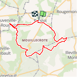
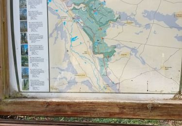
Tour Wandern von 16,1 km verfügbar auf Normandie, Eure, Brestot. Diese Tour wird von dominiquelouis vorgeschlagen.
Beschreibung
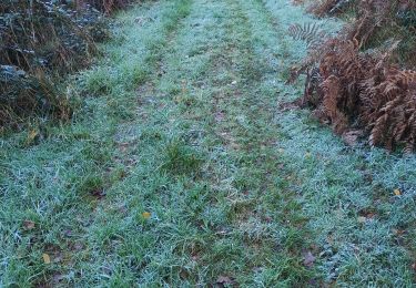
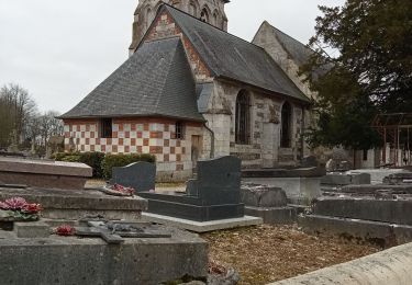
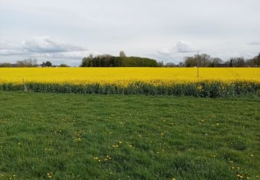
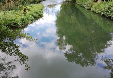
Proche de la vallée de la Risle en Normandie, une randonnée pédestre sportive de 16 km révèle un vallon bocager bien préservé et une partie peu connue de la forêt domaniale de Montfort
Ort
Land:
France
Region :
Normandie
Abteilung/Provinz :
Eure
Kommune :
Brestot
Standort:
Unknown
Gehen Sie:(Dec)
Gehen Sie:(UTM)
331843 ; 5469182 (31U) N.
Kommentare
Touren in der Umgebung
![Tour Wandern Illeville-sur-Montfort - Illeville sur Montfort - Le circuit des Jacinthes - La Ferme de Fourges - Photo](https://media.geolcdn.com/t/375/260/3f49af04-1319-456c-9456-ec8bbc5a3b82.jpg&format=jpg&maxdim=2)
![Wandern Wandern](https://static1.geolcdn.com/sitytour/trail-icons/101.png)
Illeville sur Montfort - Le circuit des Jacinthes - La Ferme de Fourges
Wandern
Schwierig
(1)
Illeville-sur-Montfort,
Normandie,
Eure,
France
![](/images/other/stat-length.png)
12,3 km | 14,4 km-effort
3h 13min
![](https://static1.geolcdn.com/siteimages/upload/files/16400158638029165_repeat_loop_refresh_sync_direction_icon.png)
Ja
![Tour Wandern Illeville-sur-Montfort - Illeville-sur-Monfort - Le circuit des Jacinthes - Photo](https://media.geolcdn.com/t/375/260/4ad22c83-41bc-47e4-95e1-447b2054afca.jpg&format=jpg&maxdim=2)
![Wandern Wandern](https://static1.geolcdn.com/sitytour/trail-icons/101.png)
Illeville-sur-Monfort - Le circuit des Jacinthes
Wandern
Schwierig
(2)
Illeville-sur-Montfort,
Normandie,
Eure,
France
![](/images/other/stat-length.png)
12,3 km | 14,5 km-effort
3h 8min
![](https://static1.geolcdn.com/siteimages/upload/files/16400158638029165_repeat_loop_refresh_sync_direction_icon.png)
Ja
![Tour Wandern La Haye-Aubrée - La Haye Aubrée - Le chemin aux Anes- Version 03-04 - Photo](https://media.geolcdn.com/t/375/260/39d82811-b877-4248-9e61-2979148c8df2.jpg&format=jpg&maxdim=2)
![Wandern Wandern](https://static1.geolcdn.com/sitytour/trail-icons/101.png)
La Haye Aubrée - Le chemin aux Anes- Version 03-04
Wandern
Schwierig
La Haye-Aubrée,
Normandie,
Eure,
France
![](/images/other/stat-length.png)
12,7 km | 14,8 km-effort
3h 19min
![](https://static1.geolcdn.com/siteimages/upload/files/16400158638029165_repeat_loop_refresh_sync_direction_icon.png)
Ja
![Tour Wandern Routot - Routot , Croix - Sainte-Marie , La Haie de Routot - Photo](https://media.geolcdn.com/t/375/260/674acfee-f83f-475c-97db-50c68854b132.jpg&format=jpg&maxdim=2)
![Wandern Wandern](https://static1.geolcdn.com/sitytour/trail-icons/101.png)
Routot , Croix - Sainte-Marie , La Haie de Routot
Wandern
Schwierig
Routot,
Normandie,
Eure,
France
![](/images/other/stat-length.png)
13,7 km | 15,6 km-effort
4h 5min
![](https://static1.geolcdn.com/siteimages/upload/files/16400158638029165_repeat_loop_refresh_sync_direction_icon.png)
Ja
![Tour Wandern Bourneville-Sainte-Croix - Bourneville-sainte-Croix- Le petit Brotonne - Photo](https://media.geolcdn.com/t/375/260/f3ccac4c-21c3-4eb7-b8a8-bd0b0eee06ac.jpg&format=jpg&maxdim=2)
![Wandern Wandern](https://static1.geolcdn.com/sitytour/trail-icons/101.png)
Bourneville-sainte-Croix- Le petit Brotonne
Wandern
Schwierig
Bourneville-Sainte-Croix,
Normandie,
Eure,
France
![](/images/other/stat-length.png)
14,1 km | 16,2 km-effort
3h 23min
![](https://static1.geolcdn.com/siteimages/upload/files/16400158638029165_repeat_loop_refresh_sync_direction_icon.png)
Ja
![Tour Wandern Colletot - Colletot à Corneille sur Risle - Photo](https://media.geolcdn.com/t/375/260/85510aa2-db3d-4ccb-b361-44d57952fb06.jpg&format=jpg&maxdim=2)
![Wandern Wandern](https://static1.geolcdn.com/sitytour/trail-icons/101.png)
Colletot à Corneille sur Risle
Wandern
Schwierig
(1)
Colletot,
Normandie,
Eure,
France
![](/images/other/stat-length.png)
11,3 km | 13,4 km-effort
2h 50min
![](https://static1.geolcdn.com/siteimages/upload/files/16400158638029165_repeat_loop_refresh_sync_direction_icon.png)
Ja
![Tour Wandern Cauverville-en-Roumois - Cauverville en Roumois - Le chemin du chênede la Vierge - Photo](https://media.geolcdn.com/t/375/260/848c1a14-2520-4048-b5ca-f7b5c61c1edf.jpg&format=jpg&maxdim=2)
![Wandern Wandern](https://static1.geolcdn.com/sitytour/trail-icons/101.png)
Cauverville en Roumois - Le chemin du chênede la Vierge
Wandern
Schwierig
(1)
Cauverville-en-Roumois,
Normandie,
Eure,
France
![](/images/other/stat-length.png)
11,7 km | 13,9 km-effort
3h 6min
![](https://static1.geolcdn.com/siteimages/upload/files/16400158638029165_repeat_loop_refresh_sync_direction_icon.png)
Ja
![Tour Wandern Appeville-Annebault - Appeville Annebault - Photo](https://media.geolcdn.com/t/375/260/1129d546-4635-4e2a-ba5f-33c44de23099.jpg&format=jpg&maxdim=2)
![Wandern Wandern](https://static1.geolcdn.com/sitytour/trail-icons/101.png)
Appeville Annebault
Wandern
Medium
(1)
Appeville-Annebault,
Normandie,
Eure,
France
![](/images/other/stat-length.png)
26 km | 33 km-effort
4h 42min
![](https://static1.geolcdn.com/siteimages/upload/files/16400158638029165_repeat_loop_refresh_sync_direction_icon.png)
Ja
![Tour Wandern Appeville-Annebault - appeville - Photo](https://media.geolcdn.com/t/375/260/ext.jpg?maxdim=2&url=https%3A%2F%2Fservices.sitytrail.com%2FGeolivesWS%2FDownloadMedia.ashx%3FTrailID%3D1021886%26Media%3Dfix__20180812105811.jpg)
![Wandern Wandern](https://static1.geolcdn.com/sitytour/trail-icons/101.png)
appeville
Wandern
Medium
Appeville-Annebault,
Normandie,
Eure,
France
![](/images/other/stat-length.png)
23 km | 29 km-effort
5h 6min
![](https://static1.geolcdn.com/siteimages/upload/files/16400158638029165_repeat_loop_refresh_sync_direction_icon.png)
Ja