


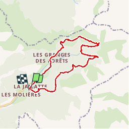

10,5 km | 20 km-effort


Benutzer


Kostenlosegpshiking-Anwendung
 SityTrail
IGN / Geografische Institute
SityTrail World
Die Welt öffnet sich für Sie
Tour Wandern von 15,8 km verfügbar auf Auvergne-Rhone-Alpen, Drôme, Lus-la-Croix-Haute. Diese Tour wird von pb07 vorgeschlagen.
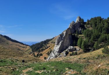
Randonnée de moyenne altitude, d'abord sur le versant Nord frais et boisé puis sur le versant sud dans les pâturages.
Le pont sur le Buech avant le Ravin du Fleytard a été détruit. La traversée peut être impraticable par hautes eaux.

Wandern

Wandern

Wandern

Wandern

Wandern

Wandern

Wandern

Wandern
Wandern