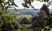
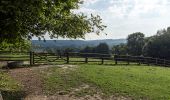
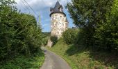
Tour Wandern Saint-Philbert-sur-Risle -        Chemin du Rossignol                     - Photo
 7217Lionel
7217Lionel

Benutzer

© OpenStreetMap contributors
Länge
Länge
10,2 km
Maximale Höhe
Maximale Höhe
148 m
Positive Höhendifferenz
260 m
Km-Effort
Km-Effort  
13,7 km
Min. Höhe
Min. Höhe
26 m
Negative Höhendifferenz
257 m
Boucle
Boucle
Ja
Erstellungsdatum :
2016-03-09 00:00:00.0
Letzte Änderung :
2016-03-09 00:00:00.0

(0 Nachricht)

Wandern
Wandern
2h30
Schwierigkeit : Medium

Scannen Sie diesen QR-Code, um die Tour in der SityTrail-Anwendung zu öffnen

Kostenlosegpshiking-Anwendung

Logo SityTrail SityTrail

IGN / Geografische Institute

SityTrail aus dem App Store herunterladen SityTrail von Google Play herunterladen

Logo SityTrail SityTrail World

Die Welt öffnet sich für Sie

SityTrail aus dem App Store herunterladen SityTrail von Google Play herunterladen SityTrail auf Huawei AppGallery herunterladen

Über SityTrail

Tour Wandern von 10,2 km verfügbar auf Normandie, Eure, Saint-Philbert-sur-Risle. Diese Tour wird von 7217Lionel vorgeschlagen.

Beschreibung

Très vallonné, bocager et forestier, ce circuit est parmi ceux qui révèlent le mieux l'identité de la vallée de la Risle avec des points forts très marqués.

Balisage: jaune

Départ: parking devant le prieuré de Saint-Philbert-sur-Risle.


Höhenprofil

Foto-Galerie

POIs

POI Saint-Philbert-sur-Risle - 1 - Photo
7217Lionel
SAINT-PHILBERT-SUR-RISLE 
POI Saint-Philbert-sur-Risle - 2 - Photo
7217Lionel
SAINT-PHILBERT-SUR-RISLE 
POI Saint-Philbert-sur-Risle - 3 - Photo
7217Lionel
SAINT-PHILBERT-SUR-RISLE 
POI Saint-Philbert-sur-Risle - 4 - Photo
7217Lionel
SAINT-PHILBERT-SUR-RISLE 
POI Saint-Philbert-sur-Risle - 5 - Photo
7217Lionel
SAINT-PHILBERT-SUR-RISLE 
POI Saint-Philbert-sur-Risle - 6 - Photo
7217Lionel
SAINT-PHILBERT-SUR-RISLE 
POI Saint-Philbert-sur-Risle - 7 - Photo
7217Lionel
SAINT-PHILBERT-SUR-RISLE 
POI Saint-Philbert-sur-Risle - 8 - Photo
7217Lionel
SAINT-PHILBERT-SUR-RISLE 
POI Saint-Philbert-sur-Risle - 9 - Photo
7217Lionel
SAINT-PHILBERT-SUR-RISLE 
POI Saint-Philbert-sur-Risle - 10 - Photo
7217Lionel
SAINT-PHILBERT-SUR-RISLE 
POI Saint-Philbert-sur-Risle - 11 - Photo
7217Lionel
SAINT-PHILBERT-SUR-RISLE 
POI Saint-Philbert-sur-Risle - Les quatre tours médiévales de la Baronnie - Photo
7217Lionel
SAINT-PHILBERT-SUR-RISLE 
POI Saint-Philbert-sur-Risle - vue - Photo
7217Lionel
SAINT-PHILBERT-SUR-RISLE 
POI Saint-Philbert-sur-Risle - vue2 - Photo
7217Lionel
SAINT-PHILBERT-SUR-RISLE 

Ort

Land:
France
Region :
Normandie
Abteilung/Provinz :
Eure
Kommune :
Saint-Philbert-sur-Risle
Standort:
Unknown
Gehen Sie:(Dec)
Gehen Sie:(UTM)
329109 ; 5463062 (31U) N.

Touren in der Umgebung

Tour Wandern Condé-sur-Risle - Circuit des faneuses -Condé sur Risle-St Christophe sur Condé  - Photo
Wandern
MichelRando7656

Wandern

Schwierig
Condé-sur-Risle, Normandie, Eure, France
14 km | 16,4 km-effort
4h 8min
Ja
Tour Wandern Appeville-Annebault - Appeville Annebault - Photo
Wandern
Roulland

Wandern

Medium
(1)
Appeville-Annebault, Normandie, Eure, France
26 km | 33 km-effort
4h 42min
Ja
Tour Wandern Montfort-sur-Risle - Montfort-sur-Risle  - Photo
Wandern
MichelRando7656

Wandern

Schwierig
Montfort-sur-Risle, Normandie, Eure, France
21 km | 26 km-effort
7h 21min
Ja
Tour Wandern Appeville-Annebault - appeville - Photo
Wandern
MichelRando7656

Wandern

Medium
Appeville-Annebault, Normandie, Eure, France
23 km | 29 km-effort
5h 6min
Ja
Tour Wandern Illeville-sur-Montfort - chemin des Séquoias - Photo
Wandern
dominiquelouis

Wandern

Medium
Illeville-sur-Montfort, Normandie, Eure, France
7,8 km | 9,7 km-effort
2h 56min
Ja
Tour Mountainbike Saint-Philbert-sur-Risle - Autour de Saint-Philbert-sur-Risle - Photo
Mountainbike
tracegps

Mountainbike

Medium
Saint-Philbert-sur-Risle, Normandie, Eure, France
38 km | 45 km-effort
3h 0min
Ja
Tour Wandern Saint-Philbert-sur-Risle - Autour de Saint-Philbert-sur-Risle - Photo
Wandern
tracegps

Wandern

Schwierig
Saint-Philbert-sur-Risle, Normandie, Eure, France
38 km | 45 km-effort
8h 0min
Ja
Tour Wandern Montfort-sur-Risle - Chemin du Rond de Beuvron - Montfort sur Risle - Photo
Wandern
tracegps

Wandern

Medium
Montfort-sur-Risle, Normandie, Eure, France
11,7 km | 14,9 km-effort
3h 0min
Ja
Tour Wandern Saint-Philbert-sur-Risle - Du Prieuré à l'Abbaye - Photo
Wandern
tracegps

Wandern

Schwierig
Saint-Philbert-sur-Risle, Normandie, Eure, France
24 km | 30 km-effort
6h 0min
Ja


Schließen
Meine Abonnements