![](/images/other/stat-length.png)
![Tour Wandern Tourouvre au Perche - Tour des Collines du Perche 5 - Photo](https://media.geolcdn.com/t/1900/400/ext.pjpeg?maxdim=2&url=https%3A%2F%2Fstatic1.geolcdn.com%2Fsiteimages%2Fupload%2Ffiles%2F1553511878bg_sport_marche.png)
Tour des Collines du Perche 5
togolo28
Benutzer
![Länge](/images/other/stat-length.png)
Länge
25 km
![Maximale Höhe](https://static1.geolcdn.com/siteimages/upload/files/1508320355ic_sort_altitude_max_24dp.png)
Maximale Höhe
261 m
![Positive Höhendifferenz](https://static1.geolcdn.com/siteimages/upload/files/1508320355ic_sort_den_pos_24dp.png)
Positive Höhendifferenz
441 m
![Km-Effort](/images/other/stat-length.png)
Km-Effort
31 km
![Min. Höhe](https://static1.geolcdn.com/siteimages/upload/files/1508320355ic_sort_altitude_min_24dp.png)
Min. Höhe
176 m
![Negative Höhendifferenz](https://static1.geolcdn.com/siteimages/upload/files/1508320355ic_sort_den_neg_24dp.png)
Negative Höhendifferenz
448 m
![Boucle](https://static1.geolcdn.com/siteimages/upload/files/16400158638029165_repeat_loop_refresh_sync_direction_icon.png)
Boucle
Nein
Erstellungsdatum :
2016-10-18 00:00:00.0
Letzte Änderung :
2020-09-17 10:15:21.668
![Wandern](https://static1.geolcdn.com/sitytour/trail-icons/101.png)
6h43
Schwierigkeit : Medium
![Scannen Sie diesen QR-Code, um die Tour in der SityTrail-Anwendung zu öffnen](https://capi.geolives.com/qq0zvz2zws4bq2lad0pu/sitytour/trails/466423/qr.png?size=200)
Kostenlosegpshiking-Anwendung
Über SityTrail
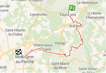
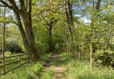
Tour Wandern von 25 km verfügbar auf Normandie, Orne, Tourouvre au Perche. Diese Tour wird von togolo28 vorgeschlagen.
Beschreibung
Le Tour des Collines du Perche à été réalisé par l'association « Itinéraires Ruraux » de Pervenchères (orne).
Vous pouvez consulter leur site internet :
http://itinerairesduperche.org
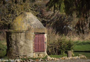
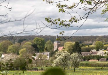
Ort
Land:
France
Region :
Normandie
Abteilung/Provinz :
Orne
Kommune :
Tourouvre au Perche
Standort:
Unknown
Gehen Sie:(Dec)
Gehen Sie:(UTM)
326831 ; 5384594 (31U) N.
Kommentare
Touren in der Umgebung
![Tour Wandern Longny les Villages - La Fonte - Malétable 7,8 km - Photo](https://media.geolcdn.com/t/375/260/58715638-860a-4ade-9990-a9918a4f42a8.jpeg&format=jpg&maxdim=2)
![Wandern Wandern](https://static1.geolcdn.com/sitytour/trail-icons/101.png)
La Fonte - Malétable 7,8 km
Wandern
Einfach
Longny les Villages,
Normandie,
Orne,
France
![](/images/other/stat-length.png)
7,8 km | 9,2 km-effort
21min
![](https://static1.geolcdn.com/siteimages/upload/files/16400158638029165_repeat_loop_refresh_sync_direction_icon.png)
Ja
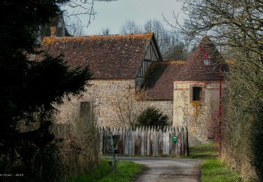
![Tour Wandern Tourouvre au Perche - [Itinéraire] Parcours de découverte de la Réserve de Bresolettes - Photo](https://media.geolcdn.com/t/375/260/8e304002-6848-4d50-9971-301dd63ddb71.jpg&format=jpg&maxdim=2)
![Wandern Wandern](https://static1.geolcdn.com/sitytour/trail-icons/101.png)
[Itinéraire] Parcours de découverte de la Réserve de Bresolettes
Wandern
Einfach
Tourouvre au Perche,
Normandie,
Orne,
France
![](/images/other/stat-length.png)
4,2 km | 4,8 km-effort
1h 5min
![](https://static1.geolcdn.com/siteimages/upload/files/16400158638029165_repeat_loop_refresh_sync_direction_icon.png)
Ja
![Tour Wandern L'Hôme-Chamondot - Traversées Percheronnes L'Home-Chamondot - La-Ferté-Vidame 20,4Km - Photo](https://media.geolcdn.com/t/375/260/775b310d-a192-48c6-b723-58a031dc55a1.jpg&format=jpg&maxdim=2)
![Wandern Wandern](https://static1.geolcdn.com/sitytour/trail-icons/101.png)
Traversées Percheronnes L'Home-Chamondot - La-Ferté-Vidame 20,4Km
Wandern
Medium
L'Hôme-Chamondot,
Normandie,
Orne,
France
![](/images/other/stat-length.png)
20 km | 23 km-effort
5h 2min
![](https://static1.geolcdn.com/siteimages/upload/files/16400158638029165_repeat_loop_refresh_sync_direction_icon.png)
Nein
![Tour Wandern L'Hôme-Chamondot - Traversées Percheronnes L'Home-Chamondot - Tourouvre 12,1Km - Photo](https://media.geolcdn.com/t/375/260/304fd560-c33e-465e-bfaa-960f3c968683.jpg&format=jpg&maxdim=2)
![Wandern Wandern](https://static1.geolcdn.com/sitytour/trail-icons/101.png)
Traversées Percheronnes L'Home-Chamondot - Tourouvre 12,1Km
Wandern
Medium
L'Hôme-Chamondot,
Normandie,
Orne,
France
![](/images/other/stat-length.png)
12 km | 14,3 km-effort
3h 10min
![](https://static1.geolcdn.com/siteimages/upload/files/16400158638029165_repeat_loop_refresh_sync_direction_icon.png)
Nein
![Tour Wandern L'Hôme-Chamondot - Traversées Percheronnes L'Home-Chamondot - Monceaux-au-Perche 16,8km PROJET - Photo](https://media.geolcdn.com/t/375/260/e749965e-7201-4a20-b74e-2679c3909745.jpg&format=jpg&maxdim=2)
![Wandern Wandern](https://static1.geolcdn.com/sitytour/trail-icons/101.png)
Traversées Percheronnes L'Home-Chamondot - Monceaux-au-Perche 16,8km PROJET
Wandern
Einfach
L'Hôme-Chamondot,
Normandie,
Orne,
France
![](/images/other/stat-length.png)
16,9 km | 20 km-effort
4h 24min
![](https://static1.geolcdn.com/siteimages/upload/files/16400158638029165_repeat_loop_refresh_sync_direction_icon.png)
Nein
![Tour Wandern Tourouvre au Perche - Bubertré - Lignerolles (Boucle) - Photo](https://media.geolcdn.com/t/375/260/ext.jpg?maxdim=2&url=https%3A%2F%2Fstatic1.geolcdn.com%2Fsiteimages%2Fupload%2Ffiles%2F1553511878bg_sport_marche.png)
![Wandern Wandern](https://static1.geolcdn.com/sitytour/trail-icons/101.png)
Bubertré - Lignerolles (Boucle)
Wandern
Einfach
(1)
Tourouvre au Perche,
Normandie,
Orne,
France
![](/images/other/stat-length.png)
12,3 km | 15,2 km-effort
3h 0min
![](https://static1.geolcdn.com/siteimages/upload/files/16400158638029165_repeat_loop_refresh_sync_direction_icon.png)
Ja
![Tour Wandern Tourouvre au Perche - Bellegarde - Autheuil - Photo](https://media.geolcdn.com/t/375/260/ext.jpg?maxdim=2&url=https%3A%2F%2Fservices.sitytrail.com%2FGeolivesWS%2FDownloadMedia.ashx%3FTrailID%3D111657%26Media%3D7895_1.jpg)
![Wandern Wandern](https://static1.geolcdn.com/sitytour/trail-icons/101.png)
Bellegarde - Autheuil
Wandern
Einfach
(1)
Tourouvre au Perche,
Normandie,
Orne,
France
![](/images/other/stat-length.png)
3,8 km | 4,8 km-effort
1h 19min
![](https://static1.geolcdn.com/siteimages/upload/files/16400158638029165_repeat_loop_refresh_sync_direction_icon.png)
Ja
![Tour Mountainbike Tourouvre au Perche - [Itinéraire] Les ruines du château de Gannes - Photo](https://media.geolcdn.com/t/375/260/ext.jpg?maxdim=2&url=https%3A%2F%2Fstatic1.geolcdn.com%2Fsiteimages%2Fupload%2Ffiles%2F1524743154velo.jpg)
![Mountainbike Mountainbike](https://static1.geolcdn.com/sitytour/trail-icons/202.png)
[Itinéraire] Les ruines du château de Gannes
Mountainbike
Schwierig
Tourouvre au Perche,
Normandie,
Orne,
France
![](/images/other/stat-length.png)
28 km | 34 km-effort
2h 20min
![](https://static1.geolcdn.com/siteimages/upload/files/16400158638029165_repeat_loop_refresh_sync_direction_icon.png)
Ja
![Tour Auto Tourouvre au Perche - 2024-02-24 Perche Trappe V du - Photo](https://media.geolcdn.com/t/375/260/ext.jpg?maxdim=2&url=https%3A%2F%2Fstatic1.geolcdn.com%2Fsiteimages%2Fupload%2Ffiles%2F15247431544x4.jpg)
![Auto Auto](https://static1.geolcdn.com/sitytour/trail-icons/401.png)
2024-02-24 Perche Trappe V du
Auto
Tourouvre au Perche,
Normandie,
Orne,
France
![](/images/other/stat-length.png)
38 km | 45 km-effort
4h 15min
![](https://static1.geolcdn.com/siteimages/upload/files/16400158638029165_repeat_loop_refresh_sync_direction_icon.png)
Nein