![](/images/other/stat-length.png)
![Tour Wandern Melleville - Melleville, Gomare - Photo](https://media.geolcdn.com/t/1900/400/ext.pjpeg?maxdim=2&url=https%3A%2F%2Fservices.sitytrail.com%2FGeolivesWS%2FDownloadMedia.ashx%3FTrailID%3D452418%26Media%3Dfix__20150731170057.jpg)
Melleville, Gomare
Brindille
Benutzer
![Länge](/images/other/stat-length.png)
Länge
13,7 km
![Maximale Höhe](https://static1.geolcdn.com/siteimages/upload/files/1508320355ic_sort_altitude_max_24dp.png)
Maximale Höhe
172 m
![Positive Höhendifferenz](https://static1.geolcdn.com/siteimages/upload/files/1508320355ic_sort_den_pos_24dp.png)
Positive Höhendifferenz
257 m
![Km-Effort](/images/other/stat-length.png)
Km-Effort
17,1 km
![Min. Höhe](https://static1.geolcdn.com/siteimages/upload/files/1508320355ic_sort_altitude_min_24dp.png)
Min. Höhe
46 m
![Negative Höhendifferenz](https://static1.geolcdn.com/siteimages/upload/files/1508320355ic_sort_den_neg_24dp.png)
Negative Höhendifferenz
256 m
![Boucle](https://static1.geolcdn.com/siteimages/upload/files/16400158638029165_repeat_loop_refresh_sync_direction_icon.png)
Boucle
Ja
Erstellungsdatum :
2016-03-09 00:00:00.0
Letzte Änderung :
2022-07-15 15:51:25.567
![Wandern](https://static1.geolcdn.com/sitytour/trail-icons/101.png)
3h17
Schwierigkeit : Unbekannt
![Scannen Sie diesen QR-Code, um die Tour in der SityTrail-Anwendung zu öffnen](https://capi.geolives.com/qq0zvz2zws4bq2lad0pu/sitytour/trails/452418/qr.png?size=200)
Kostenlosegpshiking-Anwendung
Über SityTrail
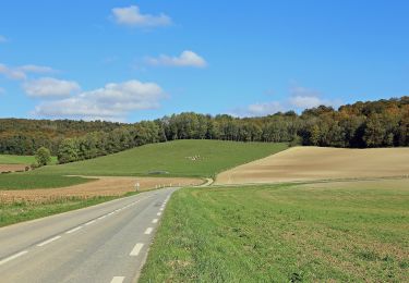
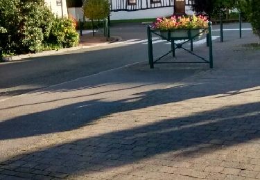
Tour Wandern von 13,7 km verfügbar auf Normandie, Seine-Maritime, Melleville. Diese Tour wird von Brindille vorgeschlagen.
Beschreibung
Départ de la place de l'église de Melleville, laisser l'église derrière et traverser la place en direction de la petite route qui mène à Millebosc
Ort
Land:
France
Region :
Normandie
Abteilung/Provinz :
Seine-Maritime
Kommune :
Melleville
Standort:
Unknown
Gehen Sie:(Dec)
Gehen Sie:(UTM)
390483 ; 5534958 (31U) N.
Kommentare
Touren in der Umgebung
![Tour Zu Fuß Grandcourt - A la Découverte de la Forêt d'Eu - Photo](https://media.geolcdn.com/t/375/260/a6eb9e3b-96ab-4ee5-b8c7-c252cb811991.jpeg&format=jpg&maxdim=2)
![Zu Fuß Zu Fuß](https://static1.geolcdn.com/sitytour/trail-icons/100.png)
A la Découverte de la Forêt d'Eu
Zu Fuß
Einfach
Grandcourt,
Normandie,
Seine-Maritime,
France
![](/images/other/stat-length.png)
9,3 km | 12,2 km-effort
2h 45min
![](https://static1.geolcdn.com/siteimages/upload/files/16400158638029165_repeat_loop_refresh_sync_direction_icon.png)
Nein
![Tour Wandern Monchy-sur-Eu - hêtre des princes II - Photo](https://media.geolcdn.com/t/375/260/ext.jpg?maxdim=2&url=https%3A%2F%2Fservices.sitytrail.com%2FGeolivesWS%2FDownloadMedia.ashx%3FTrailID%3D488083%26Media%3Dfix__20151031170306.jpg)
![Wandern Wandern](https://static1.geolcdn.com/sitytour/trail-icons/101.png)
hêtre des princes II
Wandern
Einfach
Monchy-sur-Eu,
Normandie,
Seine-Maritime,
France
![](/images/other/stat-length.png)
9,3 km | 12,1 km-effort
2h 34min
![](https://static1.geolcdn.com/siteimages/upload/files/16400158638029165_repeat_loop_refresh_sync_direction_icon.png)
Ja
![Tour Wandern Longroy - longroy - Photo](https://media.geolcdn.com/t/375/260/ext.jpg?maxdim=2&url=https%3A%2F%2Fservices.sitytrail.com%2FGeolivesWS%2FDownloadMedia.ashx%3FTrailID%3D473480%26Media%3Dfix__20150919181325.jpg)
![Wandern Wandern](https://static1.geolcdn.com/sitytour/trail-icons/101.png)
longroy
Wandern
Einfach
Longroy,
Normandie,
Seine-Maritime,
France
![](/images/other/stat-length.png)
10,3 km | 12,7 km-effort
2h 38min
![](https://static1.geolcdn.com/siteimages/upload/files/16400158638029165_repeat_loop_refresh_sync_direction_icon.png)
Nein
![Tour Wandern Monchy-sur-Eu - poteau hêtre des princes 2 - Photo](https://media.geolcdn.com/t/375/260/ext.jpg?maxdim=2&url=https%3A%2F%2Fservices.sitytrail.com%2FGeolivesWS%2FDownloadMedia.ashx%3FTrailID%3D468401%26Media%3Dfix__20150905162721.jpg)
![Wandern Wandern](https://static1.geolcdn.com/sitytour/trail-icons/101.png)
poteau hêtre des princes 2
Wandern
Einfach
Monchy-sur-Eu,
Normandie,
Seine-Maritime,
France
![](/images/other/stat-length.png)
6,8 km | 8,3 km-effort
2h 2min
![](https://static1.geolcdn.com/siteimages/upload/files/16400158638029165_repeat_loop_refresh_sync_direction_icon.png)
Ja
![Tour Wandern Monchy-sur-Eu - poteau hêtre des princes 2 - Photo](https://media.geolcdn.com/t/375/260/ext.jpg?maxdim=2&url=https%3A%2F%2Fservices.sitytrail.com%2FGeolivesWS%2FDownloadMedia.ashx%3FTrailID%3D468389%26Media%3Dfix__20150905162721.jpg)
![Wandern Wandern](https://static1.geolcdn.com/sitytour/trail-icons/101.png)
poteau hêtre des princes 2
Wandern
Einfach
Monchy-sur-Eu,
Normandie,
Seine-Maritime,
France
![](/images/other/stat-length.png)
6,8 km | 8,3 km-effort
2h 2min
![](https://static1.geolcdn.com/siteimages/upload/files/16400158638029165_repeat_loop_refresh_sync_direction_icon.png)
Ja
![Tour Wandern Melleville - Melleville, Gomare - Photo](https://media.geolcdn.com/t/375/260/ext.jpg?maxdim=2&url=https%3A%2F%2Fservices.sitytrail.com%2FGeolivesWS%2FDownloadMedia.ashx%3FTrailID%3D452425%26Media%3Dfix__20150731182734.jpg)
![Wandern Wandern](https://static1.geolcdn.com/sitytour/trail-icons/101.png)
Melleville, Gomare
Wandern
Sehr leicht
Melleville,
Normandie,
Seine-Maritime,
France
![](/images/other/stat-length.png)
12,6 km | 15,3 km-effort
3h 17min
![](https://static1.geolcdn.com/siteimages/upload/files/16400158638029165_repeat_loop_refresh_sync_direction_icon.png)
Ja
![Tour Pferd Dancourt - Circuit de la bonne Entente (N°2) - Dancourt - Photo](https://media.geolcdn.com/t/375/260/ext.jpg?maxdim=2&url=https%3A%2F%2Fservices.sitytrail.com%2FGeolivesWS%2FDownloadMedia.ashx%3FTrailID%3D215062%26Media%3D15634_5.jpg)
![Pferd Pferd](https://static1.geolcdn.com/sitytour/trail-icons/300.png)
Circuit de la bonne Entente (N°2) - Dancourt
Pferd
Einfach
Dancourt,
Normandie,
Seine-Maritime,
France
![](/images/other/stat-length.png)
3,6 km | 4,5 km-effort
34min
![](https://static1.geolcdn.com/siteimages/upload/files/16400158638029165_repeat_loop_refresh_sync_direction_icon.png)
Ja
![Tour Mountainbike Dancourt - Circuit de la bonne Entente (N°2) - Dancourt - Photo](https://media.geolcdn.com/t/375/260/ext.jpg?maxdim=2&url=https%3A%2F%2Fservices.sitytrail.com%2FGeolivesWS%2FDownloadMedia.ashx%3FTrailID%3D215061%26Media%3D15634_5.jpg)
![Mountainbike Mountainbike](https://static1.geolcdn.com/sitytour/trail-icons/202.png)
Circuit de la bonne Entente (N°2) - Dancourt
Mountainbike
Einfach
Dancourt,
Normandie,
Seine-Maritime,
France
![](/images/other/stat-length.png)
3,6 km | 4,5 km-effort
19min
![](https://static1.geolcdn.com/siteimages/upload/files/16400158638029165_repeat_loop_refresh_sync_direction_icon.png)
Ja
![Tour Wandern Dancourt - Circuit de la bonne Entente (N°2) - Dancourt - Photo](https://media.geolcdn.com/t/375/260/ext.jpg?maxdim=2&url=https%3A%2F%2Fservices.sitytrail.com%2FGeolivesWS%2FDownloadMedia.ashx%3FTrailID%3D215060%26Media%3D15634_5.jpg)
![Wandern Wandern](https://static1.geolcdn.com/sitytour/trail-icons/101.png)
Circuit de la bonne Entente (N°2) - Dancourt
Wandern
Einfach
Dancourt,
Normandie,
Seine-Maritime,
France
![](/images/other/stat-length.png)
3,6 km | 4,5 km-effort
55min
![](https://static1.geolcdn.com/siteimages/upload/files/16400158638029165_repeat_loop_refresh_sync_direction_icon.png)
Ja