


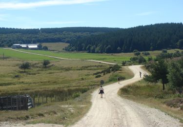
8,5 km | 12 km-effort


Benutzer


Kostenlosegpshiking-Anwendung
 SityTrail
IGN / Geografische Institute
SityTrail World
Die Welt öffnet sich für Sie
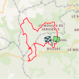
Tour Wandern von 18,1 km verfügbar auf Auvergne-Rhone-Alpen, Haute-Loire, Grèzes. Diese Tour wird von jeff66 vorgeschlagen.
TOUR DU MONTCHOUVET 43 - départ entre Bugeac et Le Menial - chante perdrix - les Bartes - le suc - zouriat - Poutarelle - vue sur Servieres - Le Courniet - site archéologique - les Hivers - le Soubirot - le MONTCHOUVET - Ronc de Chazeyrat - D 33 - Combe -


Zu Fuß
Wandern
Wandern

Wandern

Pferd
Wandern
Wandern
Wandern
Reiten