10ème étape De Ffair Rhos à Glaswll SityTrail > Touren > Outdoor > United Kingdom > Wales > Ceredigion > Unknown SityTrail > Touren > Outdoor > United Kingdom > Wales > Ceredigion > Unknown 10ème étape De Ffair Rhos à Glaswll jeff2 Benutzer 3D © OpenStreetMap contributors Länge 46 km Maximale Höhe 491 m Positive Höhendifferenz 988 m Km-Effort 59 km Min. Höhe 139 m Negative Höhendifferenz 1025 m Boucle Nein Erstellungsdatum : 2015-06-18 00:00:00.0 Letzte Änderung : 2015-06-18 00:00:00.0 (0 Nachricht) Wandern 10h16 Schwierigkeit : Medium Kostenlosegpshiking-Anwendung SityTrail IGN / Geografische Institute SityTrail World Die Welt öffnet sich für Sie Über SityTrail 
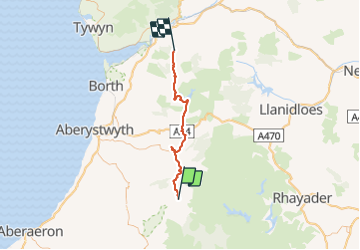
Tour Wandern von 46 km verfügbar auf Wales, Ceredigion. Diese Tour wird von jeff2 vorgeschlagen. Beschreibung Il y a beaucoup de photos que je n'arrive pas à enregistrer Legenden | Mehr Details (PDF) Höhenprofil Legenden > 15% 15% - 10% 10% - 5% Wohnung 5% - 10% 10% - 15% 15% - 30% > 30% Foto-Galerie POIs jeff2 Point 1 jeff2 Point 2 jeff2 Point 4 jeff2 Point 6 jeff2 Point 13 jeff2 Point 15 jeff2 Point 16 jeff2 Point 17 jeff2 Point 18 jeff2 Point 19 jeff2 Point 20 jeff2 Point 21 jeff2 Point 22 jeff2 Point 24 jeff2 Point 25 jeff2 Point 26 jeff2 Point 27 jeff2 Point 28 jeff2 Point 29 jeff2 Point 30 jeff2 Point 31 jeff2 Point 32 jeff2 Point 38 jeff2 Point 39 jeff2 Point 40 Ort Land: United Kingdom Region : Wales Abteilung/Provinz : Ceredigion Kommune : Unknown Standort: Unknown Gehen Sie:(Dec) 52.29638 / -3.849501 Gehen Sie:(UTM) 442068 ; 5794343 (30U) N. Kommentare Bitte melden Sie sich an, um einen Kommentar oder eine Bewertung zu hinterlassen Touren in der Umgebung jeff2 10ème étape De Ffair Rhos à Glaswll Wandern Medium , Wales, Ceredigion, United Kingdom 46 km | 59 km-effort 10h 16min Nein