


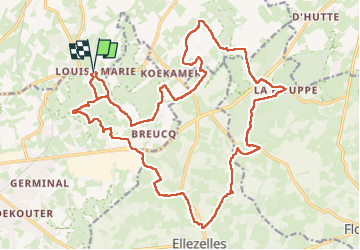

17,9 km | 22 km-effort

Benutzer


Kostenlosegpshiking-Anwendung
 SityTrail
IGN / Geografische Institute
SityTrail World
Die Welt öffnet sich für Sie
Tour Wandern von 24 km verfügbar auf Flandern, Ostflandern, Maarkedal. Diese Tour wird von Greg813 vorgeschlagen.
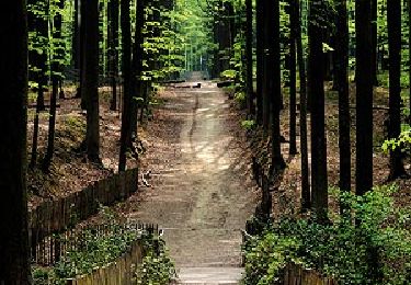
Randonnée avec Mettons le Monde en Marche entre campagne et bois nommée le “Défi des Ardennes flamandes”.
Attention en cas de pluie, le terrain devient vite très boueux !

Wandern

Elektrofahrrad
Mountainbike
Wandern
Zu Fuß

Zu Fuß

Pferd
Zu Fuß

Zu Fuß