


12,9 km | 15,7 km-effort

Benutzer GUIDE


Kostenlosegpshiking-Anwendung
 SityTrail
IGN / Geografische Institute
SityTrail World
Die Welt öffnet sich für Sie
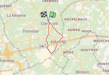
Tour Wandern von 6,7 km verfügbar auf Wallonien, Lüttich, Thimister-Clermont. Diese Tour wird von pierreh01 vorgeschlagen.
Samedi 8 février 2025 : Balade FFBMP au départ de CLERMONT.
C'est sous un beau soleil et une température clémente de /- 7 degrés que nous sommes partis en couple pour réaliser la balade de 7 Km de la FFBMP organisée par les Pédestrians.
Balade aux bottines propres avec quelques 5,5 Km de routes, avec de temps en temps un cheminement en terre en bord de route, et /- 1,2 Km de sentiers et prairies.
Distance mesurée de 6,7 Km avec Sity Trail.


43 Fotos insgesamt. Klicken Sie auf ein Foto, um sie alle in der Galerie zu sehen.

Wandern

Wandern

Wandern

Wandern

Wandern

Wandern

Wandern

Wandern
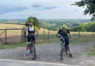
Mountainbike