![](/images/other/stat-length.png)
![Tour Zu Fuß Pfraumberg - naučná stezka Přimda - Photo](https://media.geolcdn.com/t/1900/400/e1e6d3f2-fe9e-4d62-8210-f9dffe466772.jpeg&format=pjpeg&maxdim=2)
naučná stezka Přimda
SityTrail - itinéraires balisés pédestres
Tous les sentiers balisés d’Europe GUIDE+
![Länge](/images/other/stat-length.png)
Länge
7,7 km
![Maximale Höhe](https://static1.geolcdn.com/siteimages/upload/files/1508320355ic_sort_altitude_max_24dp.png)
Maximale Höhe
824 m
![Positive Höhendifferenz](https://static1.geolcdn.com/siteimages/upload/files/1508320355ic_sort_den_pos_24dp.png)
Positive Höhendifferenz
258 m
![Km-Effort](/images/other/stat-length.png)
Km-Effort
11,3 km
![Min. Höhe](https://static1.geolcdn.com/siteimages/upload/files/1508320355ic_sort_altitude_min_24dp.png)
Min. Höhe
612 m
![Negative Höhendifferenz](https://static1.geolcdn.com/siteimages/upload/files/1508320355ic_sort_den_neg_24dp.png)
Negative Höhendifferenz
302 m
![Boucle](https://static1.geolcdn.com/siteimages/upload/files/16400158638029165_repeat_loop_refresh_sync_direction_icon.png)
Boucle
Ja
Kennzeichnung
Erstellungsdatum :
2025-02-07 16:53:54.425
Letzte Änderung :
2025-02-07 16:53:54.425
![Zu Fuß](https://static1.geolcdn.com/sitytour/trail-icons/100.png)
2h34
Schwierigkeit : Einfach
![Scannen Sie diesen QR-Code, um die Tour in der SityTrail-Anwendung zu öffnen](https://capi.geolives.com/qq0zvz2zws4bq2lad0pu/sitytour/trails/4346282/qr.png?size=200)
Kostenlosegpshiking-Anwendung
Über SityTrail
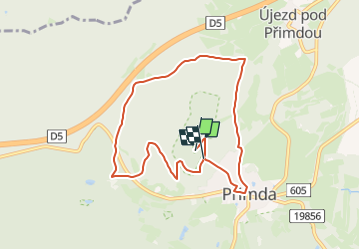
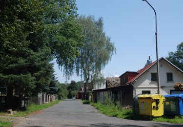
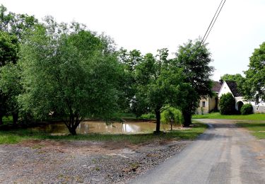
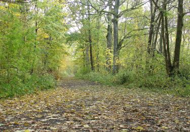
Tour Zu Fuß von 7,7 km verfügbar auf Südwesten, Pilsner Region, Pfraumberg. Diese Tour wird von SityTrail - itinéraires balisés pédestres vorgeschlagen.
Beschreibung
Tour erstellt von MÚ Přimda.
Ort
Land:
Czech Republic
Region :
Südwesten
Abteilung/Provinz :
Pilsner Region
Kommune :
Pfraumberg
Standort:
Unknown
Gehen Sie:(Dec)
Gehen Sie:(UTM)
331697 ; 5505598 (33U) N.
Kommentare
Touren in der Umgebung
![Tour Zu Fuß Bärnau - Goldsteig Verbindungsweg Bärnau - Tachov - Photo](https://media.geolcdn.com/t/375/260/9d4c2b1a-5286-473e-ad9f-026784264d66.jpeg&format=jpg&maxdim=2)
![Zu Fuß Zu Fuß](https://static1.geolcdn.com/sitytour/trail-icons/100.png)
Goldsteig Verbindungsweg Bärnau - Tachov
Zu Fuß
Medium
Bärnau,
Bayern,
Landkreis Tirschenreuth,
Germany
![](/images/other/stat-length.png)
17,9 km | 23 km-effort
5h 17min
![](https://static1.geolcdn.com/siteimages/upload/files/16400158638029165_repeat_loop_refresh_sync_direction_icon.png)
Nein
![Tour Zu Fuß Haid - NS Stráž - Souměř - Photo](https://media.geolcdn.com/t/375/260/82ae4c6d-8bda-4e77-8c25-044aef2bf619.jpeg&format=jpg&maxdim=2)
![Zu Fuß Zu Fuß](https://static1.geolcdn.com/sitytour/trail-icons/100.png)
NS Stráž - Souměř
Zu Fuß
Einfach
Haid,
Südwesten,
Pilsner Region,
Czech Republic
![](/images/other/stat-length.png)
3,1 km | 3,7 km-effort
50min
![](https://static1.geolcdn.com/siteimages/upload/files/16400158638029165_repeat_loop_refresh_sync_direction_icon.png)
Nein
![Tour Zu Fuß Hesselsdorf - Vyhlídková naučná stezka - Photo](https://media.geolcdn.com/t/375/260/de5fa688-c472-4e93-ac35-43eb0e649d0c.jpeg&format=jpg&maxdim=2)
![Zu Fuß Zu Fuß](https://static1.geolcdn.com/sitytour/trail-icons/100.png)
Vyhlídková naučná stezka
Zu Fuß
Einfach
Hesselsdorf,
Südwesten,
Pilsner Region,
Czech Republic
![](/images/other/stat-length.png)
13,6 km | 16,8 km-effort
3h 48min
![](https://static1.geolcdn.com/siteimages/upload/files/16400158638029165_repeat_loop_refresh_sync_direction_icon.png)
Ja
![Tour Zu Fuß Tschernoschin - naučná stezka Krajinou bitvy u Třebele - Photo](https://media.geolcdn.com/t/375/260/24c75f92-1a88-40c5-8531-95b3ff118a40.jpeg&format=jpg&maxdim=2)
![Zu Fuß Zu Fuß](https://static1.geolcdn.com/sitytour/trail-icons/100.png)
naučná stezka Krajinou bitvy u Třebele
Zu Fuß
Einfach
Tschernoschin,
Südwesten,
Pilsner Region,
Czech Republic
![](/images/other/stat-length.png)
8,9 km | 11,4 km-effort
2h 35min
![](https://static1.geolcdn.com/siteimages/upload/files/16400158638029165_repeat_loop_refresh_sync_direction_icon.png)
Nein
![Tour Zu Fuß Ronsperg - NS Těžba živců na Poběžovicku - Photo](https://media.geolcdn.com/t/375/260/100888aa-0e5b-4845-8fe9-70abf31b0d5a.jpeg&format=jpg&maxdim=2)
![Zu Fuß Zu Fuß](https://static1.geolcdn.com/sitytour/trail-icons/100.png)
NS Těžba živců na Poběžovicku
Zu Fuß
Einfach
Ronsperg,
Südwesten,
Pilsner Region,
Czech Republic
![](/images/other/stat-length.png)
3,4 km | 4,5 km-effort
1h 0min
![](https://static1.geolcdn.com/siteimages/upload/files/16400158638029165_repeat_loop_refresh_sync_direction_icon.png)
Nein
![Tour Zu Fuß Ronsperg - naučná stezka Těžba živcu na Poběžovicku - Photo](https://media.geolcdn.com/t/375/260/bb47f083-691f-44a4-a8cc-d3cf24c7587e.jpeg&format=jpg&maxdim=2)
![Zu Fuß Zu Fuß](https://static1.geolcdn.com/sitytour/trail-icons/100.png)
naučná stezka Těžba živcu na Poběžovicku
Zu Fuß
Einfach
Ronsperg,
Südwesten,
Pilsner Region,
Czech Republic
![](/images/other/stat-length.png)
3,1 km | 3,6 km-effort
49min
![](https://static1.geolcdn.com/siteimages/upload/files/16400158638029165_repeat_loop_refresh_sync_direction_icon.png)
Nein
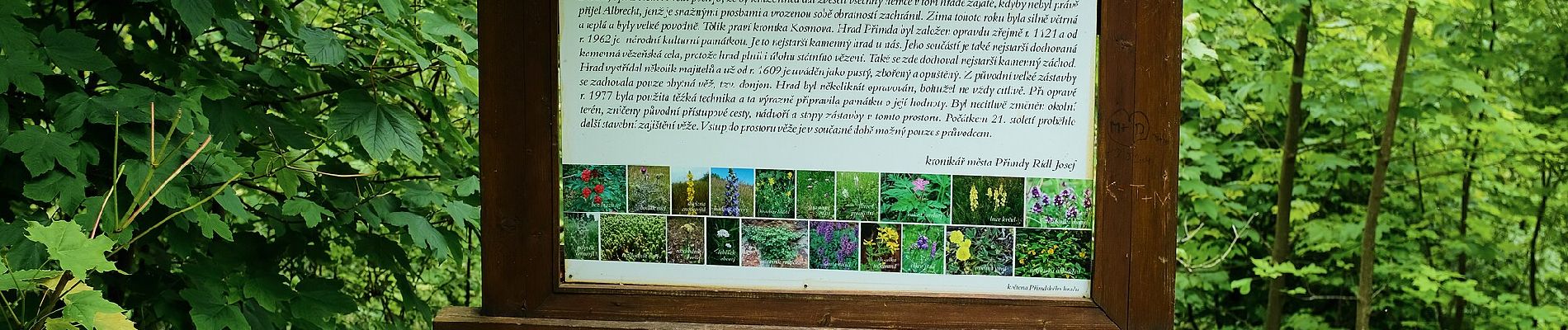
![Tour Zu Fuß Roßhaupt - [M] Okružní naučná stezka Kolowratova - Photo](https://media.geolcdn.com/t/375/260/48bd39eb-9e5f-4fa1-b21c-b0525a6f7f06.jpeg&format=jpg&maxdim=2)
![Zu Fuß Zu Fuß](https://static1.geolcdn.com/sitytour/trail-icons/100.png)
[M] Okružní naučná stezka Kolowratova
Zu Fuß
Medium
Roßhaupt,
Südwesten,
Pilsner Region,
Czech Republic
![](/images/other/stat-length.png)
17 km | 20 km-effort
4h 36min
![](https://static1.geolcdn.com/siteimages/upload/files/16400158638029165_repeat_loop_refresh_sync_direction_icon.png)
Ja
![Tour Zu Fuß Schönwald - [Z] naučná stezka historie sklářství - Photo](https://media.geolcdn.com/t/375/260/4bc902d5-239d-46bc-9e59-dc21d99fa2b6.jpeg&format=jpg&maxdim=2)
![Zu Fuß Zu Fuß](https://static1.geolcdn.com/sitytour/trail-icons/100.png)
[Z] naučná stezka historie sklářství
Zu Fuß
Einfach
Schönwald,
Südwesten,
Pilsner Region,
Czech Republic
![](/images/other/stat-length.png)
6,3 km | 8 km-effort
1h 48min
![](https://static1.geolcdn.com/siteimages/upload/files/16400158638029165_repeat_loop_refresh_sync_direction_icon.png)
Ja
![Tour Zu Fuß Weißensulz - 3 Nepomukweg - Photo](https://media.geolcdn.com/t/375/260/395eeab1-c2f5-43fc-9b14-49cffd2df5f4.jpeg&format=jpg&maxdim=2)
![Zu Fuß Zu Fuß](https://static1.geolcdn.com/sitytour/trail-icons/100.png)
3 Nepomukweg
Zu Fuß
Einfach
Weißensulz,
Südwesten,
Pilsner Region,
Czech Republic
![](/images/other/stat-length.png)
3,3 km | 4,2 km-effort
56min
![](https://static1.geolcdn.com/siteimages/upload/files/16400158638029165_repeat_loop_refresh_sync_direction_icon.png)
Nein