![](/images/other/stat-length.png)
![Tour Zu Fuß Lobenstein - NS Cvilín - Photo](https://media.geolcdn.com/t/1900/400/c9e95977-5fd3-4590-9e1a-82496b43e7c9.jpeg&format=pjpeg&maxdim=2)
NS Cvilín
SityTrail - itinéraires balisés pédestres
Tous les sentiers balisés d’Europe GUIDE+
![Länge](/images/other/stat-length.png)
Länge
7,5 km
![Maximale Höhe](https://static1.geolcdn.com/siteimages/upload/files/1508320355ic_sort_altitude_max_24dp.png)
Maximale Höhe
406 m
![Positive Höhendifferenz](https://static1.geolcdn.com/siteimages/upload/files/1508320355ic_sort_den_pos_24dp.png)
Positive Höhendifferenz
232 m
![Km-Effort](/images/other/stat-length.png)
Km-Effort
10,4 km
![Min. Höhe](https://static1.geolcdn.com/siteimages/upload/files/1508320355ic_sort_altitude_min_24dp.png)
Min. Höhe
324 m
![Negative Höhendifferenz](https://static1.geolcdn.com/siteimages/upload/files/1508320355ic_sort_den_neg_24dp.png)
Negative Höhendifferenz
178 m
![Boucle](https://static1.geolcdn.com/siteimages/upload/files/16400158638029165_repeat_loop_refresh_sync_direction_icon.png)
Boucle
Nein
Kennzeichnung
Erstellungsdatum :
2025-02-07 14:57:18.139
Letzte Änderung :
2025-02-07 14:57:18.139
![Zu Fuß](https://static1.geolcdn.com/sitytour/trail-icons/100.png)
2h21
Schwierigkeit : Einfach
![Scannen Sie diesen QR-Code, um die Tour in der SityTrail-Anwendung zu öffnen](https://capi.geolives.com/qq0zvz2zws4bq2lad0pu/sitytour/trails/4345944/qr.png?size=200)
Kostenlosegpshiking-Anwendung
Über SityTrail
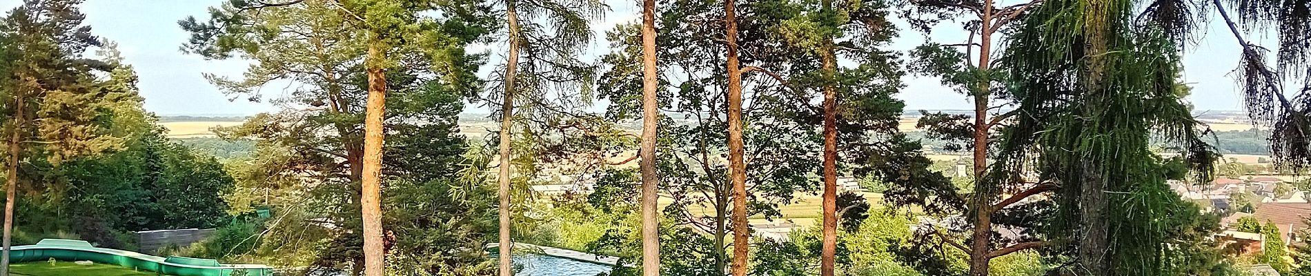
Tour Zu Fuß von 7,5 km verfügbar auf Mährisch-Schlesien, Mährisch-Schlesische Region, Lobenstein. Diese Tour wird von SityTrail - itinéraires balisés pédestres vorgeschlagen.
Beschreibung
Tour erstellt von cz:KČT.
Ort
Land:
Czech Republic
Region :
Mährisch-Schlesien
Abteilung/Provinz :
Mährisch-Schlesische Region
Kommune :
Lobenstein
Standort:
Unknown
Gehen Sie:(Dec)
Gehen Sie:(UTM)
694672 ; 5549384 (33U) N.
Kommentare
Touren in der Umgebung
![Tour Zu Fuß Karlsthal - NS Historií a přírodou Karlovic - Photo](https://media.geolcdn.com/t/375/260/76aacda6-305c-48cb-b138-307598c406a8.jpeg&format=jpg&maxdim=2)
![Zu Fuß Zu Fuß](https://static1.geolcdn.com/sitytour/trail-icons/100.png)
NS Historií a přírodou Karlovic
Zu Fuß
Einfach
Karlsthal,
Mährisch-Schlesien,
Mährisch-Schlesische Region,
Czech Republic
![](/images/other/stat-length.png)
8,2 km | 10 km-effort
2h 15min
![](https://static1.geolcdn.com/siteimages/upload/files/16400158638029165_repeat_loop_refresh_sync_direction_icon.png)
Ja
![Tour Zu Fuß Breitenau - NS Široká Niva - Photo](https://media.geolcdn.com/t/375/260/59f014ae-529f-4445-b235-27b833b97de8.jpeg&format=jpg&maxdim=2)
![Zu Fuß Zu Fuß](https://static1.geolcdn.com/sitytour/trail-icons/100.png)
NS Široká Niva
Zu Fuß
Einfach
Breitenau,
Mährisch-Schlesien,
Mährisch-Schlesische Region,
Czech Republic
![](/images/other/stat-length.png)
6,9 km | 8,2 km-effort
1h 52min
![](https://static1.geolcdn.com/siteimages/upload/files/16400158638029165_repeat_loop_refresh_sync_direction_icon.png)
Nein
![Tour Zu Fuß Olbersdorf - Vycházková stezka Dubí - Photo](https://media.geolcdn.com/t/375/260/2caedeca-8910-4700-9920-42d9b6158781.jpeg&format=jpg&maxdim=2)
![Zu Fuß Zu Fuß](https://static1.geolcdn.com/sitytour/trail-icons/100.png)
Vycházková stezka Dubí
Zu Fuß
Einfach
Olbersdorf,
Mährisch-Schlesien,
Mährisch-Schlesische Region,
Czech Republic
![](/images/other/stat-length.png)
3,4 km | 5,1 km-effort
1h 9min
![](https://static1.geolcdn.com/siteimages/upload/files/16400158638029165_repeat_loop_refresh_sync_direction_icon.png)
Ja
![Tour Zu Fuß Raase - NS Po vulkanitech - Photo](https://media.geolcdn.com/t/375/260/a7fb9482-6350-462b-b9c9-cd7324a11411.jpeg&format=jpg&maxdim=2)
![Zu Fuß Zu Fuß](https://static1.geolcdn.com/sitytour/trail-icons/100.png)
NS Po vulkanitech
Zu Fuß
Einfach
Raase,
Mährisch-Schlesien,
Mährisch-Schlesische Region,
Czech Republic
![](/images/other/stat-length.png)
5,8 km | 7,5 km-effort
1h 42min
![](https://static1.geolcdn.com/siteimages/upload/files/16400158638029165_repeat_loop_refresh_sync_direction_icon.png)
Nein
![Tour Zu Fuß Neu Erbersdorf - NS Nové Heřmínovy - Photo](https://media.geolcdn.com/t/375/260/5179c3f9-421f-4cc3-b2da-e09eba0a1276.jpeg&format=jpg&maxdim=2)
![Zu Fuß Zu Fuß](https://static1.geolcdn.com/sitytour/trail-icons/100.png)
NS Nové Heřmínovy
Zu Fuß
Einfach
Neu Erbersdorf,
Mährisch-Schlesien,
Mährisch-Schlesische Region,
Czech Republic
![](/images/other/stat-length.png)
8,6 km | 11,2 km-effort
2h 33min
![](https://static1.geolcdn.com/siteimages/upload/files/16400158638029165_repeat_loop_refresh_sync_direction_icon.png)
Nein
![Tour Zu Fuß Olbersdorf - Městský turistický okruh - Photo](https://media.geolcdn.com/t/375/260/481acb77-f957-4345-883b-55b042e9bf6a.jpeg&format=jpg&maxdim=2)
![Zu Fuß Zu Fuß](https://static1.geolcdn.com/sitytour/trail-icons/100.png)
Městský turistický okruh
Zu Fuß
Schwierig
Olbersdorf,
Mährisch-Schlesien,
Mährisch-Schlesische Region,
Czech Republic
![](/images/other/stat-length.png)
27 km | 37 km-effort
8h 27min
![](https://static1.geolcdn.com/siteimages/upload/files/16400158638029165_repeat_loop_refresh_sync_direction_icon.png)
Nein
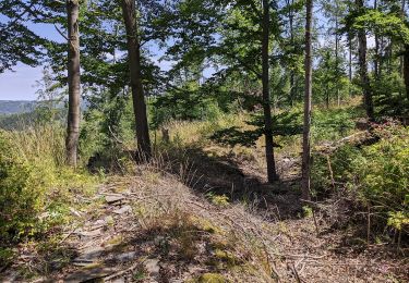
![Tour Zu Fuß Jägerndorf - [Č] okruh kolem Krnova - Photo](https://media.geolcdn.com/t/375/260/0c9d8cbf-3608-4e3b-bb39-83d0370a4b42.jpeg&format=jpg&maxdim=2)
![Zu Fuß Zu Fuß](https://static1.geolcdn.com/sitytour/trail-icons/100.png)
[Č] okruh kolem Krnova
Zu Fuß
Medium
Jägerndorf,
Mährisch-Schlesien,
Mährisch-Schlesische Region,
Czech Republic
![](/images/other/stat-length.png)
24 km | 30 km-effort
6h 55min
![](https://static1.geolcdn.com/siteimages/upload/files/16400158638029165_repeat_loop_refresh_sync_direction_icon.png)
Ja
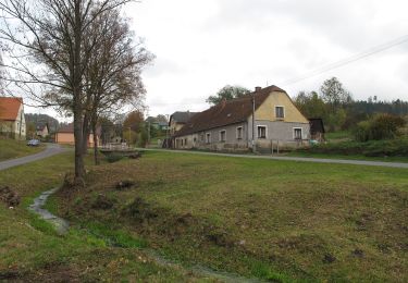
![Tour Zu Fuß Milkendorf - [M] Milotice nad Opavou - Krnov - Photo](https://media.geolcdn.com/t/375/260/8e7566ad-25ee-42af-96bf-113d9a2183cc.jpeg&format=jpg&maxdim=2)
![Zu Fuß Zu Fuß](https://static1.geolcdn.com/sitytour/trail-icons/100.png)
[M] Milotice nad Opavou - Krnov
Zu Fuß
Medium
Milkendorf,
Mährisch-Schlesien,
Mährisch-Schlesische Region,
Czech Republic
![](/images/other/stat-length.png)
21 km | 29 km-effort
6h 32min
![](https://static1.geolcdn.com/siteimages/upload/files/16400158638029165_repeat_loop_refresh_sync_direction_icon.png)
Nein
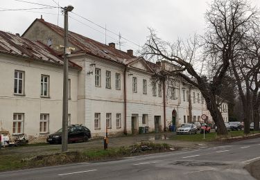
![Tour Zu Fuß Olbersdorf - [Ž] Albrechtice - Petrovy boudy - Photo](https://media.geolcdn.com/t/375/260/f4747928-09d6-4159-b288-1d744968c1cc.jpeg&format=jpg&maxdim=2)
![Zu Fuß Zu Fuß](https://static1.geolcdn.com/sitytour/trail-icons/100.png)
[Ž] Albrechtice - Petrovy boudy
Zu Fuß
Schwierig
Olbersdorf,
Mährisch-Schlesien,
Mährisch-Schlesische Region,
Czech Republic
![](/images/other/stat-length.png)
22 km | 33 km-effort
7h 25min
![](https://static1.geolcdn.com/siteimages/upload/files/16400158638029165_repeat_loop_refresh_sync_direction_icon.png)
Nein