![](/images/other/stat-length.png)
![Tour Zu Fuß Nepschewaska - NS PP Chlum - Photo](https://media.geolcdn.com/t/1900/400/d4c5be34-3834-4ac2-829f-9a826c7dc87a.jpeg&format=pjpeg&maxdim=2)
NS PP Chlum
SityTrail - itinéraires balisés pédestres
Tous les sentiers balisés d’Europe GUIDE+
![Länge](/images/other/stat-length.png)
Länge
7,3 km
![Maximale Höhe](https://static1.geolcdn.com/siteimages/upload/files/1508320355ic_sort_altitude_max_24dp.png)
Maximale Höhe
361 m
![Positive Höhendifferenz](https://static1.geolcdn.com/siteimages/upload/files/1508320355ic_sort_den_pos_24dp.png)
Positive Höhendifferenz
184 m
![Km-Effort](/images/other/stat-length.png)
Km-Effort
9,7 km
![Min. Höhe](https://static1.geolcdn.com/siteimages/upload/files/1508320355ic_sort_altitude_min_24dp.png)
Min. Höhe
228 m
![Negative Höhendifferenz](https://static1.geolcdn.com/siteimages/upload/files/1508320355ic_sort_den_neg_24dp.png)
Negative Höhendifferenz
177 m
![Boucle](https://static1.geolcdn.com/siteimages/upload/files/16400158638029165_repeat_loop_refresh_sync_direction_icon.png)
Boucle
Nein
Kennzeichnung
Erstellungsdatum :
2025-02-07 14:41:46.854
Letzte Änderung :
2025-02-07 14:41:46.854
![Zu Fuß](https://static1.geolcdn.com/sitytour/trail-icons/100.png)
2h12
Schwierigkeit : Einfach
![Scannen Sie diesen QR-Code, um die Tour in der SityTrail-Anwendung zu öffnen](https://capi.geolives.com/qq0zvz2zws4bq2lad0pu/sitytour/trails/4345895/qr.png?size=200)
Kostenlosegpshiking-Anwendung
Über SityTrail
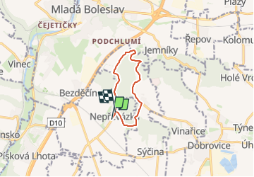
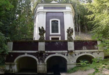
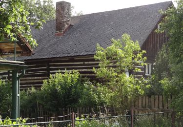
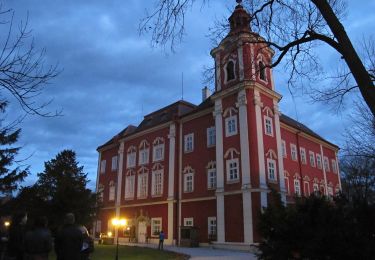
Tour Zu Fuß von 7,3 km verfügbar auf Mittelböhmen, Unbekannt, Nepschewaska. Diese Tour wird von SityTrail - itinéraires balisés pédestres vorgeschlagen.
Beschreibung
Tour erstellt von cz:KČT.
Ort
Land:
Czech Republic
Region :
Mittelböhmen
Abteilung/Provinz :
Unbekannt
Kommune :
Nepschewaska
Standort:
Unknown
Gehen Sie:(Dec)
Gehen Sie:(UTM)
493963 ; 5580595 (33U) N.
Kommentare
Touren in der Umgebung
![Tour Zu Fuß Fürstenbrück - Drhleny - Pod Malou Sněhurkou - Photo](https://media.geolcdn.com/t/375/260/38132064-3812-4ace-977c-2c2b255b8718.jpeg&format=jpg&maxdim=2)
![Zu Fuß Zu Fuß](https://static1.geolcdn.com/sitytour/trail-icons/100.png)
Drhleny - Pod Malou Sněhurkou
Zu Fuß
Einfach
Fürstenbrück,
Mittelböhmen,
Unbekannt,
Czech Republic
![](/images/other/stat-length.png)
4,4 km | 5,5 km-effort
1h 14min
![](https://static1.geolcdn.com/siteimages/upload/files/16400158638029165_repeat_loop_refresh_sync_direction_icon.png)
Nein
![Tour Zu Fuß Woken bei Hirschberg - CZ-3955 - Photo](https://media.geolcdn.com/t/375/260/ef3f6ad6-5c16-42c0-a05d-38e66d8df5a6.jpeg&format=jpg&maxdim=2)
![Zu Fuß Zu Fuß](https://static1.geolcdn.com/sitytour/trail-icons/100.png)
CZ-3955
Zu Fuß
Einfach
Woken bei Hirschberg,
Nordosten,
Reichenberger Region,
Czech Republic
![](/images/other/stat-length.png)
4,2 km | 5,7 km-effort
1h 17min
![](https://static1.geolcdn.com/siteimages/upload/files/16400158638029165_repeat_loop_refresh_sync_direction_icon.png)
Nein
![Tour Zu Fuß Backofen an der Iser - Bělá p. Bezdězem (žst., rozc.) - Klokočka - Photo](https://media.geolcdn.com/t/375/260/21932d23-f317-41e3-970d-a5fa4f1651af.jpeg&format=jpg&maxdim=2)
![Zu Fuß Zu Fuß](https://static1.geolcdn.com/sitytour/trail-icons/100.png)
Bělá p. Bezdězem (žst., rozc.) - Klokočka
Zu Fuß
Einfach
Backofen an der Iser,
Mittelböhmen,
Unbekannt,
Czech Republic
![](/images/other/stat-length.png)
9,3 km | 11,3 km-effort
2h 34min
![](https://static1.geolcdn.com/siteimages/upload/files/16400158638029165_repeat_loop_refresh_sync_direction_icon.png)
Nein
![Tour Zu Fuß Weißwasser - NS Březinské studánky - Photo](https://media.geolcdn.com/t/375/260/d631307e-373d-4417-a2d6-191b26017c78.jpeg&format=jpg&maxdim=2)
![Zu Fuß Zu Fuß](https://static1.geolcdn.com/sitytour/trail-icons/100.png)
NS Březinské studánky
Zu Fuß
Einfach
Weißwasser,
Mittelböhmen,
Unbekannt,
Czech Republic
![](/images/other/stat-length.png)
7,1 km | 8,5 km-effort
1h 56min
![](https://static1.geolcdn.com/siteimages/upload/files/16400158638029165_repeat_loop_refresh_sync_direction_icon.png)
Nein
![Tour Zu Fuß Koschatek - NS Byšice - Photo](https://media.geolcdn.com/t/375/260/9c738d9c-aa7b-4648-9e62-fd68b011a319.jpeg&format=jpg&maxdim=2)
![Zu Fuß Zu Fuß](https://static1.geolcdn.com/sitytour/trail-icons/100.png)
NS Byšice
Zu Fuß
Einfach
Koschatek,
Mittelböhmen,
Unbekannt,
Czech Republic
![](/images/other/stat-length.png)
9,1 km | 10,1 km-effort
2h 17min
![](https://static1.geolcdn.com/siteimages/upload/files/16400158638029165_repeat_loop_refresh_sync_direction_icon.png)
Nein
![Tour Zu Fuß Sud-Hlawno - NS Vladyky Sudy - Photo](https://media.geolcdn.com/t/375/260/ea93aa69-51f4-4456-b462-fef77f0b99b9.jpeg&format=jpg&maxdim=2)
![Zu Fuß Zu Fuß](https://static1.geolcdn.com/sitytour/trail-icons/100.png)
NS Vladyky Sudy
Zu Fuß
Einfach
Sud-Hlawno,
Mittelböhmen,
Unbekannt,
Czech Republic
![](/images/other/stat-length.png)
3,2 km | 3,4 km-effort
46min
![](https://static1.geolcdn.com/siteimages/upload/files/16400158638029165_repeat_loop_refresh_sync_direction_icon.png)
Ja
![Tour Zu Fuß Jetteniz - naučná stezka Viničky - Photo](https://media.geolcdn.com/t/375/260/3874deca-99d1-4f06-9f23-9e8216e8e98e.jpeg&format=jpg&maxdim=2)
![Zu Fuß Zu Fuß](https://static1.geolcdn.com/sitytour/trail-icons/100.png)
naučná stezka Viničky
Zu Fuß
Einfach
Jetteniz,
Nordosten,
Königgrätzer Region,
Czech Republic
![](/images/other/stat-length.png)
3,4 km | 4,8 km-effort
1h 5min
![](https://static1.geolcdn.com/siteimages/upload/files/16400158638029165_repeat_loop_refresh_sync_direction_icon.png)
Nein
![Tour Zu Fuß Netrebitz - naučná stezka Po stopách víly Netřebky - Photo](https://media.geolcdn.com/t/375/260/5999e30b-2a9d-4a4f-abeb-19d760f34452.jpeg&format=jpg&maxdim=2)
![Zu Fuß Zu Fuß](https://static1.geolcdn.com/sitytour/trail-icons/100.png)
naučná stezka Po stopách víly Netřebky
Zu Fuß
Einfach
Netrebitz,
Mittelböhmen,
Unbekannt,
Czech Republic
![](/images/other/stat-length.png)
3,5 km | 3,7 km-effort
50min
![](https://static1.geolcdn.com/siteimages/upload/files/16400158638029165_repeat_loop_refresh_sync_direction_icon.png)
Nein
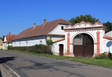
![Tour Zu Fuß Choruschitz - [M] Mělnická Vrutice - Zahájí - Photo](https://media.geolcdn.com/t/375/260/5bbe73f2-35ef-41ee-977d-f53953a5ded4.jpeg&format=jpg&maxdim=2)
![Zu Fuß Zu Fuß](https://static1.geolcdn.com/sitytour/trail-icons/100.png)
[M] Mělnická Vrutice - Zahájí
Zu Fuß
Einfach
Choruschitz,
Mittelböhmen,
Unbekannt,
Czech Republic
![](/images/other/stat-length.png)
12,3 km | 14,7 km-effort
3h 20min
![](https://static1.geolcdn.com/siteimages/upload/files/16400158638029165_repeat_loop_refresh_sync_direction_icon.png)
Nein