![](/images/other/stat-length.png)
![Tour Zu Fuß Littau - NS Luhy Litovelskeho Pomoravi - Photo](https://media.geolcdn.com/t/1900/400/eccbd319-b352-4f52-9d78-c29cff007dbc.jpeg&format=pjpeg&maxdim=2)
NS Luhy Litovelskeho Pomoravi
SityTrail - itinéraires balisés pédestres
Tous les sentiers balisés d’Europe GUIDE+
![Länge](/images/other/stat-length.png)
Länge
11,2 km
![Maximale Höhe](https://static1.geolcdn.com/siteimages/upload/files/1508320355ic_sort_altitude_max_24dp.png)
Maximale Höhe
240 m
![Positive Höhendifferenz](https://static1.geolcdn.com/siteimages/upload/files/1508320355ic_sort_den_pos_24dp.png)
Positive Höhendifferenz
79 m
![Km-Effort](/images/other/stat-length.png)
Km-Effort
12,3 km
![Min. Höhe](https://static1.geolcdn.com/siteimages/upload/files/1508320355ic_sort_altitude_min_24dp.png)
Min. Höhe
218 m
![Negative Höhendifferenz](https://static1.geolcdn.com/siteimages/upload/files/1508320355ic_sort_den_neg_24dp.png)
Negative Höhendifferenz
88 m
![Boucle](https://static1.geolcdn.com/siteimages/upload/files/16400158638029165_repeat_loop_refresh_sync_direction_icon.png)
Boucle
Nein
Kennzeichnung
Erstellungsdatum :
2025-02-07 13:19:00.634
Letzte Änderung :
2025-02-07 13:19:00.634
![Zu Fuß](https://static1.geolcdn.com/sitytour/trail-icons/100.png)
2h47
Schwierigkeit : Einfach
![Scannen Sie diesen QR-Code, um die Tour in der SityTrail-Anwendung zu öffnen](https://capi.geolives.com/qq0zvz2zws4bq2lad0pu/sitytour/trails/4345671/qr.png?size=200)
Kostenlosegpshiking-Anwendung
Über SityTrail
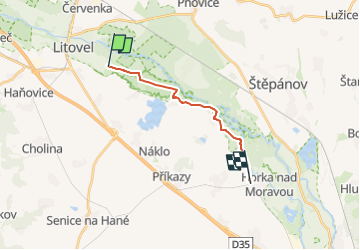
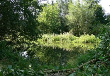
Tour Zu Fuß von 11,2 km verfügbar auf Mittelmähren, Olmützer Region, Littau. Diese Tour wird von SityTrail - itinéraires balisés pédestres vorgeschlagen.
Beschreibung
Tour erstellt von cz:KČT.
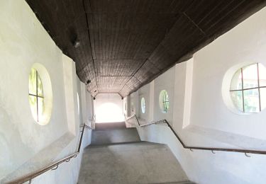
Ort
Land:
Czech Republic
Region :
Mittelmähren
Abteilung/Provinz :
Olmützer Region
Kommune :
Littau
Standort:
Unknown
Gehen Sie:(Dec)
Gehen Sie:(UTM)
651503 ; 5506534 (33U) N.
Kommentare
Touren in der Umgebung
![Tour Zu Fuß Olmütz - žlutý místní okruh Svatý kopeček - Photo](https://media.geolcdn.com/t/375/260/82dc9e37-b126-4d08-b297-3d283d21421e.jpeg&format=jpg&maxdim=2)
![Zu Fuß Zu Fuß](https://static1.geolcdn.com/sitytour/trail-icons/100.png)
žlutý místní okruh Svatý kopeček
Zu Fuß
Einfach
Olmütz,
Mittelmähren,
Olmützer Region,
Czech Republic
![](/images/other/stat-length.png)
3,2 km | 4,1 km-effort
56min
![](https://static1.geolcdn.com/siteimages/upload/files/16400158638029165_repeat_loop_refresh_sync_direction_icon.png)
Ja
![Tour Zu Fuß Olmütz - zelený místní okruh Svatý kopeček - Photo](https://media.geolcdn.com/t/375/260/7fcda208-1c27-426e-93f3-b39b2dcac466.jpeg&format=jpg&maxdim=2)
![Zu Fuß Zu Fuß](https://static1.geolcdn.com/sitytour/trail-icons/100.png)
zelený místní okruh Svatý kopeček
Zu Fuß
Einfach
Olmütz,
Mittelmähren,
Olmützer Region,
Czech Republic
![](/images/other/stat-length.png)
7,2 km | 9,6 km-effort
2h 10min
![](https://static1.geolcdn.com/siteimages/upload/files/16400158638029165_repeat_loop_refresh_sync_direction_icon.png)
Ja
![Tour Zu Fuß Olmütz - místní okruh Mariánské údolí - Velká Bystřice - Svatý kopeček - Photo](https://media.geolcdn.com/t/375/260/101996d1-c8dc-4469-bfaf-b8486d64d3a3.jpeg&format=jpg&maxdim=2)
![Zu Fuß Zu Fuß](https://static1.geolcdn.com/sitytour/trail-icons/100.png)
místní okruh Mariánské údolí - Velká Bystřice - Svatý kopeček
Zu Fuß
Medium
Olmütz,
Mittelmähren,
Olmützer Region,
Czech Republic
![](/images/other/stat-length.png)
16,8 km | 22 km-effort
4h 58min
![](https://static1.geolcdn.com/siteimages/upload/files/16400158638029165_repeat_loop_refresh_sync_direction_icon.png)
Ja
![Tour Zu Fuß Senice na Hané - NS Elišky z Kunštátu - Photo](https://media.geolcdn.com/t/375/260/4d1449a7-b2b6-4cb4-aaeb-ec2a9aea6a88.jpeg&format=jpg&maxdim=2)
![Zu Fuß Zu Fuß](https://static1.geolcdn.com/sitytour/trail-icons/100.png)
NS Elišky z Kunštátu
Zu Fuß
Einfach
Senice na Hané,
Mittelmähren,
Olmützer Region,
Czech Republic
![](/images/other/stat-length.png)
10,4 km | 12,4 km-effort
2h 48min
![](https://static1.geolcdn.com/siteimages/upload/files/16400158638029165_repeat_loop_refresh_sync_direction_icon.png)
Nein
![Tour Zu Fuß Konitz - [Z] Runářov - Konice - Photo](https://media.geolcdn.com/t/375/260/90af7c62-097b-4fe0-b74f-f80499e5b5f8.jpeg&format=jpg&maxdim=2)
![Zu Fuß Zu Fuß](https://static1.geolcdn.com/sitytour/trail-icons/100.png)
[Z] Runářov - Konice
Zu Fuß
Einfach
Konitz,
Mittelmähren,
Olmützer Region,
Czech Republic
![](/images/other/stat-length.png)
4,3 km | 5,5 km-effort
1h 14min
![](https://static1.geolcdn.com/siteimages/upload/files/16400158638029165_repeat_loop_refresh_sync_direction_icon.png)
Nein
![Tour Zu Fuß Lipina - červený místní okruh okolo Dolního žlebu - Photo](https://media.geolcdn.com/t/375/260/13934684-c548-48eb-86a5-4fd735f5e76b.jpeg&format=jpg&maxdim=2)
![Zu Fuß Zu Fuß](https://static1.geolcdn.com/sitytour/trail-icons/100.png)
červený místní okruh okolo Dolního žlebu
Zu Fuß
Einfach
Lipina,
Mittelmähren,
Olmützer Region,
Czech Republic
![](/images/other/stat-length.png)
5,9 km | 8,8 km-effort
1h 59min
![](https://static1.geolcdn.com/siteimages/upload/files/16400158638029165_repeat_loop_refresh_sync_direction_icon.png)
Nein
![Tour Zu Fuß Olmütz - Naučná stezka Kol-kolem Olomouce - Photo](https://media.geolcdn.com/t/375/260/2fe0561a-53fb-46a0-b145-8683694df41d.jpeg&format=jpg&maxdim=2)
![Zu Fuß Zu Fuß](https://static1.geolcdn.com/sitytour/trail-icons/100.png)
Naučná stezka Kol-kolem Olomouce
Zu Fuß
Einfach
Olmütz,
Mittelmähren,
Olmützer Region,
Czech Republic
![](/images/other/stat-length.png)
7,1 km | 7,6 km-effort
1h 43min
![](https://static1.geolcdn.com/siteimages/upload/files/16400158638029165_repeat_loop_refresh_sync_direction_icon.png)
Nein
![Tour Zu Fuß Velký Týnec - CZ-yellow - Photo](https://media.geolcdn.com/t/375/260/438099d0-ec20-4180-a609-c212abe669fc.jpeg&format=jpg&maxdim=2)
![Zu Fuß Zu Fuß](https://static1.geolcdn.com/sitytour/trail-icons/100.png)
CZ-yellow
Zu Fuß
Einfach
Velký Týnec,
Mittelmähren,
Olmützer Region,
Czech Republic
![](/images/other/stat-length.png)
4,7 km | 5,3 km-effort
1h 12min
![](https://static1.geolcdn.com/siteimages/upload/files/16400158638029165_repeat_loop_refresh_sync_direction_icon.png)
Nein
![Tour Zu Fuß Bílá Lhota - Naučná stezka romantický areál Nové Zámky - Photo](https://media.geolcdn.com/t/375/260/d01eff3c-f48b-45ae-a581-ad7c849ab48d.jpeg&format=jpg&maxdim=2)
![Zu Fuß Zu Fuß](https://static1.geolcdn.com/sitytour/trail-icons/100.png)
Naučná stezka romantický areál Nové Zámky
Zu Fuß
Einfach
Bílá Lhota,
Mittelmähren,
Olmützer Region,
Czech Republic
![](/images/other/stat-length.png)
8,5 km | 9,8 km-effort
2h 13min
![](https://static1.geolcdn.com/siteimages/upload/files/16400158638029165_repeat_loop_refresh_sync_direction_icon.png)
Nein