![](/images/other/stat-length.png)
![Tour Zu Fuß Raußnitz - CZ-Studánková NS - Photo](https://media.geolcdn.com/t/1900/400/26c2a764-b50a-4157-b115-4b0a7dcb62ae.jpeg&format=pjpeg&maxdim=2)
CZ-Studánková NS
SityTrail - itinéraires balisés pédestres
Tous les sentiers balisés d’Europe GUIDE+
![Länge](/images/other/stat-length.png)
Länge
8,1 km
![Maximale Höhe](https://static1.geolcdn.com/siteimages/upload/files/1508320355ic_sort_altitude_max_24dp.png)
Maximale Höhe
541 m
![Positive Höhendifferenz](https://static1.geolcdn.com/siteimages/upload/files/1508320355ic_sort_den_pos_24dp.png)
Positive Höhendifferenz
276 m
![Km-Effort](/images/other/stat-length.png)
Km-Effort
11,3 km
![Min. Höhe](https://static1.geolcdn.com/siteimages/upload/files/1508320355ic_sort_altitude_min_24dp.png)
Min. Höhe
282 m
![Negative Höhendifferenz](https://static1.geolcdn.com/siteimages/upload/files/1508320355ic_sort_den_neg_24dp.png)
Negative Höhendifferenz
139 m
![Boucle](https://static1.geolcdn.com/siteimages/upload/files/16400158638029165_repeat_loop_refresh_sync_direction_icon.png)
Boucle
Nein
Kennzeichnung
Erstellungsdatum :
2025-02-07 12:31:44.84
Letzte Änderung :
2025-02-07 12:31:44.84
![Zu Fuß](https://static1.geolcdn.com/sitytour/trail-icons/100.png)
2h34
Schwierigkeit : Einfach
![Scannen Sie diesen QR-Code, um die Tour in der SityTrail-Anwendung zu öffnen](https://capi.geolives.com/qq0zvz2zws4bq2lad0pu/sitytour/trails/4345587/qr.png?size=200)
Kostenlosegpshiking-Anwendung
Über SityTrail
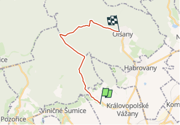
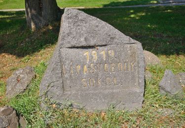
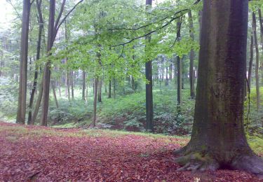
Tour Zu Fuß von 8,1 km verfügbar auf Südosten, Südmährische Region, Raußnitz. Diese Tour wird von SityTrail - itinéraires balisés pédestres vorgeschlagen.
Beschreibung
Tour erstellt von cz:KČT.
Ort
Land:
Czech Republic
Region :
Südosten
Abteilung/Provinz :
Südmährische Region
Kommune :
Raußnitz
Standort:
Unknown
Gehen Sie:(Dec)
Gehen Sie:(UTM)
634764 ; 5453182 (33U) N.
Kommentare
Touren in der Umgebung
![Tour Zu Fuß Bukovinka - [Ž] Rakovecké údolí - Malá Říčka - Photo](https://media.geolcdn.com/t/375/260/d06663d7-1067-4c22-b72c-d81a6dabd113.jpeg&format=jpg&maxdim=2)
![Zu Fuß Zu Fuß](https://static1.geolcdn.com/sitytour/trail-icons/100.png)
[Ž] Rakovecké údolí - Malá Říčka
Zu Fuß
Einfach
Bukovinka,
Südosten,
Südmährische Region,
Czech Republic
![](/images/other/stat-length.png)
4,4 km | 5,6 km-effort
1h 16min
![](https://static1.geolcdn.com/siteimages/upload/files/16400158638029165_repeat_loop_refresh_sync_direction_icon.png)
Nein
![Tour Zu Fuß Gaya - NS Kyjov - Bohuslavice - Photo](https://media.geolcdn.com/t/375/260/16565716-f7da-4e94-8dac-0505f2bd9da5.jpeg&format=jpg&maxdim=2)
![Zu Fuß Zu Fuß](https://static1.geolcdn.com/sitytour/trail-icons/100.png)
NS Kyjov - Bohuslavice
Zu Fuß
Einfach
Gaya,
Südosten,
Südmährische Region,
Czech Republic
![](/images/other/stat-length.png)
13,6 km | 17,6 km-effort
3h 59min
![](https://static1.geolcdn.com/siteimages/upload/files/16400158638029165_repeat_loop_refresh_sync_direction_icon.png)
Nein
![Tour Zu Fuß Ochoz u Brna - naučná stezka Hády a Údolí Říčky - Photo](https://media.geolcdn.com/t/375/260/ba2d53c2-7acc-4c7d-af68-1d9f242ad3c9.jpeg&format=jpg&maxdim=2)
![Zu Fuß Zu Fuß](https://static1.geolcdn.com/sitytour/trail-icons/100.png)
naučná stezka Hády a Údolí Říčky
Zu Fuß
Einfach
Ochoz u Brna,
Südosten,
Südmährische Region,
Czech Republic
![](/images/other/stat-length.png)
10,2 km | 12 km-effort
2h 44min
![](https://static1.geolcdn.com/siteimages/upload/files/16400158638029165_repeat_loop_refresh_sync_direction_icon.png)
Nein
![Tour Zu Fuß Pustiměř - Naučná stezka Melice - Photo](https://media.geolcdn.com/t/375/260/4b55e64f-1976-46b7-8693-6e08bb8a9e01.jpeg&format=jpg&maxdim=2)
![Zu Fuß Zu Fuß](https://static1.geolcdn.com/sitytour/trail-icons/100.png)
Naučná stezka Melice
Zu Fuß
Einfach
Pustiměř,
Südosten,
Südmährische Region,
Czech Republic
![](/images/other/stat-length.png)
6,7 km | 9 km-effort
2h 2min
![](https://static1.geolcdn.com/siteimages/upload/files/16400158638029165_repeat_loop_refresh_sync_direction_icon.png)
Ja
![Tour Zu Fuß Steinitz - Naučná stezka Motýlí ráj - Photo](https://media.geolcdn.com/t/375/260/d13e0f9b-0034-410d-9fa4-ff218220b19f.jpeg&format=jpg&maxdim=2)
![Zu Fuß Zu Fuß](https://static1.geolcdn.com/sitytour/trail-icons/100.png)
Naučná stezka Motýlí ráj
Zu Fuß
Einfach
Steinitz,
Südosten,
Südmährische Region,
Czech Republic
![](/images/other/stat-length.png)
5,7 km | 7,9 km-effort
1h 47min
![](https://static1.geolcdn.com/siteimages/upload/files/16400158638029165_repeat_loop_refresh_sync_direction_icon.png)
Ja
![Tour Zu Fuß Steinitz - [Ž] Černčín - Bučovice - Photo](https://media.geolcdn.com/t/375/260/0e8a5bf5-67a6-4aaf-a695-d3a2c91aad48.jpeg&format=jpg&maxdim=2)
![Zu Fuß Zu Fuß](https://static1.geolcdn.com/sitytour/trail-icons/100.png)
[Ž] Černčín - Bučovice
Zu Fuß
Einfach
Steinitz,
Südosten,
Südmährische Region,
Czech Republic
![](/images/other/stat-length.png)
12,1 km | 17,6 km-effort
3h 59min
![](https://static1.geolcdn.com/siteimages/upload/files/16400158638029165_repeat_loop_refresh_sync_direction_icon.png)
Nein
![Tour Zu Fuß Wranau - Krajem říčky Ponávky (pěší) - Photo](https://media.geolcdn.com/t/375/260/d4892074-ca0b-450c-9484-555e1ddcdd27.jpeg&format=jpg&maxdim=2)
![Zu Fuß Zu Fuß](https://static1.geolcdn.com/sitytour/trail-icons/100.png)
Krajem říčky Ponávky (pěší)
Zu Fuß
Einfach
Wranau,
Südosten,
Südmährische Region,
Czech Republic
![](/images/other/stat-length.png)
5 km | 7,2 km-effort
1h 37min
![](https://static1.geolcdn.com/siteimages/upload/files/16400158638029165_repeat_loop_refresh_sync_direction_icon.png)
Nein
![Tour Zu Fuß Račice-Pístovice - naučná stezka Rakovecké údolí - Photo](https://media.geolcdn.com/t/375/260/37fc810a-3aca-4e21-9bcd-5baf656f4474.jpeg&format=jpg&maxdim=2)
![Zu Fuß Zu Fuß](https://static1.geolcdn.com/sitytour/trail-icons/100.png)
naučná stezka Rakovecké údolí
Zu Fuß
Einfach
Račice-Pístovice,
Südosten,
Südmährische Region,
Czech Republic
![](/images/other/stat-length.png)
6,5 km | 8,4 km-effort
1h 54min
![](https://static1.geolcdn.com/siteimages/upload/files/16400158638029165_repeat_loop_refresh_sync_direction_icon.png)
Ja
![Tour Zu Fuß Nesovice - [Z] Nesovice - Jestřabice - Photo](https://media.geolcdn.com/t/375/260/7ceae2e4-1045-498d-b13d-4c03c700de18.jpeg&format=jpg&maxdim=2)
![Zu Fuß Zu Fuß](https://static1.geolcdn.com/sitytour/trail-icons/100.png)
[Z] Nesovice - Jestřabice
Zu Fuß
Einfach
Nesovice,
Südosten,
Südmährische Region,
Czech Republic
![](/images/other/stat-length.png)
11,3 km | 14,6 km-effort
3h 18min
![](https://static1.geolcdn.com/siteimages/upload/files/16400158638029165_repeat_loop_refresh_sync_direction_icon.png)
Nein