![](/images/other/stat-length.png)
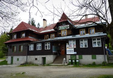
![Tour Zu Fuß Czeladna - Stezka paravýsadku Wolfram - Photo](https://media.geolcdn.com/t/1900/400/eebcea34-591b-489d-bcb7-82f153c6e734.jpeg&format=pjpeg&maxdim=2)
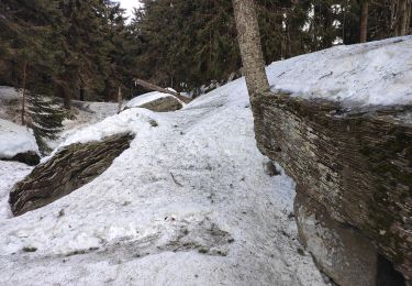
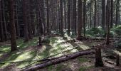
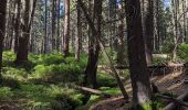
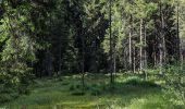
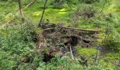
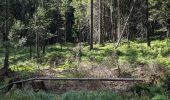
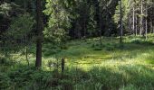
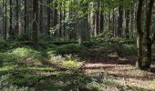
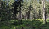
Stezka paravýsadku Wolfram
SityTrail - itinéraires balisés pédestres
Tous les sentiers balisés d’Europe GUIDE+
![Länge](/images/other/stat-length.png)
Länge
3,3 km
![Maximale Höhe](https://static1.geolcdn.com/siteimages/upload/files/1508320355ic_sort_altitude_max_24dp.png)
Maximale Höhe
960 m
![Positive Höhendifferenz](https://static1.geolcdn.com/siteimages/upload/files/1508320355ic_sort_den_pos_24dp.png)
Positive Höhendifferenz
269 m
![Km-Effort](/images/other/stat-length.png)
Km-Effort
6 km
![Min. Höhe](https://static1.geolcdn.com/siteimages/upload/files/1508320355ic_sort_altitude_min_24dp.png)
Min. Höhe
686 m
![Negative Höhendifferenz](https://static1.geolcdn.com/siteimages/upload/files/1508320355ic_sort_den_neg_24dp.png)
Negative Höhendifferenz
3 m
![Boucle](https://static1.geolcdn.com/siteimages/upload/files/16400158638029165_repeat_loop_refresh_sync_direction_icon.png)
Boucle
Nein
Kennzeichnung
Erstellungsdatum :
2025-02-07 10:09:44.799
Letzte Änderung :
2025-02-07 10:09:44.799
![Zu Fuß](https://static1.geolcdn.com/sitytour/trail-icons/100.png)
1h22
Schwierigkeit : Einfach
![Scannen Sie diesen QR-Code, um die Tour in der SityTrail-Anwendung zu öffnen](https://capi.geolives.com/qq0zvz2zws4bq2lad0pu/sitytour/trails/4345186/qr.png?size=200)
Kostenlosegpshiking-Anwendung
Über SityTrail
Tour Zu Fuß von 3,3 km verfügbar auf Mährisch-Schlesien, Mährisch-Schlesische Region, Czeladna. Diese Tour wird von SityTrail - itinéraires balisés pédestres vorgeschlagen.
Beschreibung
Tour erstellt von cz:Vlastenecký klub.
Ort
Land:
Czech Republic
Region :
Mährisch-Schlesien
Abteilung/Provinz :
Mährisch-Schlesische Region
Kommune :
Czeladna
Standort:
Unknown
Gehen Sie:(Dec)
Gehen Sie:(UTM)
308660 ; 5483385 (34U) N.
Kommentare
Touren in der Umgebung
![Tour Zu Fuß Groß Karlowitz - Okruh Galik - Horal - Photo](https://media.geolcdn.com/t/375/260/55a9f7db-9dd0-4d44-884a-90affea5c38d.jpeg&format=jpg&maxdim=2)
![Zu Fuß Zu Fuß](https://static1.geolcdn.com/sitytour/trail-icons/100.png)
Okruh Galik - Horal
Zu Fuß
Einfach
Groß Karlowitz,
Mittelmähren,
Region Zlin,
Czech Republic
![](/images/other/stat-length.png)
6,3 km | 9,7 km-effort
2h 12min
![](https://static1.geolcdn.com/siteimages/upload/files/16400158638029165_repeat_loop_refresh_sync_direction_icon.png)
Nein
![Tour Zu Fuß Ober Lomna - NS Wolfram – Morávka - Photo](https://media.geolcdn.com/t/375/260/facccdd6-2afa-401a-a0fb-4b8f1917ab88.jpeg&format=jpg&maxdim=2)
![Zu Fuß Zu Fuß](https://static1.geolcdn.com/sitytour/trail-icons/100.png)
NS Wolfram – Morávka
Zu Fuß
Einfach
Ober Lomna,
Mährisch-Schlesien,
Mährisch-Schlesische Region,
Czech Republic
![](/images/other/stat-length.png)
12,6 km | 16,6 km-effort
3h 46min
![](https://static1.geolcdn.com/siteimages/upload/files/16400158638029165_repeat_loop_refresh_sync_direction_icon.png)
Nein
![Tour Zu Fuß Pržno - CZ-značení je vybledlé nebo zamalované - Photo](https://media.geolcdn.com/t/375/260/a8d6fd52-cbb4-4c76-a853-7ad8b99156e9.jpeg&format=jpg&maxdim=2)
![Zu Fuß Zu Fuß](https://static1.geolcdn.com/sitytour/trail-icons/100.png)
CZ-značení je vybledlé nebo zamalované
Zu Fuß
Einfach
Pržno,
Mährisch-Schlesien,
Mährisch-Schlesische Region,
Czech Republic
![](/images/other/stat-length.png)
3,3 km | 3,8 km-effort
51min
![](https://static1.geolcdn.com/siteimages/upload/files/16400158638029165_repeat_loop_refresh_sync_direction_icon.png)
Ja
![Tour Zu Fuß Pstruží - Medvědí stezky - modry okruh - Photo](https://media.geolcdn.com/t/375/260/c64a6343-e3ef-458e-945b-0e373862d052.jpeg&format=jpg&maxdim=2)
![Zu Fuß Zu Fuß](https://static1.geolcdn.com/sitytour/trail-icons/100.png)
Medvědí stezky - modry okruh
Zu Fuß
Einfach
Pstruží,
Mährisch-Schlesien,
Mährisch-Schlesische Region,
Czech Republic
![](/images/other/stat-length.png)
12,7 km | 19,1 km-effort
4h 20min
![](https://static1.geolcdn.com/siteimages/upload/files/16400158638029165_repeat_loop_refresh_sync_direction_icon.png)
Nein
![Tour Zu Fuß Nový Hrozenkov - Velka- Studanky - Photo](https://media.geolcdn.com/t/375/260/f5f78048-1bf5-4521-b4f0-e61c3e953709.jpeg&format=jpg&maxdim=2)
![Zu Fuß Zu Fuß](https://static1.geolcdn.com/sitytour/trail-icons/100.png)
Velka- Studanky
Zu Fuß
Einfach
Nový Hrozenkov,
Mittelmähren,
Region Zlin,
Czech Republic
![](/images/other/stat-length.png)
4,2 km | 7,5 km-effort
1h 42min
![](https://static1.geolcdn.com/siteimages/upload/files/16400158638029165_repeat_loop_refresh_sync_direction_icon.png)
Ja
![Tour Zu Fuß Trojanowitz - Naučná stezka Čertův mlýn - Photo](https://media.geolcdn.com/t/375/260/cbf960a5-0bfe-4772-b96e-ddba56e8e225.jpeg&format=jpg&maxdim=2)
![Zu Fuß Zu Fuß](https://static1.geolcdn.com/sitytour/trail-icons/100.png)
Naučná stezka Čertův mlýn
Zu Fuß
Einfach
Trojanowitz,
Mährisch-Schlesien,
Mährisch-Schlesische Region,
Czech Republic
![](/images/other/stat-length.png)
8 km | 10,2 km-effort
2h 19min
![](https://static1.geolcdn.com/siteimages/upload/files/16400158638029165_repeat_loop_refresh_sync_direction_icon.png)
Nein
![Tour Zu Fuß Bezirk Tschadsa - NS Javorníky - Photo](https://media.geolcdn.com/t/375/260/e32c7fac-bf64-4198-87d3-f7164f2f2c3b.jpeg&format=jpg&maxdim=2)
![Zu Fuß Zu Fuß](https://static1.geolcdn.com/sitytour/trail-icons/100.png)
NS Javorníky
Zu Fuß
Schwierig
Bezirk Tschadsa,
Silleiner Landschaftsverband,
Unbekannt,
Slovakia
![](/images/other/stat-length.png)
23 km | 35 km-effort
7h 51min
![](https://static1.geolcdn.com/siteimages/upload/files/16400158638029165_repeat_loop_refresh_sync_direction_icon.png)
Nein
![Tour Zu Fuß Hütten-Solanetz - CZ-yellow - Photo](https://media.geolcdn.com/t/375/260/a0774b82-0132-49c6-bbfc-6413ced09693.jpeg&format=jpg&maxdim=2)
![Zu Fuß Zu Fuß](https://static1.geolcdn.com/sitytour/trail-icons/100.png)
CZ-yellow
Zu Fuß
Einfach
Hütten-Solanetz,
Mittelmähren,
Region Zlin,
Czech Republic
![](/images/other/stat-length.png)
8 km | 10,9 km-effort
2h 28min
![](https://static1.geolcdn.com/siteimages/upload/files/16400158638029165_repeat_loop_refresh_sync_direction_icon.png)
Nein
![Tour Zu Fuß Rosenau - Naučná stezka Hradisko - Photo](https://media.geolcdn.com/t/375/260/11d1adb9-50f7-4faa-a422-2bf2989473bd.jpeg&format=jpg&maxdim=2)
![Zu Fuß Zu Fuß](https://static1.geolcdn.com/sitytour/trail-icons/100.png)
Naučná stezka Hradisko
Zu Fuß
Einfach
Rosenau,
Mittelmähren,
Region Zlin,
Czech Republic
![](/images/other/stat-length.png)
3,1 km | 5,2 km-effort
1h 10min
![](https://static1.geolcdn.com/siteimages/upload/files/16400158638029165_repeat_loop_refresh_sync_direction_icon.png)
Ja