![](/images/other/stat-length.png)
![Tour Zu Fuß Proseč - Planetární stezka - Photo](https://media.geolcdn.com/t/1900/400/33d4a852-bac6-4ff0-8b9d-a5d212f7f261.jpeg&format=pjpeg&maxdim=2)
Planetární stezka
SityTrail - itinéraires balisés pédestres
Tous les sentiers balisés d’Europe GUIDE+
![Länge](/images/other/stat-length.png)
Länge
5,9 km
![Maximale Höhe](https://static1.geolcdn.com/siteimages/upload/files/1508320355ic_sort_altitude_max_24dp.png)
Maximale Höhe
650 m
![Positive Höhendifferenz](https://static1.geolcdn.com/siteimages/upload/files/1508320355ic_sort_den_pos_24dp.png)
Positive Höhendifferenz
79 m
![Km-Effort](/images/other/stat-length.png)
Km-Effort
7,2 km
![Min. Höhe](https://static1.geolcdn.com/siteimages/upload/files/1508320355ic_sort_altitude_min_24dp.png)
Min. Höhe
518 m
![Negative Höhendifferenz](https://static1.geolcdn.com/siteimages/upload/files/1508320355ic_sort_den_neg_24dp.png)
Negative Höhendifferenz
141 m
![Boucle](https://static1.geolcdn.com/siteimages/upload/files/16400158638029165_repeat_loop_refresh_sync_direction_icon.png)
Boucle
Nein
Kennzeichnung
Erstellungsdatum :
2025-02-07 04:50:29.093
Letzte Änderung :
2025-02-07 04:50:29.093
![Zu Fuß](https://static1.geolcdn.com/sitytour/trail-icons/100.png)
1h38
Schwierigkeit : Einfach
![Scannen Sie diesen QR-Code, um die Tour in der SityTrail-Anwendung zu öffnen](https://capi.geolives.com/qq0zvz2zws4bq2lad0pu/sitytour/trails/4344629/qr.png?size=200)
Kostenlosegpshiking-Anwendung
Über SityTrail
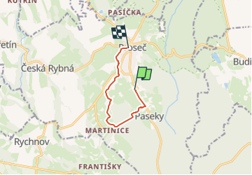
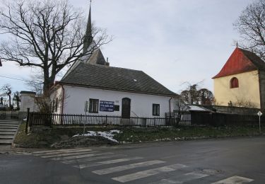
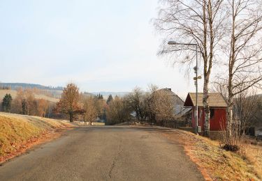
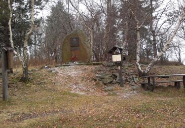
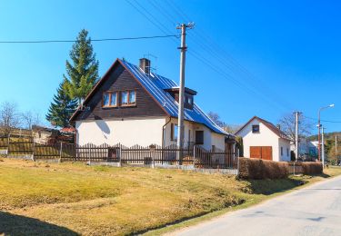
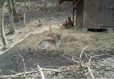
Tour Zu Fuß von 5,9 km verfügbar auf Nordosten, Pardubitzer Region, Proseč. Diese Tour wird von SityTrail - itinéraires balisés pédestres vorgeschlagen.
Beschreibung
Tour erstellt von cz:Proseč.
http://www.planetarnistezka.cz/
Ort
Land:
Czech Republic
Region :
Nordosten
Abteilung/Provinz :
Pardubitzer Region
Kommune :
Proseč
Standort:
Unknown
Gehen Sie:(Dec)
Gehen Sie:(UTM)
580438 ; 5516180 (33U) N.
Kommentare
Touren in der Umgebung
![Tour Zu Fuß Hohenmauth - NS Vraclav - Photo](https://media.geolcdn.com/t/375/260/1791c917-5d79-4fbd-ae8f-a8a4290f074f.jpeg&format=jpg&maxdim=2)
![Zu Fuß Zu Fuß](https://static1.geolcdn.com/sitytour/trail-icons/100.png)
NS Vraclav
Zu Fuß
Einfach
Hohenmauth,
Nordosten,
Pardubitzer Region,
Czech Republic
![](/images/other/stat-length.png)
7,7 km | 9,2 km-effort
2h 6min
![](https://static1.geolcdn.com/siteimages/upload/files/16400158638029165_repeat_loop_refresh_sync_direction_icon.png)
Nein
![Tour Zu Fuß Hohenmauth - NS Vinice - Photo](https://media.geolcdn.com/t/375/260/278c53cc-47e3-4b4d-b90b-fe56e6f8e7fe.jpeg&format=jpg&maxdim=2)
![Zu Fuß Zu Fuß](https://static1.geolcdn.com/sitytour/trail-icons/100.png)
NS Vinice
Zu Fuß
Einfach
Hohenmauth,
Nordosten,
Pardubitzer Region,
Czech Republic
![](/images/other/stat-length.png)
3,7 km | 4,5 km-effort
1h 1min
![](https://static1.geolcdn.com/siteimages/upload/files/16400158638029165_repeat_loop_refresh_sync_direction_icon.png)
Nein
![Tour Zu Fuß Politschka - Naučná stezka u Poličky - Photo](https://media.geolcdn.com/t/375/260/fb9f1b38-862b-4506-8953-a64fb509433a.jpeg&format=jpg&maxdim=2)
![Zu Fuß Zu Fuß](https://static1.geolcdn.com/sitytour/trail-icons/100.png)
Naučná stezka u Poličky
Zu Fuß
Einfach
Politschka,
Nordosten,
Pardubitzer Region,
Czech Republic
![](/images/other/stat-length.png)
8,1 km | 10,1 km-effort
2h 18min
![](https://static1.geolcdn.com/siteimages/upload/files/16400158638029165_repeat_loop_refresh_sync_direction_icon.png)
Nein
![Tour Zu Fuß Křižánky - Příběh krajiny pod Čtyřmi palicemi - Photo](https://media.geolcdn.com/t/375/260/afe50164-5347-4821-bfa6-7f0f6ff30948.jpeg&format=jpg&maxdim=2)
![Zu Fuß Zu Fuß](https://static1.geolcdn.com/sitytour/trail-icons/100.png)
Příběh krajiny pod Čtyřmi palicemi
Zu Fuß
Einfach
Křižánky,
Südosten,
Region Hochland,
Czech Republic
![](/images/other/stat-length.png)
4,5 km | 5,7 km-effort
1h 17min
![](https://static1.geolcdn.com/siteimages/upload/files/16400158638029165_repeat_loop_refresh_sync_direction_icon.png)
Ja
![Tour Zu Fuß Věcov - Naučná stezka Metodka - Photo](https://media.geolcdn.com/t/375/260/992490b9-69b5-47f8-9951-50652ed6ca6a.jpeg&format=jpg&maxdim=2)
![Zu Fuß Zu Fuß](https://static1.geolcdn.com/sitytour/trail-icons/100.png)
Naučná stezka Metodka
Zu Fuß
Einfach
Věcov,
Südosten,
Region Hochland,
Czech Republic
![](/images/other/stat-length.png)
3,7 km | 4,4 km-effort
1h 0min
![](https://static1.geolcdn.com/siteimages/upload/files/16400158638029165_repeat_loop_refresh_sync_direction_icon.png)
Ja
![Tour Zu Fuß Oldřiš - CZ-4299 - Photo](https://media.geolcdn.com/t/375/260/f5a5045c-0299-4e5f-8166-343ca95529ab.jpeg&format=jpg&maxdim=2)
![Zu Fuß Zu Fuß](https://static1.geolcdn.com/sitytour/trail-icons/100.png)
CZ-4299
Zu Fuß
Einfach
Oldřiš,
Nordosten,
Pardubitzer Region,
Czech Republic
![](/images/other/stat-length.png)
3,5 km | 5,2 km-effort
1h 11min
![](https://static1.geolcdn.com/siteimages/upload/files/16400158638029165_repeat_loop_refresh_sync_direction_icon.png)
Nein
![Tour Zu Fuß Borová - [Ž] Stezka Terezy Novákové - Photo](https://media.geolcdn.com/t/375/260/90432b41-0443-42db-8054-847210ebcce0.jpeg&format=jpg&maxdim=2)
![Zu Fuß Zu Fuß](https://static1.geolcdn.com/sitytour/trail-icons/100.png)
[Ž] Stezka Terezy Novákové
Zu Fuß
Einfach
Borová,
Nordosten,
Pardubitzer Region,
Czech Republic
![](/images/other/stat-length.png)
6 km | 7,9 km-effort
1h 47min
![](https://static1.geolcdn.com/siteimages/upload/files/16400158638029165_repeat_loop_refresh_sync_direction_icon.png)
Nein
![Tour Zu Fuß Skutsch - CZ-7342 - Photo](https://media.geolcdn.com/t/375/260/0602c4b3-981f-48c4-8cd0-aa3f74294ede.jpeg&format=jpg&maxdim=2)
![Zu Fuß Zu Fuß](https://static1.geolcdn.com/sitytour/trail-icons/100.png)
CZ-7342
Zu Fuß
Einfach
Skutsch,
Nordosten,
Pardubitzer Region,
Czech Republic
![](/images/other/stat-length.png)
4,5 km | 5,8 km-effort
1h 19min
![](https://static1.geolcdn.com/siteimages/upload/files/16400158638029165_repeat_loop_refresh_sync_direction_icon.png)
Nein
![Tour Zu Fuß Ziegenhain - bývalá Naučná stezka Tisůvka - Žákova hora - Photo](https://media.geolcdn.com/t/375/260/296fb354-daf1-4815-b719-83dd65514041.jpeg&format=jpg&maxdim=2)
![Zu Fuß Zu Fuß](https://static1.geolcdn.com/sitytour/trail-icons/100.png)
bývalá Naučná stezka Tisůvka - Žákova hora
Zu Fuß
Einfach
Ziegenhain,
Südosten,
Region Hochland,
Czech Republic
![](/images/other/stat-length.png)
10,1 km | 13,9 km-effort
3h 8min
![](https://static1.geolcdn.com/siteimages/upload/files/16400158638029165_repeat_loop_refresh_sync_direction_icon.png)
Ja