


4,5 km | 5,6 km-effort
![Tour Zu Fuß Libowitz - [Ž] Slaný - U Jána - Photo](https://media.geolcdn.com/t/1900/400/4c92c36a-58cf-41ef-9089-835f8abdcec7.jpeg&format=pjpeg&maxdim=2)

Tous les sentiers balisés d’Europe GUIDE+


Kostenlosegpshiking-Anwendung
 SityTrail
IGN / Geografische Institute
SityTrail World
Die Welt öffnet sich für Sie
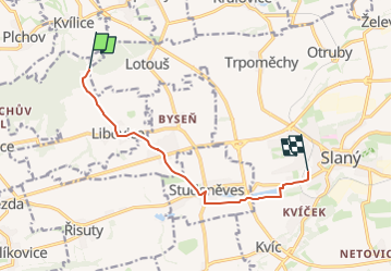
Tour Zu Fuß von 7,7 km verfügbar auf Mittelböhmen, Unbekannt, Libowitz. Diese Tour wird von SityTrail - itinéraires balisés pédestres vorgeschlagen.
Tour erstellt von cz:KČT.
![Tour Zu Fuß Libowitz - [Ž] Slaný - U Jána - Photo 1](https://media.geolcdn.com/t/2048/auto/89776475-0bce-459f-815c-9b9b95e13004.jpeg&format=jpg&maxdim=0 "Tour Zu Fuß Libowitz - [Ž] Slaný - U Jána - Photo 1")
![Tour Zu Fuß Libowitz - [Ž] Slaný - U Jána - Photo 2](https://media.geolcdn.com/t/2048/auto/43656660-0979-4d82-baf7-eb9fd69caf51.jpeg&format=jpg&maxdim=0 "Tour Zu Fuß Libowitz - [Ž] Slaný - U Jána - Photo 2")
![Tour Zu Fuß Libowitz - [Ž] Slaný - U Jána - Photo 3](https://media.geolcdn.com/t/2048/auto/7e432810-e68c-4c9f-9c55-40a3dd8e8c11.jpeg&format=jpg&maxdim=0 "Tour Zu Fuß Libowitz - [Ž] Slaný - U Jána - Photo 3")
![Tour Zu Fuß Libowitz - [Ž] Slaný - U Jána - Photo 4](https://media.geolcdn.com/t/2048/auto/1cdadd68-1e97-40fd-b818-3a833d6bb939.jpeg&format=jpg&maxdim=0 "Tour Zu Fuß Libowitz - [Ž] Slaný - U Jána - Photo 4")
![Tour Zu Fuß Libowitz - [Ž] Slaný - U Jána - Photo 5](https://media.geolcdn.com/t/2048/auto/69eb6bd4-eee4-48a6-8fe4-535566c8f1fd.jpeg&format=jpg&maxdim=0 "Tour Zu Fuß Libowitz - [Ž] Slaný - U Jána - Photo 5")
![Tour Zu Fuß Libowitz - [Ž] Slaný - U Jána - Photo 6](https://media.geolcdn.com/t/2048/auto/dcd61189-7de9-4c87-84ef-0e17f69462b4.jpeg&format=jpg&maxdim=0 "Tour Zu Fuß Libowitz - [Ž] Slaný - U Jána - Photo 6")
![Tour Zu Fuß Libowitz - [Ž] Slaný - U Jána - Photo 7](https://media.geolcdn.com/t/2048/auto/fa327308-46d9-4c12-8db3-75410e65fe98.jpeg&format=jpg&maxdim=0 "Tour Zu Fuß Libowitz - [Ž] Slaný - U Jána - Photo 7")
![Tour Zu Fuß Libowitz - [Ž] Slaný - U Jána - Photo 8](https://media.geolcdn.com/t/2048/auto/7c55f3a6-b8b6-4a97-86e8-8a8e472f50e7.jpeg&format=jpg&maxdim=0 "Tour Zu Fuß Libowitz - [Ž] Slaný - U Jána - Photo 8")
![Tour Zu Fuß Libowitz - [Ž] Slaný - U Jána - Photo 9](https://media.geolcdn.com/t/2048/auto/9ffad348-826e-46a1-adff-0865709c0e8a.jpeg&format=jpg&maxdim=0 "Tour Zu Fuß Libowitz - [Ž] Slaný - U Jána - Photo 9")
![Tour Zu Fuß Libowitz - [Ž] Slaný - U Jána - Photo 10](https://media.geolcdn.com/t/2048/auto/4c92c36a-58cf-41ef-9089-835f8abdcec7.jpeg&format=jpg&maxdim=0 "Tour Zu Fuß Libowitz - [Ž] Slaný - U Jána - Photo 10")
Zu Fuß
![Tour Zu Fuß Welwarn - [Ž] Nelahozeves - Velvary - Photo](https://media.geolcdn.com/t/375/260/3dd487bf-3b30-48f2-8f97-8b0d27624dbd.jpeg&format=jpg&maxdim=2)
Zu Fuß
Zu Fuß
![Tour Zu Fuß Rentsch - [Ž] Lány - Řevničov - Photo](https://media.geolcdn.com/t/375/260/320e557e-c428-40b1-8727-5483d7ade490.jpeg&format=jpg&maxdim=2)
Zu Fuß
Zu Fuß
![Tour Zu Fuß Bratonitz - [M] Kamenné Žehrovice - Bratronice - Photo](https://media.geolcdn.com/t/375/260/62a19af9-67a3-4298-8dff-8290148c3bfe.jpeg&format=jpg&maxdim=2)
Zu Fuß
![Tour Zu Fuß Kladen - [Z] Kladno-Valdecký les - Photo](https://media.geolcdn.com/t/375/260/cf3eeac2-5c05-4cf9-a4d6-b32313d2dcb9.jpeg&format=jpg&maxdim=2)
Zu Fuß
![Tour Zu Fuß Stein-Schechrowitz - [Z] Kamenné Žehrovice - Srby - Photo](https://media.geolcdn.com/t/375/260/42506135-74aa-456c-a9c9-53e0c9a45986.jpeg&format=jpg&maxdim=2)
Zu Fuß
Zu Fuß