


3,8 km | 4,9 km-effort
![Tour Zu Fuß Landskron - [Ž] vycházkový okruh Obora - Photo](https://media.geolcdn.com/t/1900/400/0ca3be77-e6a8-49ca-819d-6c284a1881e4.jpeg&format=pjpeg&maxdim=2)

Tous les sentiers balisés d’Europe GUIDE+


Kostenlosegpshiking-Anwendung
 SityTrail
IGN / Geografische Institute
SityTrail World
Die Welt öffnet sich für Sie
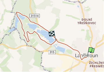
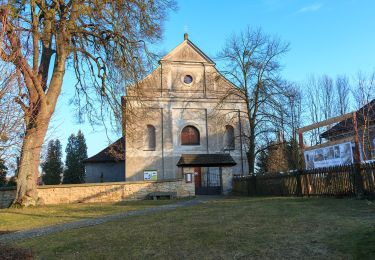
Tour Zu Fuß von 7,5 km verfügbar auf Nordosten, Pardubitzer Region, Landskron. Diese Tour wird von SityTrail - itinéraires balisés pédestres vorgeschlagen.
Tour erstellt von cz:KČT.
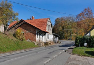
![Tour Zu Fuß Landskron - [Ž] vycházkový okruh Obora - Photo 1](https://media.geolcdn.com/t/2048/auto/14c9263a-cc66-4e78-96bf-980d8c6802ed.jpeg&format=jpg&maxdim=0 "Tour Zu Fuß Landskron - [Ž] vycházkový okruh Obora - Photo 1")
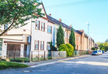
![Tour Zu Fuß Landskron - [Ž] vycházkový okruh Obora - Photo 2](https://media.geolcdn.com/t/2048/auto/73ef3c18-3508-4869-aa90-4094f79f7363.jpeg&format=jpg&maxdim=0 "Tour Zu Fuß Landskron - [Ž] vycházkový okruh Obora - Photo 2")
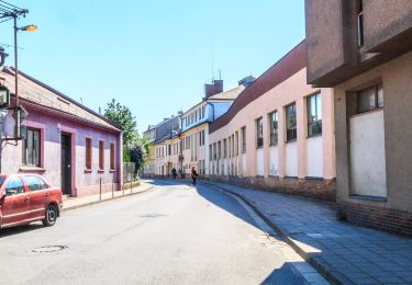
![Tour Zu Fuß Landskron - [Ž] vycházkový okruh Obora - Photo 3](https://media.geolcdn.com/t/2048/auto/c5e3ed07-23cb-49b2-a308-64db9052f937.jpeg&format=jpg&maxdim=0 "Tour Zu Fuß Landskron - [Ž] vycházkový okruh Obora - Photo 3")
![Tour Zu Fuß Landskron - [Ž] vycházkový okruh Obora - Photo 4](https://media.geolcdn.com/t/2048/auto/468677e6-c3b0-4d05-b011-39cbaad63afd.jpeg&format=jpg&maxdim=0 "Tour Zu Fuß Landskron - [Ž] vycházkový okruh Obora - Photo 4")
![Tour Zu Fuß Landskron - [Ž] vycházkový okruh Obora - Photo 5](https://media.geolcdn.com/t/2048/auto/86e9883a-5620-4b3e-9a1f-4143d0ad51e0.jpeg&format=jpg&maxdim=0 "Tour Zu Fuß Landskron - [Ž] vycházkový okruh Obora - Photo 5")
![Tour Zu Fuß Landskron - [Ž] vycházkový okruh Obora - Photo 6](https://media.geolcdn.com/t/2048/auto/39b9f853-a9f0-4c61-b793-ac6c6146333d.jpeg&format=jpg&maxdim=0 "Tour Zu Fuß Landskron - [Ž] vycházkový okruh Obora - Photo 6")
![Tour Zu Fuß Landskron - [Ž] vycházkový okruh Obora - Photo 7](https://media.geolcdn.com/t/2048/auto/3771b3d6-b484-49bb-82fb-262646de3117.jpeg&format=jpg&maxdim=0 "Tour Zu Fuß Landskron - [Ž] vycházkový okruh Obora - Photo 7")
![Tour Zu Fuß Landskron - [Ž] vycházkový okruh Obora - Photo 8](https://media.geolcdn.com/t/2048/auto/fd970ec6-97a4-4bae-894b-aead7cad8b48.jpeg&format=jpg&maxdim=0 "Tour Zu Fuß Landskron - [Ž] vycházkový okruh Obora - Photo 8")
![Tour Zu Fuß Landskron - [Ž] vycházkový okruh Obora - Photo 9](https://media.geolcdn.com/t/2048/auto/989ddfae-5802-46aa-b450-ffa7237bba7b.jpeg&format=jpg&maxdim=0 "Tour Zu Fuß Landskron - [Ž] vycházkový okruh Obora - Photo 9")
![Tour Zu Fuß Landskron - [Ž] vycházkový okruh Obora - Photo 10](https://media.geolcdn.com/t/2048/auto/0ca3be77-e6a8-49ca-819d-6c284a1881e4.jpeg&format=jpg&maxdim=0 "Tour Zu Fuß Landskron - [Ž] vycházkový okruh Obora - Photo 10")
![Tour Zu Fuß Kunzendorf - [Ž] Mladějov - Nad Vískou - Photo](https://media.geolcdn.com/t/375/260/7dbb655f-18d2-4009-8e37-3f4533b92481.jpeg&format=jpg&maxdim=2)
Zu Fuß
![Tour Zu Fuß Altstadt - [Ž] Moravskotřebovský okruh - Photo](https://media.geolcdn.com/t/375/260/a0c081a5-939f-4ea4-9866-a1839ea3719e.jpeg&format=jpg&maxdim=2)
Zu Fuß
Zu Fuß
![Tour Zu Fuß Priwat - [Ž] Zhořský kopec - Pod Lysinou - Photo](https://media.geolcdn.com/t/375/260/1e28bd45-3668-454f-9395-9932e6e89961.jpeg&format=jpg&maxdim=2)
Zu Fuß
Zu Fuß
Zu Fuß
![Tour Zu Fuß Wildenschwert - [M] Česká Třebová-Ústí nad Orlicí - Photo](https://media.geolcdn.com/t/375/260/bcfb6775-14af-4fbf-9860-41cde003e421.jpeg&format=jpg&maxdim=2)
Zu Fuß
![Tour Zu Fuß Ober Böhmisch Rothwasser - [M] Lanškroun - Mariánská hora - Photo](https://media.geolcdn.com/t/375/260/8b0f16b7-adca-43fb-abe5-f09d20153e0a.jpeg&format=jpg&maxdim=2)
Zu Fuß
Zu Fuß