


12,1 km | 13,9 km-effort
![Tour Zu Fuß Nebílovy - [Z] Štěnovice - Nebílovy - Photo](https://media.geolcdn.com/t/1900/400/78153f03-0394-41af-a8cb-63376f17de15.jpeg&format=pjpeg&maxdim=2)

Tous les sentiers balisés d’Europe GUIDE+


Kostenlosegpshiking-Anwendung
 SityTrail
IGN / Geografische Institute
SityTrail World
Die Welt öffnet sich für Sie
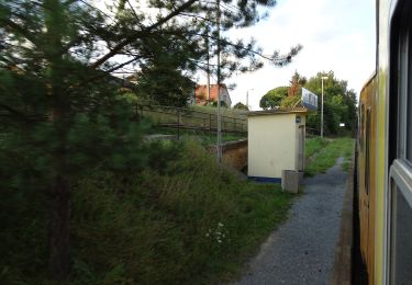
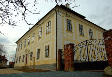
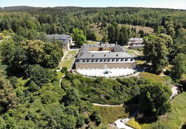
Tour Zu Fuß von 10,3 km verfügbar auf Südwesten, Pilsner Region, Nebílovy. Diese Tour wird von SityTrail - itinéraires balisés pédestres vorgeschlagen.
Tour erstellt von cz:KČT.
![Tour Zu Fuß Nebílovy - [Z] Štěnovice - Nebílovy - Photo 1](https://media.geolcdn.com/t/2048/auto/b2f308c1-eb11-4c48-b999-76bdf38e75b4.jpeg&format=jpg&maxdim=0 "Tour Zu Fuß Nebílovy - [Z] Štěnovice - Nebílovy - Photo 1")
![Tour Zu Fuß Nebílovy - [Z] Štěnovice - Nebílovy - Photo 2](https://media.geolcdn.com/t/2048/auto/5ab9c453-99af-48b6-84c4-85739c48be6b.jpeg&format=jpg&maxdim=0 "Tour Zu Fuß Nebílovy - [Z] Štěnovice - Nebílovy - Photo 2")
![Tour Zu Fuß Nebílovy - [Z] Štěnovice - Nebílovy - Photo 3](https://media.geolcdn.com/t/2048/auto/a4d47dc5-a7ea-435f-8b6b-e39b9cf32996.jpeg&format=jpg&maxdim=0 "Tour Zu Fuß Nebílovy - [Z] Štěnovice - Nebílovy - Photo 3")
![Tour Zu Fuß Nebílovy - [Z] Štěnovice - Nebílovy - Photo 4](https://media.geolcdn.com/t/2048/auto/31dda4c5-e7b3-4fd1-86dd-f18a61df62d3.jpeg&format=jpg&maxdim=0 "Tour Zu Fuß Nebílovy - [Z] Štěnovice - Nebílovy - Photo 4")
![Tour Zu Fuß Nebílovy - [Z] Štěnovice - Nebílovy - Photo 5](https://media.geolcdn.com/t/2048/auto/d32d5a99-b5ed-4d74-93b8-58ae8865356b.jpeg&format=jpg&maxdim=0 "Tour Zu Fuß Nebílovy - [Z] Štěnovice - Nebílovy - Photo 5")
![Tour Zu Fuß Nebílovy - [Z] Štěnovice - Nebílovy - Photo 6](https://media.geolcdn.com/t/2048/auto/ea1494f7-4240-44c2-bc53-7a30cc19923d.jpeg&format=jpg&maxdim=0 "Tour Zu Fuß Nebílovy - [Z] Štěnovice - Nebílovy - Photo 6")
![Tour Zu Fuß Nebílovy - [Z] Štěnovice - Nebílovy - Photo 7](https://media.geolcdn.com/t/2048/auto/7ff01482-ba15-46bc-bec5-cd942ae37c23.jpeg&format=jpg&maxdim=0 "Tour Zu Fuß Nebílovy - [Z] Štěnovice - Nebílovy - Photo 7")
![Tour Zu Fuß Nebílovy - [Z] Štěnovice - Nebílovy - Photo 8](https://media.geolcdn.com/t/2048/auto/da0263b8-fec0-465b-a99b-dab043080744.jpeg&format=jpg&maxdim=0 "Tour Zu Fuß Nebílovy - [Z] Štěnovice - Nebílovy - Photo 8")
![Tour Zu Fuß Nebílovy - [Z] Štěnovice - Nebílovy - Photo 9](https://media.geolcdn.com/t/2048/auto/78153f03-0394-41af-a8cb-63376f17de15.jpeg&format=jpg&maxdim=0 "Tour Zu Fuß Nebílovy - [Z] Štěnovice - Nebílovy - Photo 9")
![Tour Zu Fuß Nebílovy - [Z] Štěnovice - Nebílovy - Photo 10](https://media.geolcdn.com/t/2048/auto/de4d1170-bb56-4617-919c-da8e2b015a4c.jpeg&format=jpg&maxdim=0 "Tour Zu Fuß Nebílovy - [Z] Štěnovice - Nebílovy - Photo 10")
![Tour Zu Fuß Líně - [Č] Líňská okružní trasa - Photo](https://media.geolcdn.com/t/375/260/cbeb49cd-7fbd-4b7b-bd64-d76bac41e164.jpeg&format=jpg&maxdim=2)
Zu Fuß
Zu Fuß
Zu Fuß
Zu Fuß
Zu Fuß
![Tour Zu Fuß Staab - [Ž] Stod - Vytůň - Photo](https://media.geolcdn.com/t/375/260/5f465939-ef20-4d07-aeae-d7b7b507e19b.jpeg&format=jpg&maxdim=2)
Zu Fuß
![Tour Zu Fuß Pschestitz - [Ž] Přeštice - Lužany - Photo](https://media.geolcdn.com/t/375/260/919f7a9d-8b8b-43c7-bd6f-9961dd11f649.jpeg&format=jpg&maxdim=2)
Zu Fuß
![Tour Zu Fuß Dobřív - [Ž] Svojkovice - Dobřív - Photo](https://media.geolcdn.com/t/375/260/4c146c66-27ab-4e71-afca-4f50543742a3.jpeg&format=jpg&maxdim=2)
Zu Fuß
![Tour Zu Fuß Chotieschau - [Z] Chotěšov - Chudenice - Photo](https://media.geolcdn.com/t/375/260/db6e0667-71ef-4d53-8b64-8b347f6d468d.jpeg&format=jpg&maxdim=2)
Zu Fuß