![](/images/other/stat-length.png)
![Tour Zu Fuß Gurschdorf - [Ž] Lázně Jeseník - Špičák - Photo](https://media.geolcdn.com/t/1900/400/1cce9d3b-ebfd-4239-9158-7e92f3a7cb87.jpeg&format=pjpeg&maxdim=2)
[Ž] Lázně Jeseník - Špičák
SityTrail - itinéraires balisés pédestres
Tous les sentiers balisés d’Europe GUIDE+
![Länge](/images/other/stat-length.png)
Länge
25 km
![Maximale Höhe](https://static1.geolcdn.com/siteimages/upload/files/1508320355ic_sort_altitude_max_24dp.png)
Maximale Höhe
1113 m
![Positive Höhendifferenz](https://static1.geolcdn.com/siteimages/upload/files/1508320355ic_sort_den_pos_24dp.png)
Positive Höhendifferenz
719 m
![Km-Effort](/images/other/stat-length.png)
Km-Effort
35 km
![Min. Höhe](https://static1.geolcdn.com/siteimages/upload/files/1508320355ic_sort_altitude_min_24dp.png)
Min. Höhe
576 m
![Negative Höhendifferenz](https://static1.geolcdn.com/siteimages/upload/files/1508320355ic_sort_den_neg_24dp.png)
Negative Höhendifferenz
1059 m
![Boucle](https://static1.geolcdn.com/siteimages/upload/files/16400158638029165_repeat_loop_refresh_sync_direction_icon.png)
Boucle
Nein
Kennzeichnung
Erstellungsdatum :
2025-02-06 21:59:01.673
Letzte Änderung :
2025-02-06 21:59:01.673
![Zu Fuß](https://static1.geolcdn.com/sitytour/trail-icons/100.png)
8h01
Schwierigkeit : Schwierig
![Scannen Sie diesen QR-Code, um die Tour in der SityTrail-Anwendung zu öffnen](https://capi.geolives.com/qq0zvz2zws4bq2lad0pu/sitytour/trails/4344154/qr.png?size=200)
Kostenlosegpshiking-Anwendung
Über SityTrail
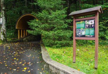
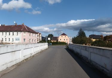
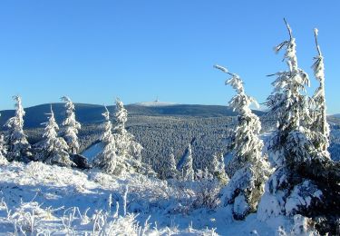
Tour Zu Fuß von 25 km verfügbar auf Mittelmähren, Olmützer Region, Gurschdorf. Diese Tour wird von SityTrail - itinéraires balisés pédestres vorgeschlagen.
Beschreibung
Tour erstellt von cz:KČT.
Ort
Land:
Czech Republic
Region :
Mittelmähren
Abteilung/Provinz :
Olmützer Region
Kommune :
Gurschdorf
Standort:
Unknown
Gehen Sie:(Dec)
Gehen Sie:(UTM)
643287 ; 5573673 (33U) N.
Kommentare
Touren in der Umgebung
![Tour Zu Fuß Jungferndorf - Naučná stezka nejen pro handicapované - Photo](https://media.geolcdn.com/t/375/260/ea13d288-17df-44b7-8a9e-0788db92a1de.jpeg&format=jpg&maxdim=2)
![Zu Fuß Zu Fuß](https://static1.geolcdn.com/sitytour/trail-icons/100.png)
Naučná stezka nejen pro handicapované
Zu Fuß
Einfach
Jungferndorf,
Mittelmähren,
Olmützer Region,
Czech Republic
![](/images/other/stat-length.png)
3,8 km | 4,4 km-effort
1h 0min
![](https://static1.geolcdn.com/siteimages/upload/files/16400158638029165_repeat_loop_refresh_sync_direction_icon.png)
Ja
![Tour Zu Fuß Gross Morau - NS Králický Sněžník - Photo](https://media.geolcdn.com/t/375/260/448cd04e-44c3-43ba-a6bf-9fbf78816dd1.jpeg&format=jpg&maxdim=2)
![Zu Fuß Zu Fuß](https://static1.geolcdn.com/sitytour/trail-icons/100.png)
NS Králický Sněžník
Zu Fuß
Einfach
Gross Morau,
Nordosten,
Pardubitzer Region,
Czech Republic
![](/images/other/stat-length.png)
4,1 km | 5,5 km-effort
1h 14min
![](https://static1.geolcdn.com/siteimages/upload/files/16400158638029165_repeat_loop_refresh_sync_direction_icon.png)
Nein
![Tour Zu Fuß Setzdorf - Latzelova stezka - Photo](https://media.geolcdn.com/t/375/260/eb9b14b8-aff6-4c45-9daa-f6f941bf764d.jpeg&format=jpg&maxdim=2)
![Zu Fuß Zu Fuß](https://static1.geolcdn.com/sitytour/trail-icons/100.png)
Latzelova stezka
Zu Fuß
Einfach
Setzdorf,
Mittelmähren,
Olmützer Region,
Czech Republic
![](/images/other/stat-length.png)
4,4 km | 6,3 km-effort
1h 26min
![](https://static1.geolcdn.com/siteimages/upload/files/16400158638029165_repeat_loop_refresh_sync_direction_icon.png)
Nein
![Tour Zu Fuß Nieder Lindewiese - NS Schroth Priessnitz - Photo](https://media.geolcdn.com/t/375/260/5a5c4a4c-ba31-42b5-84dd-beb4dced3873.jpeg&format=jpg&maxdim=2)
![Zu Fuß Zu Fuß](https://static1.geolcdn.com/sitytour/trail-icons/100.png)
NS Schroth Priessnitz
Zu Fuß
Einfach
Nieder Lindewiese,
Mittelmähren,
Olmützer Region,
Czech Republic
![](/images/other/stat-length.png)
3,9 km | 4,9 km-effort
1h 7min
![](https://static1.geolcdn.com/siteimages/upload/files/16400158638029165_repeat_loop_refresh_sync_direction_icon.png)
Nein
![Tour Zu Fuß Böhmischdorf - NS Živé vody - Photo](https://media.geolcdn.com/t/375/260/74dc6ea9-eb73-42b9-94d6-3feb5c5ace3a.jpeg&format=jpg&maxdim=2)
![Zu Fuß Zu Fuß](https://static1.geolcdn.com/sitytour/trail-icons/100.png)
NS Živé vody
Zu Fuß
Einfach
Böhmischdorf,
Mittelmähren,
Olmützer Region,
Czech Republic
![](/images/other/stat-length.png)
6,2 km | 8,6 km-effort
1h 57min
![](https://static1.geolcdn.com/siteimages/upload/files/16400158638029165_repeat_loop_refresh_sync_direction_icon.png)
Ja
![Tour Zu Fuß Böhmischdorf - Naučná stezka Česká Ves - Photo](https://media.geolcdn.com/t/375/260/617f2f43-4719-4605-8f6d-6a6096e9f43d.jpeg&format=jpg&maxdim=2)
![Zu Fuß Zu Fuß](https://static1.geolcdn.com/sitytour/trail-icons/100.png)
Naučná stezka Česká Ves
Zu Fuß
Einfach
Böhmischdorf,
Mittelmähren,
Olmützer Region,
Czech Republic
![](/images/other/stat-length.png)
3,4 km | 6 km-effort
1h 21min
![](https://static1.geolcdn.com/siteimages/upload/files/16400158638029165_repeat_loop_refresh_sync_direction_icon.png)
Nein
![Tour Zu Fuß Wiesenberg - NS S Koprníčkem na výlet Keprnickými horami - Photo](https://media.geolcdn.com/t/375/260/35abbe2b-020c-4ec1-afd2-2da4b71f8098.jpeg&format=jpg&maxdim=2)
![Zu Fuß Zu Fuß](https://static1.geolcdn.com/sitytour/trail-icons/100.png)
NS S Koprníčkem na výlet Keprnickými horami
Zu Fuß
Einfach
Wiesenberg,
Mittelmähren,
Olmützer Region,
Czech Republic
![](/images/other/stat-length.png)
12 km | 18,2 km-effort
4h 7min
![](https://static1.geolcdn.com/siteimages/upload/files/16400158638029165_repeat_loop_refresh_sync_direction_icon.png)
Nein
![Tour Zu Fuß Gross Morau - [Č] Žibřidovice - Sušina - Photo](https://media.geolcdn.com/t/375/260/3ab21def-abb9-4035-a5e9-3dd24c499c62.jpeg&format=jpg&maxdim=2)
![Zu Fuß Zu Fuß](https://static1.geolcdn.com/sitytour/trail-icons/100.png)
[Č] Žibřidovice - Sušina
Zu Fuß
Einfach
Gross Morau,
Nordosten,
Pardubitzer Region,
Czech Republic
![](/images/other/stat-length.png)
10,6 km | 13,8 km-effort
3h 7min
![](https://static1.geolcdn.com/siteimages/upload/files/16400158638029165_repeat_loop_refresh_sync_direction_icon.png)
Nein
![Tour Zu Fuß Mährisch Altstadt - [Ž] Staré Město -Kunčická hora - Photo](https://media.geolcdn.com/t/375/260/6349ef96-6910-4c2f-86ef-001248ed62c5.jpeg&format=jpg&maxdim=2)
![Zu Fuß Zu Fuß](https://static1.geolcdn.com/sitytour/trail-icons/100.png)
[Ž] Staré Město -Kunčická hora
Zu Fuß
Einfach
Mährisch Altstadt,
Mittelmähren,
Olmützer Region,
Czech Republic
![](/images/other/stat-length.png)
6,1 km | 10,2 km-effort
2h 19min
![](https://static1.geolcdn.com/siteimages/upload/files/16400158638029165_repeat_loop_refresh_sync_direction_icon.png)
Nein