


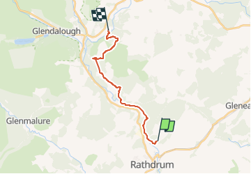

9,2 km | 14,6 km-effort

Tous les sentiers balisés d’Europe GUIDE+


Kostenlosegpshiking-Anwendung
 SityTrail
IGN / Geografische Institute
SityTrail World
Die Welt öffnet sich für Sie
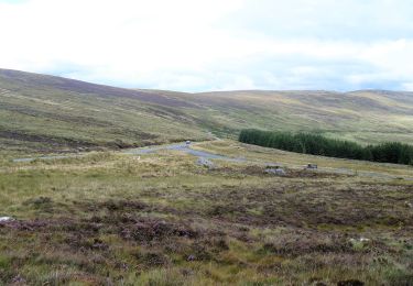
Tour Zu Fuß von 12,9 km verfügbar auf Unbekannt, County Wicklow, The Municipal District of Arklow. Diese Tour wird von SityTrail - itinéraires balisés pédestres vorgeschlagen.
Tour erstellt von Wicklow Uplands Council.
Symbol: yellow hiker on black
Website: http://www.irishtrails.ie/Trail/Avonmore-Way/905/


Zu Fuß
Zu Fuß
Zu Fuß
Zu Fuß
Wandern

Wandern

Andere Aktivitäten
Wandern
Wandern