![](/images/other/stat-length.png)
![Tour Zu Fuß Unknown - Out-and-back walk to Harris from Kinloch - Photo](https://media.geolcdn.com/t/1900/400/99c331cb-7ed5-4e99-8161-e3a673d5f1a7.jpeg&format=pjpeg&maxdim=2)
Out-and-back walk to Harris from Kinloch
SityTrail - itinéraires balisés pédestres
Tous les sentiers balisés d’Europe GUIDE+
![Länge](/images/other/stat-length.png)
![Maximale Höhe](https://static1.geolcdn.com/siteimages/upload/files/1508320355ic_sort_altitude_max_24dp.png)
![Positive Höhendifferenz](https://static1.geolcdn.com/siteimages/upload/files/1508320355ic_sort_den_pos_24dp.png)
![Km-Effort](/images/other/stat-length.png)
![Min. Höhe](https://static1.geolcdn.com/siteimages/upload/files/1508320355ic_sort_altitude_min_24dp.png)
![Negative Höhendifferenz](https://static1.geolcdn.com/siteimages/upload/files/1508320355ic_sort_den_neg_24dp.png)
![Boucle](https://static1.geolcdn.com/siteimages/upload/files/16400158638029165_repeat_loop_refresh_sync_direction_icon.png)
![Zu Fuß](https://static1.geolcdn.com/sitytour/trail-icons/100.png)
3h34
Schwierigkeit : Einfach
![Scannen Sie diesen QR-Code, um die Tour in der SityTrail-Anwendung zu öffnen](https://capi.geolives.com/qq0zvz2zws4bq2lad0pu/sitytour/trails/4341811/qr.png?size=200)
Kostenlosegpshiking-Anwendung
Über SityTrail
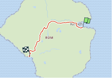
Tour Zu Fuß von 12,2 km verfügbar auf Schottland, Highland. Diese Tour wird von SityTrail - itinéraires balisés pédestres vorgeschlagen.
Beschreibung
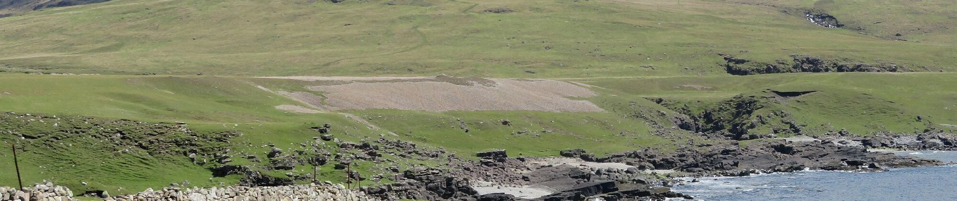
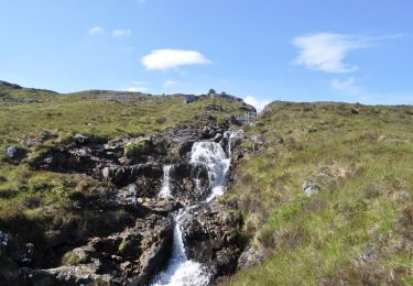
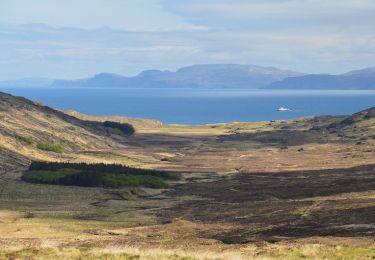
This long walk follows an excellent track right through the wild and bleak heart of Rum to reach beautiful Harris and its mausoleum on the west coast. There are excellent views of the Cuillin along the way, but the long distance means this walk would perhaps be better enjoyed on a mountain bike.
Website: https://www.walkhighlands.co.uk/islands/harris-rum.shtml
Ort
Kommentare
Touren in der Umgebung
![Tour Zu Fuß - Rum Cuillin traverse - Photo](https://media.geolcdn.com/t/375/260/c468dca8-43f0-4964-9d3b-4bf912547b78.jpeg&format=jpg&maxdim=2)
![Zu Fuß Zu Fuß](https://static1.geolcdn.com/sitytour/trail-icons/100.png)
Zu Fuß
![](/images/other/stat-length.png)
![](https://static1.geolcdn.com/siteimages/upload/files/16400158638029165_repeat_loop_refresh_sync_direction_icon.png)
![Tour Zu Fuß - Orval, return via Harris - Photo](https://media.geolcdn.com/t/375/260/c468dca8-43f0-4964-9d3b-4bf912547b78.jpeg&format=jpg&maxdim=2)
![Zu Fuß Zu Fuß](https://static1.geolcdn.com/sitytour/trail-icons/100.png)
Zu Fuß
![](/images/other/stat-length.png)
![](https://static1.geolcdn.com/siteimages/upload/files/16400158638029165_repeat_loop_refresh_sync_direction_icon.png)
![Tour Zu Fuß - Hallival and Barkeval - Photo](https://media.geolcdn.com/t/375/260/8c8ca3df-2bdc-4b5d-87c8-2537fa733032.jpeg&format=jpg&maxdim=2)
![Zu Fuß Zu Fuß](https://static1.geolcdn.com/sitytour/trail-icons/100.png)
Zu Fuß
![](/images/other/stat-length.png)
![](https://static1.geolcdn.com/siteimages/upload/files/16400158638029165_repeat_loop_refresh_sync_direction_icon.png)
![Tour Zu Fuß - Kilmory Bay - Photo](https://media.geolcdn.com/t/375/260/281f2b0a-5c72-4e96-a97c-66de1616b5d2.jpeg&format=jpg&maxdim=2)
![Zu Fuß Zu Fuß](https://static1.geolcdn.com/sitytour/trail-icons/100.png)
Zu Fuß
![](/images/other/stat-length.png)
![](https://static1.geolcdn.com/siteimages/upload/files/16400158638029165_repeat_loop_refresh_sync_direction_icon.png)