![](/images/other/stat-length.png)
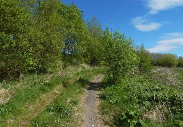
![Tour Zu Fuß Unknown - Laird's Trail - Photo](https://media.geolcdn.com/t/1900/400/2bd84e92-7ee4-4747-afd3-fb384710ee82.jpeg&format=pjpeg&maxdim=2)
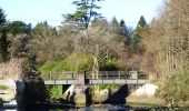
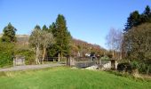
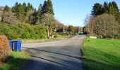
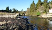
Laird's Trail
SityTrail - itinéraires balisés pédestres
Tous les sentiers balisés d’Europe GUIDE+
![Länge](/images/other/stat-length.png)
Länge
3 km
![Maximale Höhe](https://static1.geolcdn.com/siteimages/upload/files/1508320355ic_sort_altitude_max_24dp.png)
Maximale Höhe
66 m
![Positive Höhendifferenz](https://static1.geolcdn.com/siteimages/upload/files/1508320355ic_sort_den_pos_24dp.png)
Positive Höhendifferenz
64 m
![Km-Effort](/images/other/stat-length.png)
Km-Effort
3,9 km
![Min. Höhe](https://static1.geolcdn.com/siteimages/upload/files/1508320355ic_sort_altitude_min_24dp.png)
Min. Höhe
2 m
![Negative Höhendifferenz](https://static1.geolcdn.com/siteimages/upload/files/1508320355ic_sort_den_neg_24dp.png)
Negative Höhendifferenz
64 m
![Boucle](https://static1.geolcdn.com/siteimages/upload/files/16400158638029165_repeat_loop_refresh_sync_direction_icon.png)
Boucle
Nein
Kennzeichnung
Erstellungsdatum :
2025-02-05 13:46:30.833
Letzte Änderung :
2025-02-05 13:46:30.833
![Zu Fuß](https://static1.geolcdn.com/sitytour/trail-icons/100.png)
52m
Schwierigkeit : Einfach
![Scannen Sie diesen QR-Code, um die Tour in der SityTrail-Anwendung zu öffnen](https://capi.geolives.com/qq0zvz2zws4bq2lad0pu/sitytour/trails/4341631/qr.png?size=200)
Kostenlosegpshiking-Anwendung
Über SityTrail
Tour Zu Fuß von 3 km verfügbar auf Schottland, Argyll and Bute. Diese Tour wird von SityTrail - itinéraires balisés pédestres vorgeschlagen.
Beschreibung
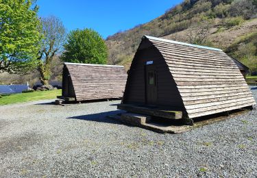
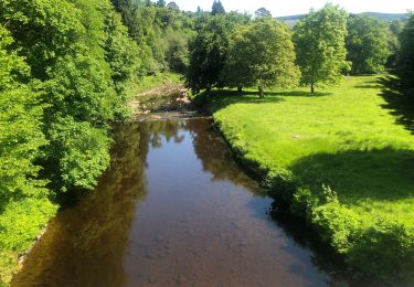
Tour erstellt von Argyll Forest Park.
Ort
Land:
United Kingdom
Region :
Schottland
Abteilung/Provinz :
Argyll and Bute
Kommune :
Unknown
Standort:
Unknown
Gehen Sie:(Dec)
Gehen Sie:(UTM)
380931 ; 6213748 (30V) N.
Kommentare
Touren in der Umgebung
![Tour Zu Fuß - The Shore Circular Path - Photo](https://media.geolcdn.com/t/375/260/cd299b72-5d26-4fb2-ac57-8169e867483c.jpeg&format=jpg&maxdim=2)
![Zu Fuß Zu Fuß](https://static1.geolcdn.com/sitytour/trail-icons/100.png)
The Shore Circular Path
Zu Fuß
Einfach
,
Schottland,
West Dunbartonshire,
United Kingdom
![](/images/other/stat-length.png)
7,5 km | 8,4 km-effort
1h 54min
![](https://static1.geolcdn.com/siteimages/upload/files/16400158638029165_repeat_loop_refresh_sync_direction_icon.png)
Ja
![Tour Zu Fuß - West Highland Way - alternate - Photo](https://media.geolcdn.com/t/375/260/21eec664-33f1-4220-8e04-5c0290c5d497.jpeg&format=jpg&maxdim=2)
![Zu Fuß Zu Fuß](https://static1.geolcdn.com/sitytour/trail-icons/100.png)
West Highland Way - alternate
Zu Fuß
Einfach
,
Schottland,
Stirling,
United Kingdom
![](/images/other/stat-length.png)
4,7 km | 5,7 km-effort
1h 18min
![](https://static1.geolcdn.com/siteimages/upload/files/16400158638029165_repeat_loop_refresh_sync_direction_icon.png)
Nein
![Tour Zu Fuß - The Greenock Cut - Photo](https://media.geolcdn.com/t/375/260/46e4cef5-c567-4eeb-97a1-7ebba52d0789.jpeg&format=jpg&maxdim=2)
![Zu Fuß Zu Fuß](https://static1.geolcdn.com/sitytour/trail-icons/100.png)
The Greenock Cut
Zu Fuß
Einfach
,
Schottland,
Inverclyde,
United Kingdom
![](/images/other/stat-length.png)
7,9 km | 8,8 km-effort
1h 59min
![](https://static1.geolcdn.com/siteimages/upload/files/16400158638029165_repeat_loop_refresh_sync_direction_icon.png)
Nein
![Tour Zu Fuß - The Kelly Cut - Photo](https://media.geolcdn.com/t/375/260/08751e91-e7d9-46b4-8555-a0c5cf95be1e.jpeg&format=jpg&maxdim=2)
![Zu Fuß Zu Fuß](https://static1.geolcdn.com/sitytour/trail-icons/100.png)
The Kelly Cut
Zu Fuß
Einfach
,
Schottland,
Inverclyde,
United Kingdom
![](/images/other/stat-length.png)
5,6 km | 6 km-effort
1h 21min
![](https://static1.geolcdn.com/siteimages/upload/files/16400158638029165_repeat_loop_refresh_sync_direction_icon.png)
Nein
![Tour Zu Fuß - The Waterman's Road - Photo](https://media.geolcdn.com/t/375/260/95829a7b-f693-4e21-b702-b131ec9f891a.jpeg&format=jpg&maxdim=2)
![Zu Fuß Zu Fuß](https://static1.geolcdn.com/sitytour/trail-icons/100.png)
The Waterman's Road
Zu Fuß
Einfach
,
Schottland,
Inverclyde,
United Kingdom
![](/images/other/stat-length.png)
3,5 km | 4,5 km-effort
1h 1min
![](https://static1.geolcdn.com/siteimages/upload/files/16400158638029165_repeat_loop_refresh_sync_direction_icon.png)
Nein
![Tour Pfad - rowardennan - Beinglas farm - Photo](https://media.geolcdn.com/t/375/260/5142ac2c-7e6c-4318-9ef3-cad5fa817a30.jpg&format=jpg&maxdim=2)
![Pfad Pfad](https://static1.geolcdn.com/sitytour/trail-icons/104.png)
rowardennan - Beinglas farm
Pfad
Sehr leicht
,
Schottland,
Stirling,
United Kingdom
![](/images/other/stat-length.png)
23 km | 30 km-effort
3h 6min
![](https://static1.geolcdn.com/siteimages/upload/files/16400158638029165_repeat_loop_refresh_sync_direction_icon.png)
Nein
![Tour Wandern - Ecosse Inveraray - Photo](https://media.geolcdn.com/t/375/260/f05cdd17-e130-430a-8a3d-6dfda0ddcb56.jpg&format=jpg&maxdim=2)
![Wandern Wandern](https://static1.geolcdn.com/sitytour/trail-icons/101.png)
Ecosse Inveraray
Wandern
Einfach
,
Schottland,
Argyll and Bute,
United Kingdom
![](/images/other/stat-length.png)
5 km | 5,5 km-effort
1h 40min
![](https://static1.geolcdn.com/siteimages/upload/files/16400158638029165_repeat_loop_refresh_sync_direction_icon.png)
Nein
![Tour Wandern - Ben Lomond Scotland En boucle - Photo](https://media.geolcdn.com/t/375/260/ext.jpg?maxdim=2&url=https%3A%2F%2Fstatic1.geolcdn.com%2Fsiteimages%2Fupload%2Ffiles%2F1553511878bg_sport_marche.png)
![Wandern Wandern](https://static1.geolcdn.com/sitytour/trail-icons/101.png)
Ben Lomond Scotland En boucle
Wandern
Medium
,
Schottland,
Stirling,
United Kingdom
![](/images/other/stat-length.png)
12,4 km | 25 km-effort
6h 11min
![](https://static1.geolcdn.com/siteimages/upload/files/16400158638029165_repeat_loop_refresh_sync_direction_icon.png)
Ja
![Tour Wandern - Ben lomond scotland - Photo](https://media.geolcdn.com/t/375/260/ext.jpg?maxdim=2&url=https%3A%2F%2Fstatic1.geolcdn.com%2Fsiteimages%2Fupload%2Ffiles%2F1553511878bg_sport_marche.png)
![Wandern Wandern](https://static1.geolcdn.com/sitytour/trail-icons/101.png)
Ben lomond scotland
Wandern
Schwierig
,
Schottland,
Stirling,
United Kingdom
![](/images/other/stat-length.png)
12,5 km | 25 km-effort
4h 49min
![](https://static1.geolcdn.com/siteimages/upload/files/16400158638029165_repeat_loop_refresh_sync_direction_icon.png)
Ja