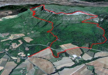
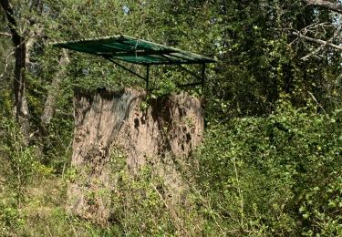
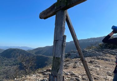
Tour Nordic Walking Ollières - challenge grand parcours essai 1 2025 - Photo

challenge grand parcours essai 1 2025

 gonzi83
gonzi83

Benutzer

© OpenStreetMap contributors
Länge
Länge
15 km
Maximale Höhe
Maximale Höhe
588 m
Positive Höhendifferenz
296 m
Km-Effort
Km-Effort  
18,9 km
Min. Höhe
Min. Höhe
379 m
Negative Höhendifferenz
297 m
Boucle
Boucle
Ja
Erstellungsdatum :
2025-01-15 07:38:19.329
Letzte Änderung :
2025-01-15 07:44:51.725

(0 Nachricht)

Nordic Walking
Nordic Walking
3h00
Schwierigkeit : Sehr leicht

Scannen Sie diesen QR-Code, um die Tour in der SityTrail-Anwendung zu öffnen

Kostenlosegpshiking-Anwendung

Logo SityTrail SityTrail

IGN / Geografische Institute

SityTrail aus dem App Store herunterladen SityTrail von Google Play herunterladen

Logo SityTrail SityTrail World

Die Welt öffnet sich für Sie

SityTrail aus dem App Store herunterladen SityTrail von Google Play herunterladen SityTrail auf Huawei AppGallery herunterladen

Über SityTrail

Tour Nordic Walking von 15 km verfügbar auf Provence-Alpes-Côte d'Azur, Var, Ollières. Diese Tour wird von gonzi83 vorgeschlagen.

Höhenprofil

Ort

Land:
France
Region :
Provence-Alpes-Côte d'Azur
Abteilung/Provinz :
Var
Kommune :
Ollières
Standort:
Unknown
Gehen Sie:(UTM)
726915 ; 4819212 (31T) N.

Touren in der Umgebung

Tour Wandern Pourrières - JPS Monts  Aurélien-17655561 - Photo
Wandern
GUIDE
affinetataille

Wandern

Medium
(1)
Pourrières, Provence-Alpes-Côte d'Azur, Var, France
17,3 km | 27 km-effort
7h 0min
Ja
Tour Wandern Pourcieux - 2022-11-11_17h53m46_pourcieux - Photo
Wandern
Levant

Wandern

Sehr schwierig
(1)
Pourcieux, Provence-Alpes-Côte d'Azur, Var, France
18,2 km | 28 km-effort
6h 21min
Ja
Tour Wandern Pourcieux - pas des iifs - Photo
Wandern
coureurdegarrigue

Wandern

Einfach
(1)
Pourcieux, Provence-Alpes-Côte d'Azur, Var, France
15,8 km | 24 km-effort
5h 55min
Ja
Tour Wandern Pourrières - Mt Olympe et le pas du Titet - Photo
Wandern
ETMU5496

Wandern

Schwierig
Pourrières, Provence-Alpes-Côte d'Azur, Var, France
19,9 km | 32 km-effort
7h 15min
Ja
Tour Wandern Pourcieux - 2024-03-02_17h01m33_La chouette d'Or Pourcieux - Photo
Wandern

Wandern

Medium
(1)
Pourcieux, Provence-Alpes-Côte d'Azur, Var, France
7,2 km | 11,9 km-effort
2h 41min
Ja
Tour Wandern Pourrières - Pourcieux :Mont Olympe et Pas du Titet - Photo
Wandern
ETMU5496

Wandern

Sehr schwierig
(1)
Pourrières, Provence-Alpes-Côte d'Azur, Var, France
20 km | 32 km-effort
7h 22min
Nein
Tour Wandern Pourcieux - Pourcieux - ¨Pas des Ifs, de la Croix et de Titet - Olympe - Rocher de Onze Heures - Croix de Pourcieux - Photo
Wandern
LtZIP

Wandern

Schwierig
Pourcieux, Provence-Alpes-Côte d'Azur, Var, France
19,2 km | 30 km-effort
4h 49min
Ja
Tour Wandern Pourcieux - Croix de pourcieux - Photo
Wandern
gaggiroland

Wandern

Schwierig
Pourcieux, Provence-Alpes-Côte d'Azur, Var, France
9,9 km | 15 km-effort
3h 31min
Ja
Tour Wandern Pourcieux - Crêtes du Mont Aurélien - Photo
Wandern
ETMU5496

Wandern

Schwierig
Pourcieux, Provence-Alpes-Côte d'Azur, Var, France
19,4 km | 30 km-effort
4h 37min
Ja


Schließen
Meine Abonnements