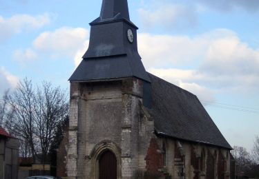
22 km | 25 km-effort
Présumé aux
dedehenry
Benutzer
Länge
11,4 km
Maximale Höhe
138 m
Positive Höhendifferenz
105 m
Km-Effort
12,8 km
Min. Höhe
82 m
Negative Höhendifferenz
106 m
Boucle
Ja
Erstellungsdatum :
2025-01-14 08:00:09.0
Letzte Änderung :
2025-01-14 10:38:43.298
Kostenlosegpshiking-Anwendung
Über SityTrail
Tour von 11,4 km verfügbar auf Nordfrankreich, Somme, Oresmaux. Diese Tour wird von dedehenry vorgeschlagen.
Ort
Land:
France
Region :
Nordfrankreich
Abteilung/Provinz :
Somme
Kommune :
Oresmaux
Standort:
Unknown
Gehen Sie:(Dec)
Gehen Sie:(UTM)
447438 ; 5513208 (31U) N.
Kommentare
Touren in der Umgebung
Grattepanche-Absous-Larris
Wandern
Schwierig
(1)
Grattepanche,
Nordfrankreich,
Somme,
France
11 km | 13 km-effort
2h 51min
Ja
La Montagne des Grès
Zu Fuß
Einfach
Grattepanche,
Nordfrankreich,
Somme,
France
3,9 km | 4,8 km-effort
1h 5min
Nein
Grattepanche fantaisie
Wandern
Grattepanche,
Nordfrankreich,
Somme,
France
10,7 km | 13 km-effort
2h 48min
Ja
cedric 55km
Mountainbike
Medium
Grattepanche,
Nordfrankreich,
Somme,
France
55 km | 64 km-effort
3h 41min
Ja
La Sessolienne 60 km
Mountainbike
Medium
Saint-Sauflieu,
Nordfrankreich,
Somme,
France
56 km | 68 km-effort
4h 23min
Ja
La Racineuse raccourci
Wandern
Einfach
Sains-en-Amiénois,
Nordfrankreich,
Somme,
France
6 km | 7,5 km-effort
1h 33min
Ja
La Racineuse
Wandern
Medium
Sains-en-Amiénois,
Nordfrankreich,
Somme,
France
6,5 km | 8,2 km-effort
1h 45min
Ja
La montagne des Grés
Wandern
Medium
Grattepanche,
Nordfrankreich,
Somme,
France
4,4 km | 5,4 km-effort
1h 19min
Ja