![](/images/other/stat-length.png)
![Tour Wandern Cuers - Pilon Saint Clément - Photo](https://media.geolcdn.com/t/1900/400/127c8d12-3441-42a6-b036-f1c61808aeac.jpg&format=pjpeg&maxdim=2)
Pilon Saint Clément
FSantoni
Benutzer
![Länge](/images/other/stat-length.png)
Länge
9,4 km
![Maximale Höhe](https://static1.geolcdn.com/siteimages/upload/files/1508320355ic_sort_altitude_max_24dp.png)
Maximale Höhe
698 m
![Positive Höhendifferenz](https://static1.geolcdn.com/siteimages/upload/files/1508320355ic_sort_den_pos_24dp.png)
Positive Höhendifferenz
438 m
![Km-Effort](/images/other/stat-length.png)
Km-Effort
15,2 km
![Min. Höhe](https://static1.geolcdn.com/siteimages/upload/files/1508320355ic_sort_altitude_min_24dp.png)
Min. Höhe
318 m
![Negative Höhendifferenz](https://static1.geolcdn.com/siteimages/upload/files/1508320355ic_sort_den_neg_24dp.png)
Negative Höhendifferenz
439 m
![Boucle](https://static1.geolcdn.com/siteimages/upload/files/16400158638029165_repeat_loop_refresh_sync_direction_icon.png)
Boucle
Ja
Erstellungsdatum :
2025-01-12 07:50:19.556
Letzte Änderung :
2025-01-12 16:04:05.66
![Wandern](https://static1.geolcdn.com/sitytour/trail-icons/101.png)
4h55
Schwierigkeit : Schwierig
![Scannen Sie diesen QR-Code, um die Tour in der SityTrail-Anwendung zu öffnen](https://capi.geolives.com/qq0zvz2zws4bq2lad0pu/sitytour/trails/4316811/qr.png?size=200)
Kostenlosegpshiking-Anwendung
Über SityTrail
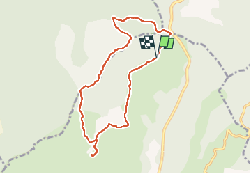
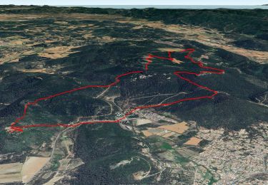
Tour Wandern von 9,4 km verfügbar auf Provence-Alpes-Côte d'Azur, Var, Cuers. Diese Tour wird von FSantoni vorgeschlagen.
Beschreibung
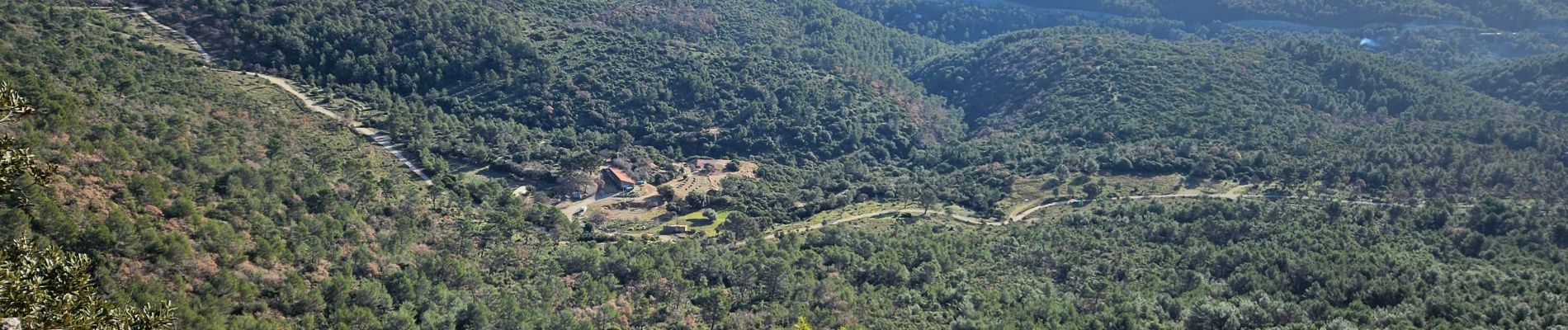
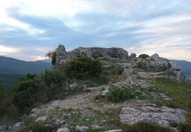
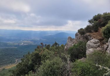
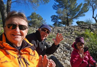
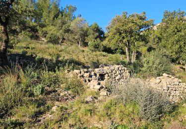
En partant du col de la Bigue, montée vers le pilon saint Clément, puis cheminement le long de la barre de Cuers, puis descente par le pas de Cuers, pique-nique et retour.
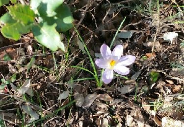
Plutôt court, mais avec une belle première montée et surtout des paysages merveilleux !
Ort
Land:
France
Region :
Provence-Alpes-Côte d'Azur
Abteilung/Provinz :
Var
Kommune :
Cuers
Standort:
Unknown
Gehen Sie:(Dec)
Gehen Sie:(UTM)
261935 ; 4796342 (32T) N.
Kommentare
Touren in der Umgebung
![Tour Wandern Rocbaron - SityTrail - rocbaron victor - Photo](https://media.geolcdn.com/t/375/260/65b9c34e-6588-477e-8f02-e7295c203708.jpg&format=jpg&maxdim=2)
![Wandern Wandern](https://static1.geolcdn.com/sitytour/trail-icons/101.png)
SityTrail - rocbaron victor
Wandern
Medium
(1)
Rocbaron,
Provence-Alpes-Côte d'Azur,
Var,
France
![](/images/other/stat-length.png)
14,2 km | 21 km-effort
6h 0min
![](https://static1.geolcdn.com/siteimages/upload/files/16400158638029165_repeat_loop_refresh_sync_direction_icon.png)
Ja
![Tour Mountainbike Rocbaron - La Chapelle Sainte-Philomène - Rocbaron - Photo](https://media.geolcdn.com/t/375/260/ext.jpg?maxdim=2&url=https%3A%2F%2Fservices.sitytrail.com%2FGeolivesWS%2FDownloadMedia.ashx%3FTrailID%3D173149%26Media%3D14715_4.jpg)
![Mountainbike Mountainbike](https://static1.geolcdn.com/sitytour/trail-icons/202.png)
La Chapelle Sainte-Philomène - Rocbaron
Mountainbike
Schwierig
(1)
Rocbaron,
Provence-Alpes-Côte d'Azur,
Var,
France
![](/images/other/stat-length.png)
25 km | 34 km-effort
4h 0min
![](https://static1.geolcdn.com/siteimages/upload/files/16400158638029165_repeat_loop_refresh_sync_direction_icon.png)
Ja
![Tour Wandern Néoules - Neoules crête 19,5 km - Photo](https://media.geolcdn.com/t/375/260/80c386c8-cc89-4ce0-b16a-56ff29c0cd34.jpg&format=jpg&maxdim=2)
![Wandern Wandern](https://static1.geolcdn.com/sitytour/trail-icons/101.png)
Neoules crête 19,5 km
Wandern
Medium
Néoules,
Provence-Alpes-Côte d'Azur,
Var,
France
![](/images/other/stat-length.png)
19,5 km | 27 km-effort
7h 34min
![](https://static1.geolcdn.com/siteimages/upload/files/16400158638029165_repeat_loop_refresh_sync_direction_icon.png)
Ja
![Tour Wandern Rocbaron - le pilon Saint Clément et les barres de Cuers - Photo](https://media.geolcdn.com/t/375/260/3bb3c32a-33e5-4027-b08e-a3329095baff.jpg&format=jpg&maxdim=2)
![Wandern Wandern](https://static1.geolcdn.com/sitytour/trail-icons/101.png)
le pilon Saint Clément et les barres de Cuers
Wandern
Medium
(1)
Rocbaron,
Provence-Alpes-Côte d'Azur,
Var,
France
![](/images/other/stat-length.png)
15,9 km | 24 km-effort
6h 0min
![](https://static1.geolcdn.com/siteimages/upload/files/16400158638029165_repeat_loop_refresh_sync_direction_icon.png)
Ja
![Tour Wandern Cuers - la foux cuers opidum - Photo](https://media.geolcdn.com/t/375/260/ext.jpg?maxdim=2&url=https%3A%2F%2Fservices.sitytrail.com%2FGeolivesWS%2FDownloadMedia.ashx%3FTrailID%3D518258%26Media%3Dfix__20160127150117.jpg)
![Wandern Wandern](https://static1.geolcdn.com/sitytour/trail-icons/101.png)
la foux cuers opidum
Wandern
Schwierig
(2)
Cuers,
Provence-Alpes-Côte d'Azur,
Var,
France
![](/images/other/stat-length.png)
15,1 km | 25 km-effort
6h 8min
![](https://static1.geolcdn.com/siteimages/upload/files/16400158638029165_repeat_loop_refresh_sync_direction_icon.png)
Ja
![Tour Wandern Rocbaron - Sainte Philomène depuis le col de la Bigue - Photo](https://media.geolcdn.com/t/375/260/1802182a-3a4b-4826-bf99-f072108d695c.jpg&format=jpg&maxdim=2)
![Wandern Wandern](https://static1.geolcdn.com/sitytour/trail-icons/101.png)
Sainte Philomène depuis le col de la Bigue
Wandern
Medium
Rocbaron,
Provence-Alpes-Côte d'Azur,
Var,
France
![](/images/other/stat-length.png)
12 km | 17,4 km-effort
4h 57min
![](https://static1.geolcdn.com/siteimages/upload/files/16400158638029165_repeat_loop_refresh_sync_direction_icon.png)
Ja
![Tour Wandern Puget-Ville - Puget-ville Sainte Philomène - Photo](https://media.geolcdn.com/t/375/260/2dc2febd-ae0c-4426-b6da-cece7743c366.jpg&format=jpg&maxdim=2)
![Wandern Wandern](https://static1.geolcdn.com/sitytour/trail-icons/101.png)
Puget-ville Sainte Philomène
Wandern
Schwierig
Puget-Ville,
Provence-Alpes-Côte d'Azur,
Var,
France
![](/images/other/stat-length.png)
11,1 km | 15,4 km-effort
4h 52min
![](https://static1.geolcdn.com/siteimages/upload/files/16400158638029165_repeat_loop_refresh_sync_direction_icon.png)
Ja
![Tour Wandern Cuers - Du col de la bigue vers le bas des barres de Cuers - Photo](https://media.geolcdn.com/t/375/260/4deb610c-bf41-4af0-baa2-7e7e353ac8a9.jpg&format=jpg&maxdim=2)
![Wandern Wandern](https://static1.geolcdn.com/sitytour/trail-icons/101.png)
Du col de la bigue vers le bas des barres de Cuers
Wandern
Schwierig
Cuers,
Provence-Alpes-Côte d'Azur,
Var,
France
![](/images/other/stat-length.png)
11,9 km | 16,5 km-effort
5h 56min
![](https://static1.geolcdn.com/siteimages/upload/files/16400158638029165_repeat_loop_refresh_sync_direction_icon.png)
Ja
![Tour Wandern Cuers - Sous les barres de Cuers en partant de La Foux - Photo](https://media.geolcdn.com/t/375/260/ddaffc22-d3b7-42da-aa7d-3b1cd8482841.jpg&format=jpg&maxdim=2)
![Wandern Wandern](https://static1.geolcdn.com/sitytour/trail-icons/101.png)
Sous les barres de Cuers en partant de La Foux
Wandern
Schwierig
Cuers,
Provence-Alpes-Côte d'Azur,
Var,
France
![](/images/other/stat-length.png)
13,4 km | 18,4 km-effort
4h 10min
![](https://static1.geolcdn.com/siteimages/upload/files/16400158638029165_repeat_loop_refresh_sync_direction_icon.png)
Ja