


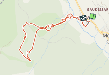

19,1 km | 36 km-effort


Benutzer


Kostenlosegpshiking-Anwendung
 SityTrail
IGN / Geografische Institute
SityTrail World
Die Welt öffnet sich für Sie
Tour Skiwanderen von 5,8 km verfügbar auf Provence-Alpes-Côte d'Azur, Hochalpen, Molines-en-Queyras. Diese Tour wird von loicthev vorgeschlagen.
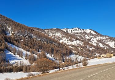
ski de rando au-dessus de Molines
nuit à la Cabane de Clot Henry
11 et 12/01/2025
Alexandre

Wandern

Wandern

Wandern

Mountainbike

Schneeschuhwandern

Wandern
Schneeschuhwandern
Wandern
Wandern