


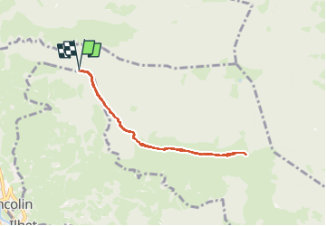

4,4 km | 5,9 km-effort


Benutzer


Kostenlosegpshiking-Anwendung
 SityTrail
IGN / Geografische Institute
SityTrail World
Die Welt öffnet sich für Sie
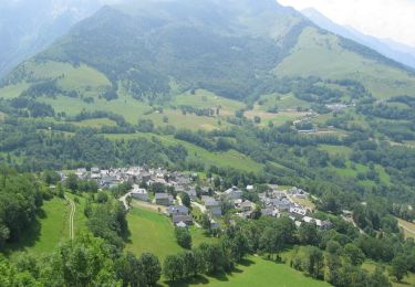
Tour Wandern von 7,6 km verfügbar auf Okzitanien, Hautes-Pyrénées, Sarrancolin. Diese Tour wird von damerenvielle@gmail.com vorgeschlagen.
A Sarrancolin prendre la route du Tous et continuer jusqu' au début de la piste non accidentée, puis jusqu'au début du sentier qui monte dans la forêt.
Wandern
Wandern
Wandern
Mountainbike
Wandern
Laufen

Wandern
Wandern
Wandern