


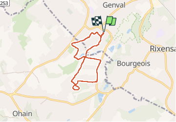

23 km | 28 km-effort


Benutzer


Kostenlosegpshiking-Anwendung
 SityTrail
IGN / Geografische Institute
SityTrail World
Die Welt öffnet sich für Sie
Tour Wandern von 5,7 km verfügbar auf Wallonien, Wallonisch-Brabant, Rixensart. Diese Tour wird von calofrancis vorgeschlagen.
guide : Francis
version adaptée P21 de Lasne nature pour démarrer du parking place communale
Annulé le 21/11 météo hivernale
Projet remis au 2/1/25
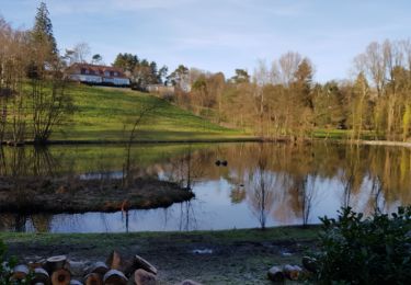
Beau parcours dans les vallées MAIS TRES humide et boueux

Wandern

Wandern

Wandern

Wandern

Wandern

Wandern

Wandern

Wandern
Wandern