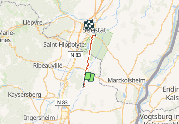
![](/images/other/stat-length.png)
![Tour Kanufahren - Kajakfahren Kolmar - Canoé-descente de l'ill - Photo](https://media.geolcdn.com/t/1900/400/2d110005-7289-4feb-8dd0-0910656b4f4e.jpg&format=pjpeg&maxdim=2)
Canoé-descente de l'ill
benoit747
Benutzer
![Länge](/images/other/stat-length.png)
![Maximale Höhe](https://static1.geolcdn.com/siteimages/upload/files/1508320355ic_sort_altitude_max_24dp.png)
![Positive Höhendifferenz](https://static1.geolcdn.com/siteimages/upload/files/1508320355ic_sort_den_pos_24dp.png)
![Km-Effort](/images/other/stat-length.png)
![Min. Höhe](https://static1.geolcdn.com/siteimages/upload/files/1508320355ic_sort_altitude_min_24dp.png)
![Negative Höhendifferenz](https://static1.geolcdn.com/siteimages/upload/files/1508320355ic_sort_den_neg_24dp.png)
![Boucle](https://static1.geolcdn.com/siteimages/upload/files/16400158638029165_repeat_loop_refresh_sync_direction_icon.png)
![Kanufahren - Kajakfahren](https://static1.geolcdn.com/sitytour/trail-icons/703.png)
3h00
Schwierigkeit : Medium
![Scannen Sie diesen QR-Code, um die Tour in der SityTrail-Anwendung zu öffnen](https://capi.geolives.com/qq0zvz2zws4bq2lad0pu/sitytour/trails/428472/qr.png?size=200)
Kostenlosegpshiking-Anwendung
Über SityTrail
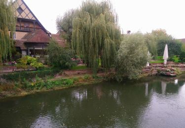
Tour Kanufahren - Kajakfahren von 13,3 km verfügbar auf Großer Osten, Oberelsass, Kolmar. Diese Tour wird von benoit747 vorgeschlagen.
Beschreibung
Sécurité :
La pratique du canoé est une activité à risque.
Cette descente ne doit pas être réalisée par une personne novice en canoé-kayak
les rivières sont des milieux changeant... le parcours proposé ici peut ne pas être réalisable dans certaines conditions (niveaux d'eaux, présence d'obstacle)
Vous réalisez cette descente à vos risque et péril. Je ne peux pas garantir l'état de cette rivière au moment où vous la ferez
descriptif :
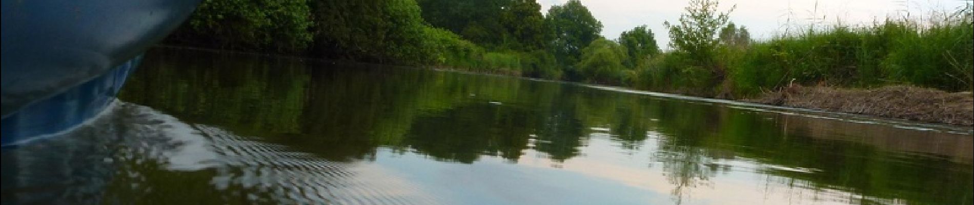
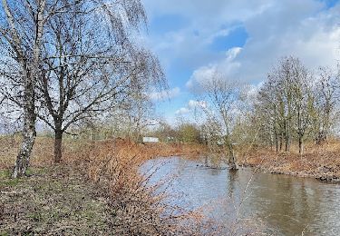
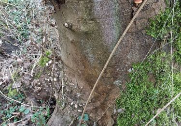
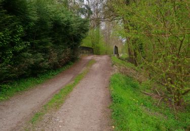
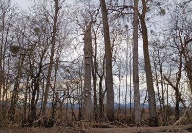
une descente assez sauvage
Prendre un anti moustique car en sous bois, ils sont très agressif
Arrivée au canoé du ried possible , ils acceptent (en 2016) de faire la navette pour un prix modique même si vous venez avec vos propres canoés.
Les appeler pour confirmer la possibilité de débarquer et d'organiser la navette
Ort
Kommentare
Touren in der Umgebung
![Tour Wandern Porte-du-Ried - Sur les sentiers d'Holtzwihr et de Riedwihr - Photo](https://media.geolcdn.com/t/375/260/6928e266-2e52-49c8-9ebd-9a70ab6a481f.jpg&format=jpg&maxdim=2)
![Wandern Wandern](https://static1.geolcdn.com/sitytour/trail-icons/101.png)
Wandern
![](/images/other/stat-length.png)
![](https://static1.geolcdn.com/siteimages/upload/files/16400158638029165_repeat_loop_refresh_sync_direction_icon.png)
![Tour Wandern Porte-du-Ried - Sentiers botaniques d'Holtzwihr et de Riedwihr - Photo](https://media.geolcdn.com/t/375/260/76e2a4c0-424d-4b89-956a-3b59b74bc678.jpg&format=jpg&maxdim=2)
![Wandern Wandern](https://static1.geolcdn.com/sitytour/trail-icons/101.png)
Wandern
![](/images/other/stat-length.png)
![](https://static1.geolcdn.com/siteimages/upload/files/16400158638029165_repeat_loop_refresh_sync_direction_icon.png)
![Tour Wandern Bergheim - Bergheim - Entre vignes et crèches - Photo](https://media.geolcdn.com/t/375/260/a477d2e6-5848-4aa5-a73d-eb5b2ce999b8.jpg&format=jpg&maxdim=2)
![Wandern Wandern](https://static1.geolcdn.com/sitytour/trail-icons/101.png)
Wandern
![](/images/other/stat-length.png)
![](https://static1.geolcdn.com/siteimages/upload/files/16400158638029165_repeat_loop_refresh_sync_direction_icon.png)
![Tour Wandern Ostheim - Le long de la rivière Fecht à Ostheim en France - Photo](https://media.geolcdn.com/t/375/260/e49f18ff-da2a-44e2-88bc-a804e5f08011.jpeg&format=jpg&maxdim=2)
![Wandern Wandern](https://static1.geolcdn.com/sitytour/trail-icons/101.png)
Wandern
![](/images/other/stat-length.png)
![](https://static1.geolcdn.com/siteimages/upload/files/16400158638029165_repeat_loop_refresh_sync_direction_icon.png)
![Tour Wandern Kolmar - champignons - Photo](https://media.geolcdn.com/t/375/260/d0e9264b-566e-43f0-aa52-eb3e222f3598.jpg&format=jpg&maxdim=2)
![Wandern Wandern](https://static1.geolcdn.com/sitytour/trail-icons/101.png)
Wandern
![](/images/other/stat-length.png)
![](https://static1.geolcdn.com/siteimages/upload/files/16400158638029165_repeat_loop_refresh_sync_direction_icon.png)
![Tour Wandern Kolmar - Entre l'Ill et la forêt - Photo](https://media.geolcdn.com/t/375/260/1071f0da-e023-474a-a4e4-7cc7791235fb.jpg&format=jpg&maxdim=2)
![Wandern Wandern](https://static1.geolcdn.com/sitytour/trail-icons/101.png)
Wandern
![](/images/other/stat-length.png)
![](https://static1.geolcdn.com/siteimages/upload/files/16400158638029165_repeat_loop_refresh_sync_direction_icon.png)
![Tour Wandern Illhäusern - Illhausern Le sentier des Ried, voie romaine - Photo](https://media.geolcdn.com/t/375/260/15dff561-8248-4bc4-96fc-1abfaaa08034.jpg&format=jpg&maxdim=2)
![Wandern Wandern](https://static1.geolcdn.com/sitytour/trail-icons/101.png)
Wandern
![](/images/other/stat-length.png)
![](https://static1.geolcdn.com/siteimages/upload/files/16400158638029165_repeat_loop_refresh_sync_direction_icon.png)
![Tour Wandern Kolmar - Près de Riedwihr - Photo](https://media.geolcdn.com/t/375/260/f3e479b2-913b-4e49-8a43-c1722fd6775e.jpg&format=jpg&maxdim=2)
![Wandern Wandern](https://static1.geolcdn.com/sitytour/trail-icons/101.png)
Wandern
![](/images/other/stat-length.png)
![](https://static1.geolcdn.com/siteimages/upload/files/16400158638029165_repeat_loop_refresh_sync_direction_icon.png)
![Tour Wandern Porte-du-Ried - Boucle sentiers de découverte Holtzwihr - Photo](https://media.geolcdn.com/t/375/260/ext.jpg?maxdim=2&url=https%3A%2F%2Fstatic1.geolcdn.com%2Fsiteimages%2Fupload%2Ffiles%2F1553511878bg_sport_marche.png)
![Wandern Wandern](https://static1.geolcdn.com/sitytour/trail-icons/101.png)
Wandern
![](/images/other/stat-length.png)
![](https://static1.geolcdn.com/siteimages/upload/files/16400158638029165_repeat_loop_refresh_sync_direction_icon.png)