![](/images/other/stat-length.png)
![Tour Wandern Saint-Marcel-en-Marcillat - Les mares et les murets - Photo](https://media.geolcdn.com/t/1900/400/ext.pjpeg?maxdim=2&url=https%3A%2F%2Fstatic1.geolcdn.com%2Fsiteimages%2Fupload%2Ffiles%2F1553511878bg_sport_marche.png)
Les mares et les murets
fanthou
Benutzer
![Länge](/images/other/stat-length.png)
Länge
14,2 km
![Maximale Höhe](https://static1.geolcdn.com/siteimages/upload/files/1508320355ic_sort_altitude_max_24dp.png)
Maximale Höhe
534 m
![Positive Höhendifferenz](https://static1.geolcdn.com/siteimages/upload/files/1508320355ic_sort_den_pos_24dp.png)
Positive Höhendifferenz
247 m
![Km-Effort](/images/other/stat-length.png)
Km-Effort
17,5 km
![Min. Höhe](https://static1.geolcdn.com/siteimages/upload/files/1508320355ic_sort_altitude_min_24dp.png)
Min. Höhe
444 m
![Negative Höhendifferenz](https://static1.geolcdn.com/siteimages/upload/files/1508320355ic_sort_den_neg_24dp.png)
Negative Höhendifferenz
247 m
![Boucle](https://static1.geolcdn.com/siteimages/upload/files/16400158638029165_repeat_loop_refresh_sync_direction_icon.png)
Boucle
Ja
Erstellungsdatum :
2024-11-29 18:40:54.295
Letzte Änderung :
2025-02-09 12:12:00.654
![Wandern](https://static1.geolcdn.com/sitytour/trail-icons/101.png)
3h58
Schwierigkeit : Schwierig
![Scannen Sie diesen QR-Code, um die Tour in der SityTrail-Anwendung zu öffnen](https://capi.geolives.com/qq0zvz2zws4bq2lad0pu/sitytour/trails/4284106/qr.png?size=200)
Kostenlosegpshiking-Anwendung
Über SityTrail
Tour Wandern von 14,2 km verfügbar auf Auvergne-Rhone-Alpen, Allier, Saint-Marcel-en-Marcillat. Diese Tour wird von fanthou vorgeschlagen.
Beschreibung
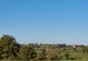
Parcourez les chemins bordés de murets de pierres sèches qui défient le temps.Enchainez en douceur montées et descentes, pour apprivoiser des paysages spectaculaires. Laissez-vous charmer par les vallées alentours.
Ort
Land:
France
Region :
Auvergne-Rhone-Alpen
Abteilung/Provinz :
Allier
Kommune :
Saint-Marcel-en-Marcillat
Standort:
Unknown
Gehen Sie:(Dec)
Gehen Sie:(UTM)
468304 ; 5110274 (31T) N.
Kommentare
Touren in der Umgebung
![Tour Mountainbike Saint-Fargeol - Le moulin rouge - Photo](https://media.geolcdn.com/t/375/260/de9828df-3c3a-48d7-b5cf-82bde7aa66d6.jpg&format=jpg&maxdim=2)
![Mountainbike Mountainbike](https://static1.geolcdn.com/sitytour/trail-icons/202.png)
Le moulin rouge
Mountainbike
Schwierig
Saint-Fargeol,
Auvergne-Rhone-Alpen,
Allier,
France
![](/images/other/stat-length.png)
30 km | 38 km-effort
2h 39min
![](https://static1.geolcdn.com/siteimages/upload/files/16400158638029165_repeat_loop_refresh_sync_direction_icon.png)
Ja
![Tour Mountainbike Saint-Fargeol - St fargeol - Photo](https://media.geolcdn.com/t/375/260/ext.jpg?maxdim=2&url=https%3A%2F%2Fservices.sitytrail.com%2FGeolivesWS%2FDownloadMedia.ashx%3FTrailID%3D240508%26Media%3Dfix__20140105155324.jpg)
![Mountainbike Mountainbike](https://static1.geolcdn.com/sitytour/trail-icons/202.png)
St fargeol
Mountainbike
Schwierig
Saint-Fargeol,
Auvergne-Rhone-Alpen,
Allier,
France
![](/images/other/stat-length.png)
27 km | 35 km-effort
3h 17min
![](https://static1.geolcdn.com/siteimages/upload/files/16400158638029165_repeat_loop_refresh_sync_direction_icon.png)
Ja
![Tour Zu Fuß Évaux-les-Bains - Le Chateau de Ligondes - Photo](https://media.geolcdn.com/t/375/260/ext.jpg?maxdim=2&url=https%3A%2F%2Fstatic1.geolcdn.com%2Fsiteimages%2Fupload%2Ffiles%2F1545311037marcheuse_200dpi.jpg)
![Zu Fuß Zu Fuß](https://static1.geolcdn.com/sitytour/trail-icons/100.png)
Le Chateau de Ligondes
Zu Fuß
Einfach
Évaux-les-Bains,
Neu-Aquitanien,
Creuse,
France
![](/images/other/stat-length.png)
10,6 km | 15 km-effort
3h 24min
![](https://static1.geolcdn.com/siteimages/upload/files/16400158638029165_repeat_loop_refresh_sync_direction_icon.png)
Ja
![Tour Zu Fuß Saint-Hilaire - La Vallee de Lacot - Photo](https://media.geolcdn.com/t/375/260/ext.jpg?maxdim=2&url=https%3A%2F%2Fstatic1.geolcdn.com%2Fsiteimages%2Fupload%2Ffiles%2F1545311037marcheuse_200dpi.jpg)
![Zu Fuß Zu Fuß](https://static1.geolcdn.com/sitytour/trail-icons/100.png)
La Vallee de Lacot
Zu Fuß
Einfach
(1)
Saint-Hilaire,
Auvergne-Rhone-Alpen,
Puy-de-Dôme,
France
![](/images/other/stat-length.png)
11,7 km | 15 km-effort
3h 24min
![](https://static1.geolcdn.com/siteimages/upload/files/16400158638029165_repeat_loop_refresh_sync_direction_icon.png)
Nein
![Tour Moto-Cross Marcillat-en-Combraille - Marcillat - Eveau les Bain - Rochebut - Marcillat - Photo](https://media.geolcdn.com/t/375/260/ext.jpg?maxdim=2&url=https%3A%2F%2Fstatic1.geolcdn.com%2Fsiteimages%2Fupload%2Ffiles%2F1524743155moto.jpg)
![Moto-Cross Moto-Cross](https://static1.geolcdn.com/sitytour/trail-icons/406.png)
Marcillat - Eveau les Bain - Rochebut - Marcillat
Moto-Cross
Medium
(1)
Marcillat-en-Combraille,
Auvergne-Rhone-Alpen,
Allier,
France
![](/images/other/stat-length.png)
54 km | 72 km-effort
Unbekannt
![](https://static1.geolcdn.com/siteimages/upload/files/16400158638029165_repeat_loop_refresh_sync_direction_icon.png)
Ja
![Tour Wandern Marcillat-en-Combraille - L'Économique - Photo](https://media.geolcdn.com/t/375/260/ext.jpg?maxdim=2&url=https%3A%2F%2Fstatic1.geolcdn.com%2Fsiteimages%2Fupload%2Ffiles%2F1553511878bg_sport_marche.png)
![Wandern Wandern](https://static1.geolcdn.com/sitytour/trail-icons/101.png)
L'Économique
Wandern
Schwierig
Marcillat-en-Combraille,
Auvergne-Rhone-Alpen,
Allier,
France
![](/images/other/stat-length.png)
12 km | 14,3 km-effort
3h 15min
![](https://static1.geolcdn.com/siteimages/upload/files/16400158638029165_repeat_loop_refresh_sync_direction_icon.png)
Ja
![Tour Wandern Marcillat-en-Combraille - Les Tartasses - Photo](https://media.geolcdn.com/t/375/260/ext.jpg?maxdim=2&url=https%3A%2F%2Fstatic1.geolcdn.com%2Fsiteimages%2Fupload%2Ffiles%2F1553511878bg_sport_marche.png)
![Wandern Wandern](https://static1.geolcdn.com/sitytour/trail-icons/101.png)
Les Tartasses
Wandern
Sehr schwierig
Marcillat-en-Combraille,
Auvergne-Rhone-Alpen,
Allier,
France
![](/images/other/stat-length.png)
22 km | 31 km-effort
6h 56min
![](https://static1.geolcdn.com/siteimages/upload/files/16400158638029165_repeat_loop_refresh_sync_direction_icon.png)
Ja
![Tour Wandern Marcillat-en-Combraille - Les Tartasses Bis - Photo](https://media.geolcdn.com/t/375/260/ext.jpg?maxdim=2&url=https%3A%2F%2Fstatic1.geolcdn.com%2Fsiteimages%2Fupload%2Ffiles%2F1553511878bg_sport_marche.png)
![Wandern Wandern](https://static1.geolcdn.com/sitytour/trail-icons/101.png)
Les Tartasses Bis
Wandern
Schwierig
Marcillat-en-Combraille,
Auvergne-Rhone-Alpen,
Allier,
France
![](/images/other/stat-length.png)
9,4 km | 12,8 km-effort
2h 54min
![](https://static1.geolcdn.com/siteimages/upload/files/16400158638029165_repeat_loop_refresh_sync_direction_icon.png)
Ja
![Tour Wandern Saint-Fargeol - Le dolmen de Mazérat Bis - Photo](https://media.geolcdn.com/t/375/260/ext.jpg?maxdim=2&url=https%3A%2F%2Fstatic1.geolcdn.com%2Fsiteimages%2Fupload%2Ffiles%2F1553511878bg_sport_marche.png)
![Wandern Wandern](https://static1.geolcdn.com/sitytour/trail-icons/101.png)
Le dolmen de Mazérat Bis
Wandern
Medium
Saint-Fargeol,
Auvergne-Rhone-Alpen,
Allier,
France
![](/images/other/stat-length.png)
9,1 km | 11,3 km-effort
2h 34min
![](https://static1.geolcdn.com/siteimages/upload/files/16400158638029165_repeat_loop_refresh_sync_direction_icon.png)
Ja