![](/images/other/stat-length.png)
![Tour Wandern La Chapelle-en-Vercors - Serre Plumé - Photo](https://media.geolcdn.com/t/1900/400/86da3767-95d8-4e79-b2dd-2495b2dc9585.jpg&format=pjpeg&maxdim=2)
Serre Plumé
crocau
Benutzer
![Länge](/images/other/stat-length.png)
![Maximale Höhe](https://static1.geolcdn.com/siteimages/upload/files/1508320355ic_sort_altitude_max_24dp.png)
![Positive Höhendifferenz](https://static1.geolcdn.com/siteimages/upload/files/1508320355ic_sort_den_pos_24dp.png)
![Km-Effort](/images/other/stat-length.png)
![Min. Höhe](https://static1.geolcdn.com/siteimages/upload/files/1508320355ic_sort_altitude_min_24dp.png)
![Negative Höhendifferenz](https://static1.geolcdn.com/siteimages/upload/files/1508320355ic_sort_den_neg_24dp.png)
![Boucle](https://static1.geolcdn.com/siteimages/upload/files/16400158638029165_repeat_loop_refresh_sync_direction_icon.png)
![Wandern](https://static1.geolcdn.com/sitytour/trail-icons/101.png)
2h42
Schwierigkeit : Medium
![Scannen Sie diesen QR-Code, um die Tour in der SityTrail-Anwendung zu öffnen](https://capi.geolives.com/qq0zvz2zws4bq2lad0pu/sitytour/trails/4238721/qr.png?size=200)
Kostenlosegpshiking-Anwendung
Über SityTrail
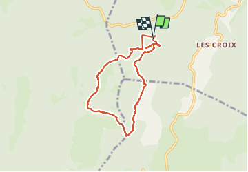
Tour Wandern von 7,2 km verfügbar auf Auvergne-Rhone-Alpen, Drôme, La Chapelle-en-Vercors. Diese Tour wird von crocau vorgeschlagen.
Beschreibung
Il faut prendre sa voiture jusqu'au col de Carry puis, de là, continuer prudemment en voiture sur une piste jusqu'à l'Estouge à 2 km. Ensuite le chemin vers le col de la Mure n'est pas très bien indiqué dans les bois. Pour autant avec un GPS on arrive à s'en sortir. On passe d'ailleurs d'abords par Serre Plumé.
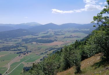
Depuis Serre Plumé c'est plus compliqué: la descente est bien indiquée mais raide et glissante. Ensuite la balade serait plus appropriée pour du VTT, en effet on marche sur une piste assez longtemps. La pelouse du lièvre blanc est plutôt jolie.
En fin de compte je conseillerais plutôt de combiner VTT et marche à pied pour cette balade: on peut par exemple déposer son vélo au col de la mure et monter à pied à Serre Plumé pour admirer la vue.
Si on temps l'oreille on entend le roitelet huppé dans les bois.
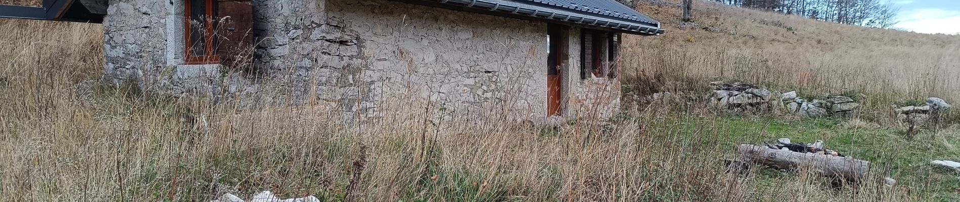
Enfin il est à noter que sur le chemin il y a refuge non gardé qui est très joli.
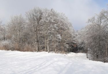
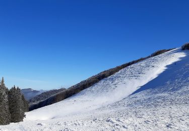
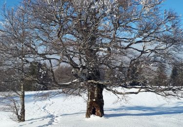
Ort
Kommentare
Touren in der Umgebung
![Tour Schneeschuhwandern Bouvante - Les gagères en raquettes - Photo](https://media.geolcdn.com/t/375/260/2981cf80-2281-48d0-9011-dd17ca071224.jpg&format=jpg&maxdim=2)
![Schneeschuhwandern Schneeschuhwandern](https://static1.geolcdn.com/sitytour/trail-icons/504.png)
Schneeschuhwandern
![](/images/other/stat-length.png)
![](https://static1.geolcdn.com/siteimages/upload/files/16400158638029165_repeat_loop_refresh_sync_direction_icon.png)
![Tour Schneeschuhwandern La Chapelle-en-Vercors - 26 raq claveyron - Photo](https://media.geolcdn.com/t/375/260/d59c2ca4-fd91-4928-b5ba-f5a74d483fc8.jpg&format=jpg&maxdim=2)
![Schneeschuhwandern Schneeschuhwandern](https://static1.geolcdn.com/sitytour/trail-icons/504.png)
Schneeschuhwandern
![](/images/other/stat-length.png)
![](https://static1.geolcdn.com/siteimages/upload/files/16400158638029165_repeat_loop_refresh_sync_direction_icon.png)
![Tour Wandern Saint-Agnan-en-Vercors - 26 st Agnan champ gros de la vache - Photo](https://media.geolcdn.com/t/375/260/3e876886-71b3-45d3-bba1-ada65af3bf18.jpg&format=jpg&maxdim=2)
![Wandern Wandern](https://static1.geolcdn.com/sitytour/trail-icons/101.png)
Wandern
![](/images/other/stat-length.png)
![](https://static1.geolcdn.com/siteimages/upload/files/16400158638029165_repeat_loop_refresh_sync_direction_icon.png)
![Tour Wandern La Chapelle-en-Vercors - serre plumé depuis carri par la bournette col de la baume grange de vauneyre col de la mure puis les cretes jusqu a pré bellet refuge de crobache lievre blanc scialet royer - Photo](https://media.geolcdn.com/t/375/260/82d39288-8889-4dde-9abf-27f32f728f38.jpg&format=jpg&maxdim=2)
![Wandern Wandern](https://static1.geolcdn.com/sitytour/trail-icons/101.png)
Wandern
![](/images/other/stat-length.png)
![](https://static1.geolcdn.com/siteimages/upload/files/16400158638029165_repeat_loop_refresh_sync_direction_icon.png)
![Tour Wandern Bouvante - Boucle du Plateau de Font d'Urle - Photo](https://media.geolcdn.com/t/375/260/50aac9f1-41c9-480c-904d-17b530d5dbff.jpg&format=jpg&maxdim=2)
![Wandern Wandern](https://static1.geolcdn.com/sitytour/trail-icons/101.png)
Wandern
![](/images/other/stat-length.png)
![](https://static1.geolcdn.com/siteimages/upload/files/16400158638029165_repeat_loop_refresh_sync_direction_icon.png)
![Tour Wandern Bouvante - Font d’Urle les Trois cloches Glacières les Gagères - Photo](https://media.geolcdn.com/t/375/260/d811593c-e678-4b00-a285-b7dce29eecce.jpg&format=jpg&maxdim=2)
![Wandern Wandern](https://static1.geolcdn.com/sitytour/trail-icons/101.png)
Wandern
![](/images/other/stat-length.png)
![](https://static1.geolcdn.com/siteimages/upload/files/16400158638029165_repeat_loop_refresh_sync_direction_icon.png)
![Tour Wandern Bouvante - Col de la Machine - Photo](https://media.geolcdn.com/t/375/260/0d18de73-0fe0-48b2-b5db-96ecf4348995.jpg&format=jpg&maxdim=2)
![Wandern Wandern](https://static1.geolcdn.com/sitytour/trail-icons/101.png)
Wandern
![](/images/other/stat-length.png)
![](https://static1.geolcdn.com/siteimages/upload/files/16400158638029165_repeat_loop_refresh_sync_direction_icon.png)
![Tour Wandern Bouvante - Crête des Gagères - Photo](https://media.geolcdn.com/t/375/260/238839e4-2c7b-463c-a8a4-13f730b00e0a.jpg&format=jpg&maxdim=2)
![Wandern Wandern](https://static1.geolcdn.com/sitytour/trail-icons/101.png)
Wandern
![](/images/other/stat-length.png)
![](https://static1.geolcdn.com/siteimages/upload/files/16400158638029165_repeat_loop_refresh_sync_direction_icon.png)
![Tour Nordic Walking Bouvante - 202201fontdurle2 - Photo](https://media.geolcdn.com/t/375/260/148c551f-c1f7-4a77-89d2-b6cfec149cab.jpg&format=jpg&maxdim=2)
![Nordic Walking Nordic Walking](https://static1.geolcdn.com/sitytour/trail-icons/102.png)
Nordic Walking
![](/images/other/stat-length.png)
![](https://static1.geolcdn.com/siteimages/upload/files/16400158638029165_repeat_loop_refresh_sync_direction_icon.png)