


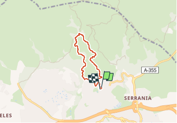

6,1 km | 10,9 km-effort


Benutzer


Kostenlosegpshiking-Anwendung
 SityTrail
IGN / Geografische Institute
SityTrail World
Die Welt öffnet sich für Sie
Tour Wandern von 5,6 km verfügbar auf Andalusien, Málaga, Marbella. Diese Tour wird von fagakra vorgeschlagen.
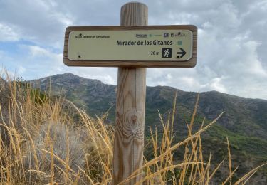
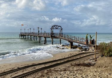
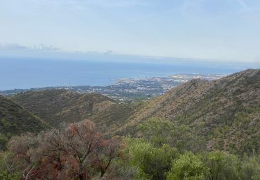
Balade de montagne, bonnes chaussures nécessaire. Magnifiques paysages de la côte et de montagne. Passage par les ruines de l’ancien ermitage franciscains.
Wandern
Wandern
Wandern

Wandern
Wandern