![](/images/other/stat-length.png)
![Tour Wandern Crécy-en-Ponthieu - Forêt de Crécy-en-Ponthieu - Photo](https://media.geolcdn.com/t/1900/400/fd05b009-a0e0-48d9-b30d-737c848f8a0a.jpg&format=pjpeg&maxdim=2)
Forêt de Crécy-en-Ponthieu
lucclaes
Benutzer GUIDE
![Länge](/images/other/stat-length.png)
Länge
18,8 km
![Maximale Höhe](https://static1.geolcdn.com/siteimages/upload/files/1508320355ic_sort_altitude_max_24dp.png)
Maximale Höhe
90 m
![Positive Höhendifferenz](https://static1.geolcdn.com/siteimages/upload/files/1508320355ic_sort_den_pos_24dp.png)
Positive Höhendifferenz
207 m
![Km-Effort](/images/other/stat-length.png)
Km-Effort
22 km
![Min. Höhe](https://static1.geolcdn.com/siteimages/upload/files/1508320355ic_sort_altitude_min_24dp.png)
Min. Höhe
20 m
![Negative Höhendifferenz](https://static1.geolcdn.com/siteimages/upload/files/1508320355ic_sort_den_neg_24dp.png)
Negative Höhendifferenz
206 m
![Boucle](https://static1.geolcdn.com/siteimages/upload/files/16400158638029165_repeat_loop_refresh_sync_direction_icon.png)
Boucle
Ja
Erstellungsdatum :
2024-09-14 07:54:48.466
Letzte Änderung :
2024-09-14 14:48:26.379
![Wandern](https://static1.geolcdn.com/sitytour/trail-icons/101.png)
4h38
Schwierigkeit : Medium
![Scannen Sie diesen QR-Code, um die Tour in der SityTrail-Anwendung zu öffnen](https://capi.geolives.com/qq0zvz2zws4bq2lad0pu/sitytour/trails/4189576/qr.png?size=200)
Kostenlosegpshiking-Anwendung
Über SityTrail
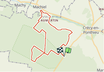
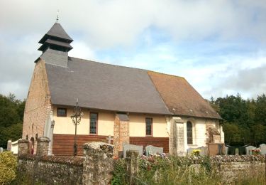
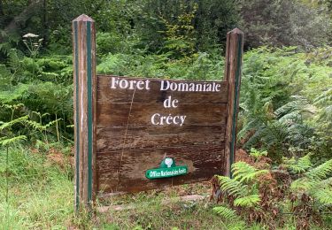
Tour Wandern von 18,8 km verfügbar auf Nordfrankreich, Somme, Crécy-en-Ponthieu. Diese Tour wird von lucclaes vorgeschlagen.
Beschreibung
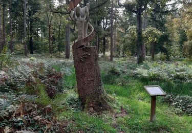
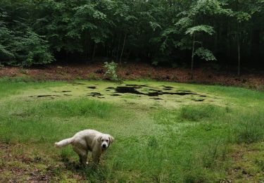
Inspiré d'une autre randonnée SityTrail mais évitant la traversée d'une propriété privée et avec moins d'asphalte...
Ort
Land:
France
Region :
Nordfrankreich
Abteilung/Provinz :
Somme
Kommune :
Crécy-en-Ponthieu
Standort:
Crécy-en-Ponthieu
Gehen Sie:(Dec)
Gehen Sie:(UTM)
418142 ; 5565013 (31U) N.
Kommentare
Touren in der Umgebung
![Tour Fahrrad Crécy-en-Ponthieu - Les Vieux Chênes - Crécy en Ponthieu - Photo](https://media.geolcdn.com/t/375/260/ext.jpg?maxdim=2&url=https%3A%2F%2Fservices.sitytrail.com%2FGeolivesWS%2FDownloadMedia.ashx%3FTrailID%3D109915%26Media%3D4931_1.jpg)
![Fahrrad Fahrrad](https://static1.geolcdn.com/sitytour/trail-icons/200.png)
Les Vieux Chênes - Crécy en Ponthieu
Fahrrad
Schwierig
(1)
Crécy-en-Ponthieu,
Nordfrankreich,
Somme,
France
![](/images/other/stat-length.png)
49 km | 54 km-effort
3h 0min
![](https://static1.geolcdn.com/siteimages/upload/files/16400158638029165_repeat_loop_refresh_sync_direction_icon.png)
Ja
![Tour Mountainbike Forest-l'Abbaye - Forest-l'Abbaye Cyclisme - Photo](https://media.geolcdn.com/t/375/260/9d218c20-19f9-4002-98b6-99eda2a32b95.png&format=jpg&maxdim=2)
![Mountainbike Mountainbike](https://static1.geolcdn.com/sitytour/trail-icons/202.png)
Forest-l'Abbaye Cyclisme
Mountainbike
Einfach
Forest-l'Abbaye,
Nordfrankreich,
Somme,
France
![](/images/other/stat-length.png)
9,4 km | 10,6 km-effort
43min
![](https://static1.geolcdn.com/siteimages/upload/files/16400158638029165_repeat_loop_refresh_sync_direction_icon.png)
Ja
![Tour Wandern Forest-l'Abbaye - Forest l’Abbaye - Photo](https://media.geolcdn.com/t/375/260/23604bac-d1df-4fcb-bab6-ba45040d791e.jpg&format=jpg&maxdim=2)
![Wandern Wandern](https://static1.geolcdn.com/sitytour/trail-icons/101.png)
Forest l’Abbaye
Wandern
Medium
Forest-l'Abbaye,
Nordfrankreich,
Somme,
France
![](/images/other/stat-length.png)
18,5 km | 21 km-effort
4h 22min
![](https://static1.geolcdn.com/siteimages/upload/files/16400158638029165_repeat_loop_refresh_sync_direction_icon.png)
Ja
![Tour Wandern Forest-l'Abbaye - À la découverte d'arbres remarquables en Forêt de Crécy - Photo](https://media.geolcdn.com/t/375/260/8a9c9e06-a466-4037-92ca-f29b0b2e52d6.jpeg&format=jpg&maxdim=2)
![Wandern Wandern](https://static1.geolcdn.com/sitytour/trail-icons/101.png)
À la découverte d'arbres remarquables en Forêt de Crécy
Wandern
Medium
Forest-l'Abbaye,
Nordfrankreich,
Somme,
France
![](/images/other/stat-length.png)
7,9 km | 8,8 km-effort
1h 59min
![](https://static1.geolcdn.com/siteimages/upload/files/16400158638029165_repeat_loop_refresh_sync_direction_icon.png)
Ja
![Tour Wandern Crécy-en-Ponthieu - Forêt de Crécy - Photo](https://media.geolcdn.com/t/375/260/f1b387ad-8151-48dc-8a2f-cae702cbbcd3.jpeg&format=jpg&maxdim=2)
![Wandern Wandern](https://static1.geolcdn.com/sitytour/trail-icons/101.png)
Forêt de Crécy
Wandern
Medium
Crécy-en-Ponthieu,
Nordfrankreich,
Somme,
France
![](/images/other/stat-length.png)
6,3 km | 7 km-effort
2h 21min
![](https://static1.geolcdn.com/siteimages/upload/files/16400158638029165_repeat_loop_refresh_sync_direction_icon.png)
Ja
![Tour Zu Fuß Forest-l'Abbaye - Le Hallot - Photo](https://media.geolcdn.com/t/375/260/55088aac-3fac-47bc-a0c5-00e9894c90f2.jpeg&format=jpg&maxdim=2)
![Zu Fuß Zu Fuß](https://static1.geolcdn.com/sitytour/trail-icons/100.png)
Le Hallot
Zu Fuß
Einfach
Forest-l'Abbaye,
Nordfrankreich,
Somme,
France
![](/images/other/stat-length.png)
4,3 km | 4,9 km-effort
1h 6min
![](https://static1.geolcdn.com/siteimages/upload/files/16400158638029165_repeat_loop_refresh_sync_direction_icon.png)
Ja
![Tour Wandern Crécy-en-Ponthieu - LP80_Crecy Ponthieu_Scultures bois - Photo](https://media.geolcdn.com/t/375/260/85252c58-db6b-4eda-bb40-73441ade40b9.jpg&format=jpg&maxdim=2)
![Wandern Wandern](https://static1.geolcdn.com/sitytour/trail-icons/101.png)
LP80_Crecy Ponthieu_Scultures bois
Wandern
Sehr leicht
Crécy-en-Ponthieu,
Nordfrankreich,
Somme,
France
![](/images/other/stat-length.png)
4,2 km | 4,7 km-effort
1h 41min
![](https://static1.geolcdn.com/siteimages/upload/files/16400158638029165_repeat_loop_refresh_sync_direction_icon.png)
Nein
![Tour Wandern Crécy-en-Ponthieu - forêt de Crecy - Photo](https://media.geolcdn.com/t/375/260/63501a4c-5e7d-4485-abe4-dbf7d7ae3149.jpg&format=jpg&maxdim=2)
![Wandern Wandern](https://static1.geolcdn.com/sitytour/trail-icons/101.png)
forêt de Crecy
Wandern
Sehr leicht
Crécy-en-Ponthieu,
Nordfrankreich,
Somme,
France
![](/images/other/stat-length.png)
7,1 km | 8,3 km-effort
1h 44min
![](https://static1.geolcdn.com/siteimages/upload/files/16400158638029165_repeat_loop_refresh_sync_direction_icon.png)
Ja
![Mountainbike Mountainbike](https://static1.geolcdn.com/sitytour/trail-icons/202.png)
activity_5258602101
Mountainbike
Sehr leicht
Crécy-en-Ponthieu,
Nordfrankreich,
Somme,
France
![](/images/other/stat-length.png)
12,6 km | 14,1 km-effort
40min
![](https://static1.geolcdn.com/siteimages/upload/files/16400158638029165_repeat_loop_refresh_sync_direction_icon.png)
Ja