![](/images/other/stat-length.png)
![Tour Wandern Hohenfels - Sandrine: le hérou et le chesle - Photo](https://media.geolcdn.com/t/1900/400/b0ca0966-e4b1-4890-b197-71cfed1d3b01.jpg&format=pjpeg&maxdim=2)
Sandrine: le hérou et le chesle
dragonchef
Benutzer
![Länge](/images/other/stat-length.png)
Länge
10,7 km
![Maximale Höhe](https://static1.geolcdn.com/siteimages/upload/files/1508320355ic_sort_altitude_max_24dp.png)
Maximale Höhe
410 m
![Positive Höhendifferenz](https://static1.geolcdn.com/siteimages/upload/files/1508320355ic_sort_den_pos_24dp.png)
Positive Höhendifferenz
379 m
![Km-Effort](/images/other/stat-length.png)
Km-Effort
15,7 km
![Min. Höhe](https://static1.geolcdn.com/siteimages/upload/files/1508320355ic_sort_altitude_min_24dp.png)
Min. Höhe
253 m
![Negative Höhendifferenz](https://static1.geolcdn.com/siteimages/upload/files/1508320355ic_sort_den_neg_24dp.png)
Negative Höhendifferenz
377 m
![Boucle](https://static1.geolcdn.com/siteimages/upload/files/16400158638029165_repeat_loop_refresh_sync_direction_icon.png)
Boucle
Ja
Erstellungsdatum :
2024-09-07 09:26:03.578
Letzte Änderung :
2024-09-07 13:07:45.375
![Wandern](https://static1.geolcdn.com/sitytour/trail-icons/101.png)
3h14
Schwierigkeit : Schwierig
![Scannen Sie diesen QR-Code, um die Tour in der SityTrail-Anwendung zu öffnen](https://capi.geolives.com/qq0zvz2zws4bq2lad0pu/sitytour/trails/4181711/qr.png?size=200)
Kostenlosegpshiking-Anwendung
Über SityTrail
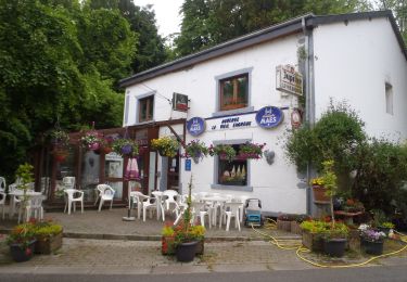
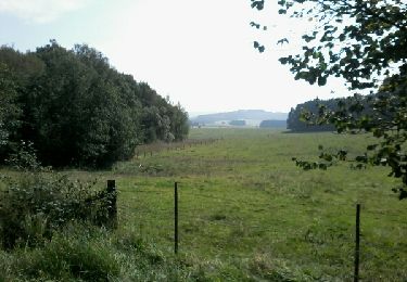
Tour Wandern von 10,7 km verfügbar auf Wallonien, Luxemburg, Hohenfels. Diese Tour wird von dragonchef vorgeschlagen.
Beschreibung
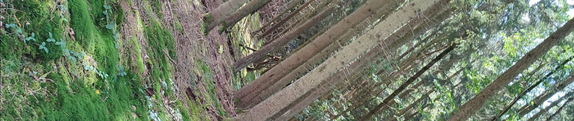
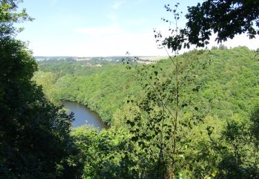
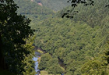
très beau parcours pédestre, assez technique
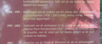
crêtes, descente à la chaîne, sentier rocailleux à la découverte de l Ourthe, des crêtes, du site historique du cheslé
Ort
Land:
Belgium
Region :
Wallonien
Abteilung/Provinz :
Luxemburg
Kommune :
Hohenfels
Standort:
Unknown
Gehen Sie:(Dec)
Gehen Sie:(UTM)
690187 ; 5559359 (31U) N.
Kommentare
Touren in der Umgebung
![Tour Wandern Hohenfels - Balade autour du lac de Nisramont - Photo](https://media.geolcdn.com/t/375/260/ext.jpg?maxdim=2&url=https%3A%2F%2Fservices.sitytrail.com%2FGeolivesWS%2FDownloadMedia.ashx%3FTrailID%3D457261%26Media%3D047b12b6-031b-4dbd-a17f-541f1907c604.JPG)
![Wandern Wandern](https://static1.geolcdn.com/sitytour/trail-icons/101.png)
Balade autour du lac de Nisramont
Wandern
Medium
(9)
Hohenfels,
Wallonien,
Luxemburg,
Belgium
![](/images/other/stat-length.png)
13,4 km | 18,8 km-effort
3h 59min
![](https://static1.geolcdn.com/siteimages/upload/files/16400158638029165_repeat_loop_refresh_sync_direction_icon.png)
Ja
![Tour Wandern Hohenfels - Nadrin et le Rocher du Hérou - Photo](https://media.geolcdn.com/t/375/260/ext.jpg?maxdim=2&url=https%3A%2F%2Fservices.sitytrail.com%2FGeolivesWS%2FDownloadMedia.ashx%3FTrailID%3D1009974%26Media%3D6524bd08-d031-4749-9180-8d830da29ec9.jpg)
![Wandern Wandern](https://static1.geolcdn.com/sitytour/trail-icons/101.png)
Nadrin et le Rocher du Hérou
Wandern
Medium
(5)
Hohenfels,
Wallonien,
Luxemburg,
Belgium
![](/images/other/stat-length.png)
6,7 km | 9,6 km-effort
2h 11min
![](https://static1.geolcdn.com/siteimages/upload/files/16400158638029165_repeat_loop_refresh_sync_direction_icon.png)
Ja
![Wandern Wandern](https://static1.geolcdn.com/sitytour/trail-icons/101.png)
RB-Lu-28_Engreux_via-racc-1
Wandern
Sehr leicht
(2)
Hohenfels,
Wallonien,
Luxemburg,
Belgium
![](/images/other/stat-length.png)
15 km | 19,7 km-effort
4h 15min
![](https://static1.geolcdn.com/siteimages/upload/files/16400158638029165_repeat_loop_refresh_sync_direction_icon.png)
Ja
![Wandern Wandern](https://static1.geolcdn.com/sitytour/trail-icons/101.png)
RB-Lu-28_Engreux
Wandern
Sehr leicht
(4)
Hohenfels,
Wallonien,
Luxemburg,
Belgium
![](/images/other/stat-length.png)
25 km | 33 km-effort
7h 7min
![](https://static1.geolcdn.com/siteimages/upload/files/16400158638029165_repeat_loop_refresh_sync_direction_icon.png)
Ja
![Tour Wandern La Roche-en-Ardenne - Bérismenil - Circuit Natura 2000, des sites qui valent le détour - Lx19 - Photo](https://media.geolcdn.com/t/375/260/ext.jpg?maxdim=2&url=https%3A%2F%2Fservices.sitytrail.com%2FGeolivesWS%2FDownloadMedia.ashx%3FTrailID%3D356413%26Media%3D926c17f8-7479-49f8-a1c9-842bf0b93137.JPG)
![Wandern Wandern](https://static1.geolcdn.com/sitytour/trail-icons/101.png)
Bérismenil - Circuit Natura 2000, des sites qui valent le détour - Lx19
Wandern
Medium
(4)
La Roche-en-Ardenne,
Wallonien,
Luxemburg,
Belgium
![](/images/other/stat-length.png)
7,4 km | 10,4 km-effort
2h 15min
![](https://static1.geolcdn.com/siteimages/upload/files/16400158638029165_repeat_loop_refresh_sync_direction_icon.png)
Ja
![Tour Wandern Hohenfels - lac des 2 ourthes - nisramont - Photo](https://media.geolcdn.com/t/375/260/69b172b5-a70c-4885-b7ab-0e154bafdade.jpg&format=jpg&maxdim=2)
![Wandern Wandern](https://static1.geolcdn.com/sitytour/trail-icons/101.png)
lac des 2 ourthes - nisramont
Wandern
Sehr leicht
(1)
Hohenfels,
Wallonien,
Luxemburg,
Belgium
![](/images/other/stat-length.png)
13,4 km | 18,1 km-effort
3h 32min
![](https://static1.geolcdn.com/siteimages/upload/files/16400158638029165_repeat_loop_refresh_sync_direction_icon.png)
Ja
![Tour Wandern La Roche-en-Ardenne - Celtes et Ourthe - Photo](https://media.geolcdn.com/t/375/260/ext.jpg?maxdim=2&url=https%3A%2F%2Fservices.sitytrail.com%2FGeolivesWS%2FDownloadMedia.ashx%3FTrailID%3D854402%26Media%3Dfix__20171030123801.jpg)
![Wandern Wandern](https://static1.geolcdn.com/sitytour/trail-icons/101.png)
Celtes et Ourthe
Wandern
Schwierig
(1)
La Roche-en-Ardenne,
Wallonien,
Luxemburg,
Belgium
![](/images/other/stat-length.png)
9,8 km | 13,4 km-effort
3h 4min
![](https://static1.geolcdn.com/siteimages/upload/files/16400158638029165_repeat_loop_refresh_sync_direction_icon.png)
Ja
![Tour Wandern Hohenfels - RF-Lu-05 - Dans les méandres de l'Ourthe : Ollômont - Photo](https://media.geolcdn.com/t/375/260/ext.jpg?maxdim=2&url=https%3A%2F%2Fstatic1.geolcdn.com%2Fsiteimages%2Fupload%2Ffiles%2F1553511878bg_sport_marche.png)
![Wandern Wandern](https://static1.geolcdn.com/sitytour/trail-icons/101.png)
RF-Lu-05 - Dans les méandres de l'Ourthe : Ollômont
Wandern
Sehr leicht
(2)
Hohenfels,
Wallonien,
Luxemburg,
Belgium
![](/images/other/stat-length.png)
11,4 km | 15,6 km-effort
3h 27min
![](https://static1.geolcdn.com/siteimages/upload/files/16400158638029165_repeat_loop_refresh_sync_direction_icon.png)
Ja
![Tour Wandern La Roche-en-Ardenne - buisson - nagimont - Ortho - Photo](https://media.geolcdn.com/t/375/260/ext.jpg?maxdim=2&url=https%3A%2F%2Fservices.sitytrail.com%2FGeolivesWS%2FDownloadMedia.ashx%3FTrailID%3D343702%26Media%3Dfix__20140909123303.jpg)
![Wandern Wandern](https://static1.geolcdn.com/sitytour/trail-icons/101.png)
buisson - nagimont - Ortho
Wandern
Sehr leicht
(1)
La Roche-en-Ardenne,
Wallonien,
Luxemburg,
Belgium
![](/images/other/stat-length.png)
9,1 km | 11,7 km-effort
2h 30min
![](https://static1.geolcdn.com/siteimages/upload/files/16400158638029165_repeat_loop_refresh_sync_direction_icon.png)
Ja