![](/images/other/stat-length.png)
![Tour Wandern La Ferté-sous-Jouarre - GR15-09 La Ferté-sous-Jouarre à Saâcy-sur-Marne - Photo](https://media.geolcdn.com/t/1900/400/1d1275d6-db81-46a6-95f5-294c7ac7d0b6.jpg&format=pjpeg&maxdim=2)
GR15-09 La Ferté-sous-Jouarre à Saâcy-sur-Marne
clalaur
Benutzer
![Länge](/images/other/stat-length.png)
Länge
13,4 km
![Maximale Höhe](https://static1.geolcdn.com/siteimages/upload/files/1508320355ic_sort_altitude_max_24dp.png)
Maximale Höhe
190 m
![Positive Höhendifferenz](https://static1.geolcdn.com/siteimages/upload/files/1508320355ic_sort_den_pos_24dp.png)
Positive Höhendifferenz
280 m
![Km-Effort](/images/other/stat-length.png)
Km-Effort
17,1 km
![Min. Höhe](https://static1.geolcdn.com/siteimages/upload/files/1508320355ic_sort_altitude_min_24dp.png)
Min. Höhe
49 m
![Negative Höhendifferenz](https://static1.geolcdn.com/siteimages/upload/files/1508320355ic_sort_den_neg_24dp.png)
Negative Höhendifferenz
281 m
![Boucle](https://static1.geolcdn.com/siteimages/upload/files/16400158638029165_repeat_loop_refresh_sync_direction_icon.png)
Boucle
Nein
Erstellungsdatum :
2024-09-03 07:36:02.466
Letzte Änderung :
2024-09-13 08:49:07.514
![Wandern](https://static1.geolcdn.com/sitytour/trail-icons/101.png)
3h53
Schwierigkeit : Schwierig
![Scannen Sie diesen QR-Code, um die Tour in der SityTrail-Anwendung zu öffnen](https://capi.geolives.com/qq0zvz2zws4bq2lad0pu/sitytour/trails/4177559/qr.png?size=200)
Kostenlosegpshiking-Anwendung
Über SityTrail
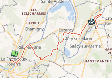
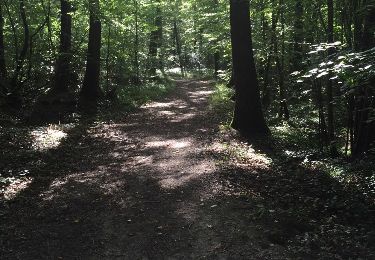
Tour Wandern von 13,4 km verfügbar auf Île-de-France, Seine-et-Marne, La Ferté-sous-Jouarre. Diese Tour wird von clalaur vorgeschlagen.
Beschreibung
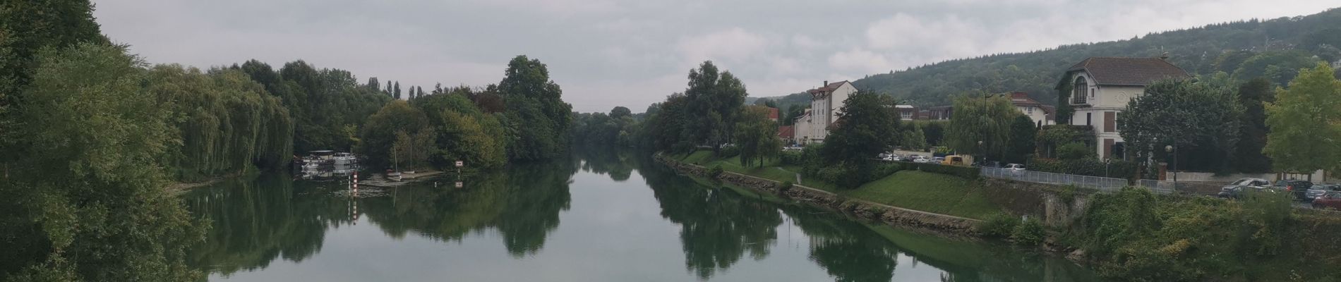
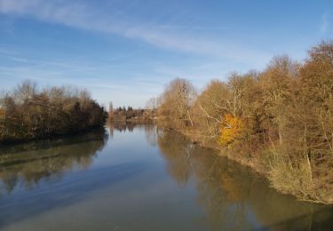
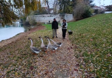
Randonnée faite le mardi 3 septembre 2024.
Départ : gare de la Ferté-sous-Jouarre (Train P) La Ferté-sous-Jouarre : Arrivée : gare de Nanteuil - Saâcy (Train P) Saâcy-sur-Marne
Ort
Land:
France
Region :
Île-de-France
Abteilung/Provinz :
Seine-et-Marne
Kommune :
La Ferté-sous-Jouarre
Standort:
Unknown
Gehen Sie:(Dec)
Gehen Sie:(UTM)
509193 ; 5421981 (31U) N.
Kommentare
Touren in der Umgebung
![Tour Wandern Jouarre - Jouarre et ses cryptes - Photo](https://media.geolcdn.com/t/375/260/ext.jpg?maxdim=2&url=https%3A%2F%2Fstatic1.geolcdn.com%2Fsiteimages%2Fupload%2Ffiles%2F1553511878bg_sport_marche.png)
![Wandern Wandern](https://static1.geolcdn.com/sitytour/trail-icons/101.png)
Jouarre et ses cryptes
Wandern
Medium
(4)
Jouarre,
Île-de-France,
Seine-et-Marne,
France
![](/images/other/stat-length.png)
15,4 km | 18,4 km-effort
4h 0min
![](https://static1.geolcdn.com/siteimages/upload/files/16400158638029165_repeat_loop_refresh_sync_direction_icon.png)
Ja
![Tour Wandern La Ferté-sous-Jouarre - RP51-08 La Ferté-sous-Jouarre à Changis-sur-Marne - Photo](https://media.geolcdn.com/t/375/260/ef75080a-2b54-498f-83f5-ffb33b9d0314.jpg&format=jpg&maxdim=2)
![Wandern Wandern](https://static1.geolcdn.com/sitytour/trail-icons/101.png)
RP51-08 La Ferté-sous-Jouarre à Changis-sur-Marne
Wandern
Schwierig
La Ferté-sous-Jouarre,
Île-de-France,
Seine-et-Marne,
France
![](/images/other/stat-length.png)
15,3 km | 19 km-effort
4h 18min
![](https://static1.geolcdn.com/siteimages/upload/files/16400158638029165_repeat_loop_refresh_sync_direction_icon.png)
Nein
![Tour Wandern La Ferté-sous-Jouarre - LaFerteSousJouarre-boucle-2-6-2024-20Km - Photo](https://media.geolcdn.com/t/375/260/91dca338-45d3-4638-9df4-956dc5b0281b.jpg&format=jpg&maxdim=2)
![Wandern Wandern](https://static1.geolcdn.com/sitytour/trail-icons/101.png)
LaFerteSousJouarre-boucle-2-6-2024-20Km
Wandern
Einfach
La Ferté-sous-Jouarre,
Île-de-France,
Seine-et-Marne,
France
![](/images/other/stat-length.png)
20 km | 25 km-effort
6h 44min
![](https://static1.geolcdn.com/siteimages/upload/files/16400158638029165_repeat_loop_refresh_sync_direction_icon.png)
Ja
![Tour Wandern La Ferté-sous-Jouarre - Ferté sous Jouarre et la Meulière - Photo](https://media.geolcdn.com/t/375/260/e6908593-8b7c-485b-a9db-a8ba1355face.jpg&format=jpg&maxdim=2)
![Wandern Wandern](https://static1.geolcdn.com/sitytour/trail-icons/101.png)
Ferté sous Jouarre et la Meulière
Wandern
Sehr schwierig
La Ferté-sous-Jouarre,
Île-de-France,
Seine-et-Marne,
France
![](/images/other/stat-length.png)
22 km | 25 km-effort
4h 36min
![](https://static1.geolcdn.com/siteimages/upload/files/16400158638029165_repeat_loop_refresh_sync_direction_icon.png)
Ja
![Tour Wandern Saint-Cyr-sur-Morin - godillot - Photo](https://media.geolcdn.com/t/375/260/ext.jpg?maxdim=2&url=https%3A%2F%2Fstatic1.geolcdn.com%2Fsiteimages%2Fupload%2Ffiles%2F1553511878bg_sport_marche.png)
![Wandern Wandern](https://static1.geolcdn.com/sitytour/trail-icons/101.png)
godillot
Wandern
Sehr leicht
(1)
Saint-Cyr-sur-Morin,
Île-de-France,
Seine-et-Marne,
France
![](/images/other/stat-length.png)
21 km | 26 km-effort
5h 55min
![](https://static1.geolcdn.com/siteimages/upload/files/16400158638029165_repeat_loop_refresh_sync_direction_icon.png)
Ja
![Tour Wandern La Ferté-sous-Jouarre - LA FERTE S/JOUARRE BOUCLE 13 KM - Photo](https://media.geolcdn.com/t/375/260/ext.jpg?maxdim=2&url=https%3A%2F%2Fstatic1.geolcdn.com%2Fsiteimages%2Fupload%2Ffiles%2F1553511878bg_sport_marche.png)
![Wandern Wandern](https://static1.geolcdn.com/sitytour/trail-icons/101.png)
LA FERTE S/JOUARRE BOUCLE 13 KM
Wandern
Sehr leicht
(1)
La Ferté-sous-Jouarre,
Île-de-France,
Seine-et-Marne,
France
![](/images/other/stat-length.png)
12,4 km | 15,6 km-effort
3h 20min
![](https://static1.geolcdn.com/siteimages/upload/files/16400158638029165_repeat_loop_refresh_sync_direction_icon.png)
Ja
![Tour Wandern Jouarre - Abbaye de Jouarrre Grand parcours - Photo](https://media.geolcdn.com/t/375/260/ext.jpg?maxdim=2&url=https%3A%2F%2Fstatic1.geolcdn.com%2Fsiteimages%2Fupload%2Ffiles%2F1553511878bg_sport_marche.png)
![Wandern Wandern](https://static1.geolcdn.com/sitytour/trail-icons/101.png)
Abbaye de Jouarrre Grand parcours
Wandern
Einfach
(2)
Jouarre,
Île-de-France,
Seine-et-Marne,
France
![](/images/other/stat-length.png)
20 km | 25 km-effort
5h 5min
![](https://static1.geolcdn.com/siteimages/upload/files/16400158638029165_repeat_loop_refresh_sync_direction_icon.png)
Ja
![Tour Wandern La Ferté-sous-Jouarre - Circuit au départ de La Ferté sous Jouarre - Photo](https://media.geolcdn.com/t/375/260/ext.jpg?maxdim=2&url=https%3A%2F%2Fservices.sitytrail.com%2FGeolivesWS%2FDownloadMedia.ashx%3FTrailID%3D618388%26Media%3D20160821101138.jpg)
![Wandern Wandern](https://static1.geolcdn.com/sitytour/trail-icons/101.png)
Circuit au départ de La Ferté sous Jouarre
Wandern
Medium
La Ferté-sous-Jouarre,
Île-de-France,
Seine-et-Marne,
France
![](/images/other/stat-length.png)
21 km | 25 km-effort
5h 24min
![](https://static1.geolcdn.com/siteimages/upload/files/16400158638029165_repeat_loop_refresh_sync_direction_icon.png)
Ja
![Tour Zu Fuß Jouarre - visorando-de-meaux-a-jouarre (1) - Photo](https://media.geolcdn.com/t/375/260/ext.jpg?maxdim=2&url=https%3A%2F%2Fstatic1.geolcdn.com%2Fsiteimages%2Fupload%2Ffiles%2F1545311037marcheuse_200dpi.jpg)
![Zu Fuß Zu Fuß](https://static1.geolcdn.com/sitytour/trail-icons/100.png)
visorando-de-meaux-a-jouarre (1)
Zu Fuß
Schwierig
Jouarre,
Île-de-France,
Seine-et-Marne,
France
![](/images/other/stat-length.png)
32 km | 38 km-effort
8h 33min
![](https://static1.geolcdn.com/siteimages/upload/files/16400158638029165_repeat_loop_refresh_sync_direction_icon.png)
Nein