


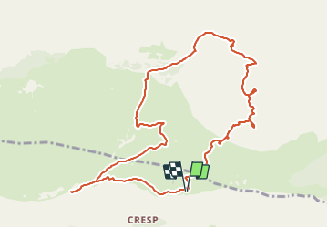


7,2 km | 11,2 km-effort


Benutzer


Kostenlosegpshiking-Anwendung
 SityTrail
IGN / Geografische Institute
SityTrail World
Die Welt öffnet sich für Sie
Tour Wandern von 11,7 km verfügbar auf Provence-Alpes-Côte d'Azur, Seealpen, Caussols. Diese Tour wird von jlrayon vorgeschlagen.
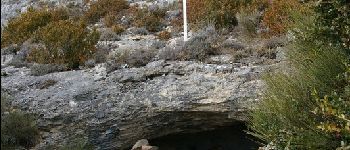
Parking de l'Observatoire, Grotte Aven des Baudillouns, Grotte du Tombeau, Aven de l' Enclos, Aven Moustique Chapelle souterraine N.D. de Calern, Retour à l'Observatoire


Wandern

Wandern

Wandern

Zu Fuß

Zu Fuß

Zu Fuß

Zu Fuß

Zu Fuß

Zu Fuß