![](/images/other/stat-length.png)
![Tour Wandern Archail - Sommet de Couard - Photo](https://media.geolcdn.com/t/1900/400/617bf3ec-d772-4852-a48b-6268ec9b769f.jpg&format=pjpeg&maxdim=2)
Sommet de Couard
Marco05
Benutzer GUIDE
![Länge](/images/other/stat-length.png)
![Maximale Höhe](https://static1.geolcdn.com/siteimages/upload/files/1508320355ic_sort_altitude_max_24dp.png)
![Positive Höhendifferenz](https://static1.geolcdn.com/siteimages/upload/files/1508320355ic_sort_den_pos_24dp.png)
![Km-Effort](/images/other/stat-length.png)
![Min. Höhe](https://static1.geolcdn.com/siteimages/upload/files/1508320355ic_sort_altitude_min_24dp.png)
![Negative Höhendifferenz](https://static1.geolcdn.com/siteimages/upload/files/1508320355ic_sort_den_neg_24dp.png)
![Boucle](https://static1.geolcdn.com/siteimages/upload/files/16400158638029165_repeat_loop_refresh_sync_direction_icon.png)
![Wandern](https://static1.geolcdn.com/sitytour/trail-icons/101.png)
6h17
Schwierigkeit : Schwierig
![Scannen Sie diesen QR-Code, um die Tour in der SityTrail-Anwendung zu öffnen](https://capi.geolives.com/qq0zvz2zws4bq2lad0pu/sitytour/trails/4159894/qr.png?size=200)
Kostenlosegpshiking-Anwendung
Über SityTrail
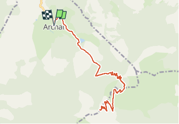
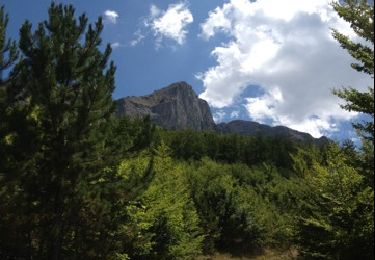
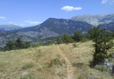
Tour Wandern von 14,3 km verfügbar auf Provence-Alpes-Côte d'Azur, Alpes-de-Haute-Provence, Archail. Diese Tour wird von Marco05 vorgeschlagen.
Beschreibung
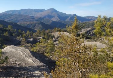
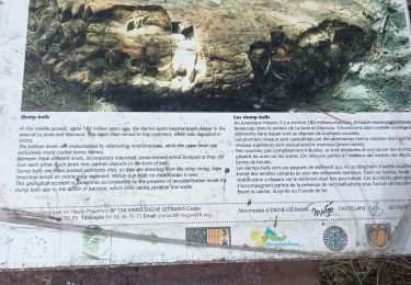
Au départ du petit village d'Archail, pas très loin de Digne.
Il est conseille de monter la voiture jusqu'à la limite du goudron.
Ceci évite 3 km aller-retour sans intérêt.
Il y a la place pour 5 voitures.
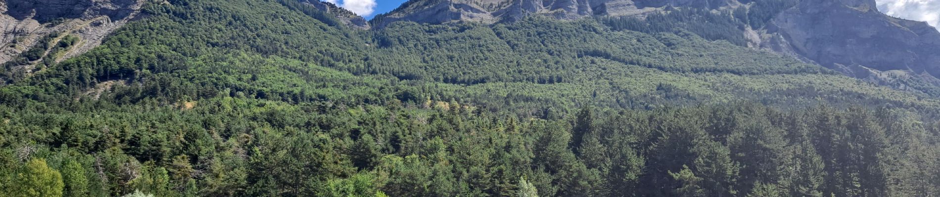
La montée se fait tranquillement jusqu'au Pas d'Archail.
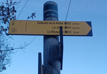
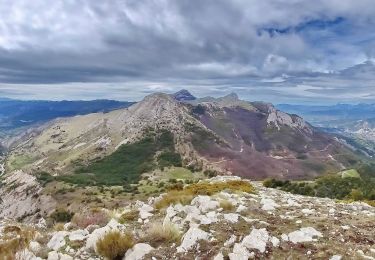
À cet endroit prendre sur la droite en suivant bien mon itinéraire, car le trac" est un peu aléatoire.
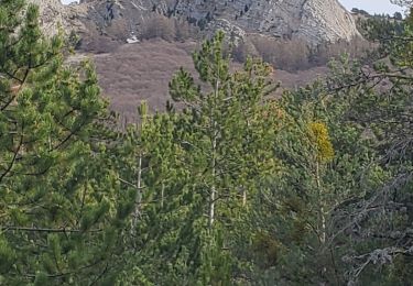
Ensuite le chemin se fait évident et on le suit sans difficulté juqu'au sommet.
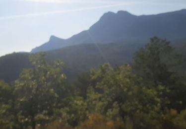
Au retour, pensez à jeter un ppetit ragrd sur le barrage face au parking.
Ort
Kommentare
Touren in der Umgebung
![Tour Wandern Draix - DRAIX .REFUGE DE BELON .CRETE DE LA BLACHE .O L - Photo](https://media.geolcdn.com/t/375/260/e8831a04-d962-4369-8704-d88e490a9a32.jpg&format=jpg&maxdim=2)
![Wandern Wandern](https://static1.geolcdn.com/sitytour/trail-icons/101.png)
Wandern
![](/images/other/stat-length.png)
![](https://static1.geolcdn.com/siteimages/upload/files/16400158638029165_repeat_loop_refresh_sync_direction_icon.png)
![Tour Wandern Marcoux - DIGNE . LES ROBINES DU BANASTRE n ol - Photo](https://media.geolcdn.com/t/375/260/dcce991a-de45-4ec5-a0f2-a1115a3d83c1.jpg&format=jpg&maxdim=2)
![Wandern Wandern](https://static1.geolcdn.com/sitytour/trail-icons/101.png)
Wandern
![](/images/other/stat-length.png)
![](https://static1.geolcdn.com/siteimages/upload/files/16400158638029165_repeat_loop_refresh_sync_direction_icon.png)
![Tour Wandern Marcoux - Villar des dourbes archail 734m 12kms - Photo](https://media.geolcdn.com/t/375/260/1fbc3102-e22a-4a79-be22-3dc99b63495b.jpg&format=jpg&maxdim=2)
![Wandern Wandern](https://static1.geolcdn.com/sitytour/trail-icons/101.png)
Wandern
![](/images/other/stat-length.png)
![](https://static1.geolcdn.com/siteimages/upload/files/16400158638029165_repeat_loop_refresh_sync_direction_icon.png)
![Tour Wandern Archail - Archail cucuyon 10kms 850m - Photo](https://media.geolcdn.com/t/375/260/c348f6c1-7258-47d7-9586-40bbf4181938.jpg&format=jpg&maxdim=2)
![Wandern Wandern](https://static1.geolcdn.com/sitytour/trail-icons/101.png)
Wandern
![](/images/other/stat-length.png)
![](https://static1.geolcdn.com/siteimages/upload/files/16400158638029165_repeat_loop_refresh_sync_direction_icon.png)
![Tour Wandern Le Brusquet - LE BRUSQUET .Le tour des Blaches n - Photo](https://media.geolcdn.com/t/375/260/8f49b41b-86fe-49d3-8404-7ee7a8e8e571.jpg&format=jpg&maxdim=2)
![Wandern Wandern](https://static1.geolcdn.com/sitytour/trail-icons/101.png)
Wandern
![](/images/other/stat-length.png)
![](https://static1.geolcdn.com/siteimages/upload/files/16400158638029165_repeat_loop_refresh_sync_direction_icon.png)
![Tour Wandern Draix - 20210506_Draix - Tête de Chabane - Photo](https://media.geolcdn.com/t/375/260/0a858e9b-ff56-4fb8-8c1f-13fe4add2cbd.jpg&format=jpg&maxdim=2)
![Wandern Wandern](https://static1.geolcdn.com/sitytour/trail-icons/101.png)
Wandern
![](/images/other/stat-length.png)
![](https://static1.geolcdn.com/siteimages/upload/files/16400158638029165_repeat_loop_refresh_sync_direction_icon.png)
![Tour Wandern Le Brusquet - pierres ocres - Photo](https://media.geolcdn.com/t/375/260/c4f58e11-452c-48be-8c08-199d0d0829dc.jpg&format=jpg&maxdim=2)
![Wandern Wandern](https://static1.geolcdn.com/sitytour/trail-icons/101.png)
Wandern
![](/images/other/stat-length.png)
![](https://static1.geolcdn.com/siteimages/upload/files/16400158638029165_repeat_loop_refresh_sync_direction_icon.png)
![Tour Wandern Archail - Randoguide - Photo](https://media.geolcdn.com/t/375/260/ext.jpg?maxdim=2&url=https%3A%2F%2Fservices.sitytrail.com%2FGeolivesWS%2FDownloadMedia.ashx%3FTrailID%3D142239%26Media%3D20120729151454.jpg)
![Wandern Wandern](https://static1.geolcdn.com/sitytour/trail-icons/101.png)
Wandern
![](/images/other/stat-length.png)
![](https://static1.geolcdn.com/siteimages/upload/files/16400158638029165_repeat_loop_refresh_sync_direction_icon.png)
![Tour Mountainbike Archail - Grande Traversée des PréAlpes à VTT : La Bâtie Neuve (Maison forestière ruinée) - Col du Défens - Photo](https://media.geolcdn.com/t/375/260/ext.jpg?maxdim=2&url=https%3A%2F%2Fservices.sitytrail.com%2FGeolivesWS%2FDownloadMedia.ashx%3FTrailID%3D104770%26Media%3D8225_1.jpg)
![Mountainbike Mountainbike](https://static1.geolcdn.com/sitytour/trail-icons/202.png)
Mountainbike
![](/images/other/stat-length.png)
![](https://static1.geolcdn.com/siteimages/upload/files/16400158638029165_repeat_loop_refresh_sync_direction_icon.png)